Home
States
Colorado
Connecticut
Maine
Massachusetts
New Hampshire
New York
Rhode Island
Utah
Vermont
View All
Lists
NE 4,000 Footers
NE 100 Highest
NH 4,000 Footers
NH 100 Highest
NH 52 With A View
NH Belknap Range
NH Ossipee 10
Links
Trail Conditions
Trip Log
Sunrises
Sunsets
About
|
Green Mountain
Effingham, NH
Trailheads, measurements, times, distances, and maps are all approximate and relative to the hike(s) as shown below.
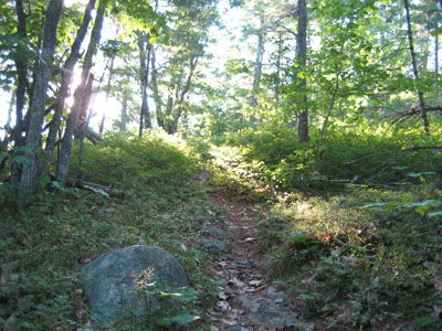
Heading up the Dearborn Trail
Route: Dearborn Trail
Thanks to the long summer days, I was able to finish up a good chunk of my Sunday night work by dinner time. As a result, I had enough time to do a shorter hike. With thick clouds moving in along the Sandwich Range, I decided to head a bit south and east to Green Mountain.
Having already hiked the Highwatch and Libby trails, I decided to give the Dearborn Trail a try.
Though the best marked of the Green Mountain trails, the Dearborn Trail appears to be the least travelled, as it was in many places single file with ferns and shrubs overflowing into the path. The ascent starts off relatively flat, before picking up to a more moderate pitch as it enters some wild lowbush blueberry fields. After these fields (and the quasi-famous 'split rock'), things pick up again, before a flat final stretch to the summit tower.
Despite the nice weather (60 degrees, partly sunny), there was not a soul out on the trail or at the tower. Though the views to the north didn't stretch beyond the Sandwich Range, the sights into Maine were excellent.
The descent wasn't too bad - despite forgotting to put on my patella strap and take Aleve, I was able to make it down without limping too much.
| Hike Ratings |
|
Getting To Trailhead: |
Easy |
| Destination: |
Green Mountain |
|
Length: |
Moderate |
|
Steepness: |
Moderate |
|
Navigation: |
Easy |
|
Views: |
Excellent |
|
Crowds: |
Minimal |
|
| Hike Stats |
|
Date Hiked: |
Sunday, July 1, 2007 |
| Hike Commenced: |
6:00 PM |
| Parking Elevation: |
505' |
| Destination: |
Green Mountain |
| Ascent Commenced: |
6:01 PM |
| Summit Reached: |
6:44 PM |
| Time Elapsed: |
00:43 |
| Trailhead Elevation: |
505' |
| Summit Elevation: |
1,907' |
| Distance: |
1.4 miles |
| Vertical Gain: |
1,427' |
|
|
| Hike Ended: |
7:38 PM |
| Hike Time Elapsed: |
01:38 |
| Hike Distance: |
2.8 miles |
| Hike Vertical Gain: |
1,452' |
|
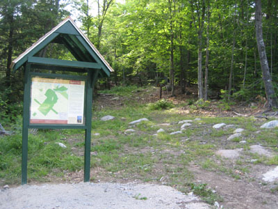
Dearborn Trail trailhead
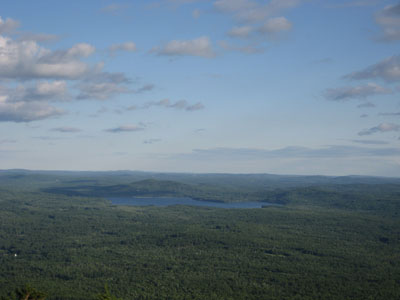
Looking southeast from the Green Mountain summit
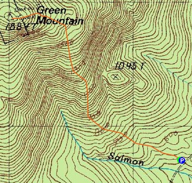

Directions to trailhead: Take Route 16 North to Route 153. Take Route 153 North to Hobbs Road (on the left, there will be a sharp curve with a schoolhouse monument). Hobbs Road will trun into a Class IV Road. Shortly after that warning, the parking lot is on the right. Dearborn Trail trailhead is at the back of the parking lot.
Back to Green Mountain Profile
|

