Home
States
Colorado
Connecticut
Maine
Massachusetts
New Hampshire
New York
Rhode Island
Utah
Vermont
View All
Lists
NE 4,000 Footers
NE 100 Highest
NH 4,000 Footers
NH 100 Highest
NH 52 With A View
NH Belknap Range
NH Ossipee 10
Links
Trail Conditions
Trip Log
Sunrises
Sunsets
About
|
Green Mountain
Effingham, NH
Trailheads, measurements, times, distances, and maps are all approximate and relative to the hike(s) as shown below.
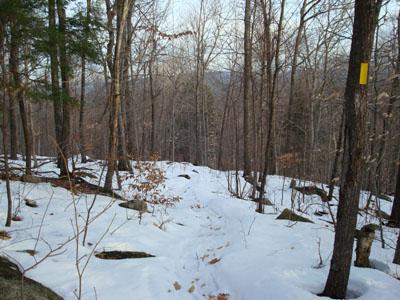
Looking down the Dearborn Trail
Route: Dearborn Trail
Primary day! The weather forecast had called for a mostly cloudy day with rain. Looking out the window all day, I didn't see as much as a cloud in the sky! Thus, I needed to get outside.
The actual parking lot for the Dearborn Trail hadn't been plowed in a few storms - however, there were places at the end of the road plowed enough for maybe half a dozen vehicles.
At 56 degrees, it was a warm day for January standards! As a result of the warm trend, significant portions of the trail were bare and very wet. Not only that, but the remaining slush and wet granular made for more challenging snowshoeing - uphill and down.
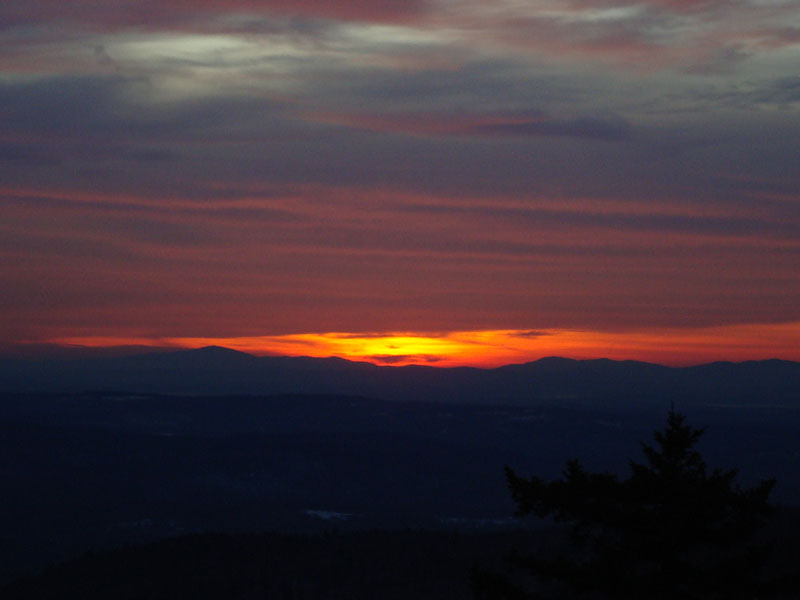
Arriving at the summit, much of the sky had been overtaken by clouds. Nonetheless, I was able to see a decent sunset.
| Hike Ratings |
|
Getting To Trailhead: |
Easy |
| Destination: |
Green Mountain |
|
Length: |
Moderate |
|
Steepness: |
Moderate |
|
Navigation: |
Easy |
|
Views: |
Excellent |
|
Crowds: |
Minimal |
|
| Hike Stats |
|
Date Hiked: |
Tuesday, January 8, 2008 |
| Hike Commenced: |
3:17 PM |
| Parking Elevation: |
510' |
| Destination: |
Green Mountain |
| Ascent Commenced: |
3:18 PM |
| Summit Reached: |
4:14 PM |
| Time Elapsed: |
00:56 |
| Trailhead Elevation: |
505' |
| Summit Elevation: |
1,907' |
| Distance: |
1.4 miles |
| Vertical Gain: |
1,427' |
|
|
| Hike Ended: |
5:23 PM |
| Hike Time Elapsed: |
02:06 |
| Hike Distance: |
2.8 miles |
| Hike Vertical Gain: |
1,457' |
|
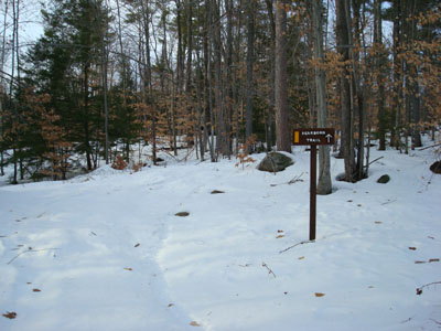
Dearborn Trail trailhead
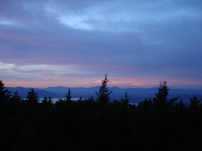
Looking at the Sandwich Range from the Green Mountain fire tower
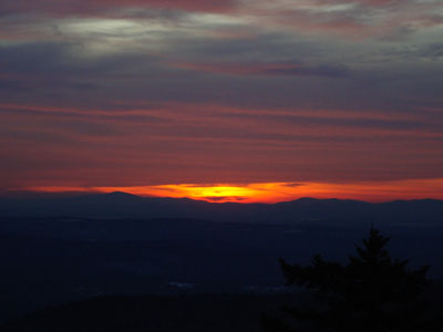
The sunset as seen from the Green Mountain fire tower
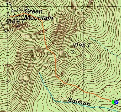

Directions to trailhead: Take Route 16 North to Route 153. Take Route 153 North to Hobbs Road (on the left, there will be a sharp curve with a schoolhouse monument). Hobbs Road will trun into a Class IV Road. Shortly after that warning, the parking lot is on the right. Dearborn Trail trailhead is at the back of the parking lot.
Back to Green Mountain Profile
|