Home
States
Colorado
Connecticut
Maine
Massachusetts
New Hampshire
New York
Rhode Island
Utah
Vermont
View All
Lists
NE 4,000 Footers
NE 100 Highest
NH 4,000 Footers
NH 100 Highest
NH 52 With A View
NH Belknap Range
NH Ossipee 10
Links
Trail Conditions
Trip Log
Sunrises
Sunsets
About
|
Gunstock Mountain, Belknap Mountain
Gilford, NH
Trailheads, measurements, times, distances, and maps are all approximate and relative to the hike(s) as shown below.
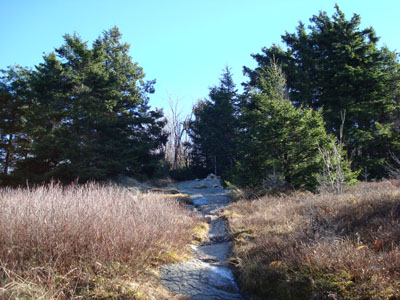
Looking down The Flats on the way to the Gunstock Mountain summit
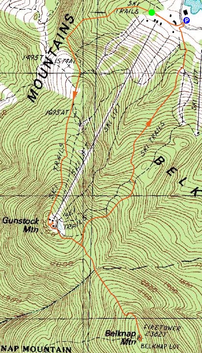
Route: Stonebar, The Flats, Flintlock, (Gunstock Mountain), Brook Trail, White Trail, Blue Trail, (Belknap Mountain), Blue Trail, White Trail, (bushwack), Upper Gunsmoke, Middle Gunsmoke, Lower Gunsmoke, Musket
The forecast for much of the mountains in New Hampshire was for clouds, so I decided to look for a loophole - that loophole was the Lakes Region. The Belknaps enjoyed mostly sunny skies for my entire hike.
Wanting views, I decided to hike up the ski trails at Gunstock. My pace was slowed a bit as I took a work call. The intermediate ski trails I followed had two steep pitches - the top of Stonebar and the top of Flintlock.
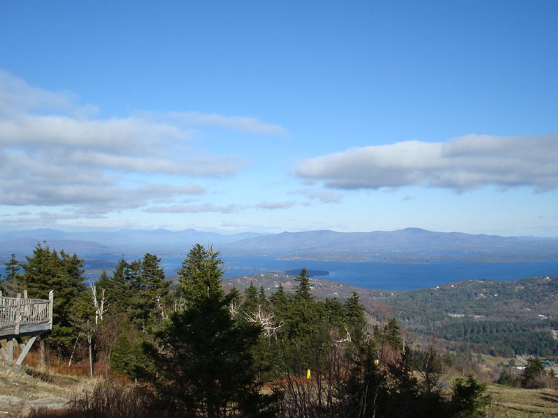
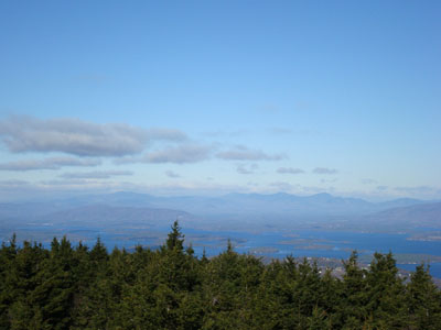
The views from the Gunstock Mountain summit were excellent - Lake Winnipesaukee was a very deep blue and the southern White Mountains were visible despite the distant clouds.
After talking with some ski area folks on the summit, I ducked into the woods onto the Brook Trail and headed over to Belknap Mountain. It's a fairly quick, not overly steep walk. Though the real views are from the tower, there were multiple halfway decent looks at the lake through the trees.
The views from the fire tower were excellent - but cold! I was somewhat scared of losing my balance and falling over the railing due to the wind gusts. Nonetheless, I survived.
I considered taking the Brook Trail back to the parking lot at Gunstock, however I was not sure what condition the trail was in with the recent wet and cold weather. As a result, I did a very simple bushwack from the Brook/White Trail junction up to the Gunsmoke Trail.
By the time I arrived back at the base area, the was a small crowd of curious people looking at the manmade snow on the lower mountain.
| Hike Ratings |
|
Getting To Trailhead: |
Easy |
| Destination: |
Gunstock Mountain |
|
Length: |
Moderate |
|
Steepness: |
Difficult |
|
Navigation: |
Easy |
|
Views: |
Excellent |
|
Crowds: |
Minimal |
| Destination: |
Belknap Mountain |
|
Length: |
Moderate |
|
Steepness: |
Moderate |
|
Navigation: |
Easy |
|
Views: |
Excellent |
|
Crowds: |
Minimal |
|
| Hike Stats |
|
Date Hiked: |
Friday, November 23, 2007 |
| Hike Commenced: |
10:28 AM |
| Parking Elevation: |
935' |
| Destination: |
Gunstock Mountain |
| Ascent Commenced: |
10:32 AM |
| Summit Reached: |
11:15 AM |
| Time Elapsed: |
00:43 |
| Trailhead Elevation: |
960' |
| Summit Elevation: |
2,245' |
| Vertical Gain: |
1,285' |
| Destination: |
Belknap Mountain |
| Ascent Commenced: |
11:29 AM |
| Summit Reached: |
11:55 AM |
| Time Elapsed: |
00:26 |
| Trailhead Elevation: |
2,245' |
| Summit Elevation: |
2,382' |
| Vertical Gain: |
407' |
|
|
| Hike Ended: |
12:54 PM |
| Hike Time Elapsed: |
02:26 |
| Hike Vertical Gain: |
1,817' |
|
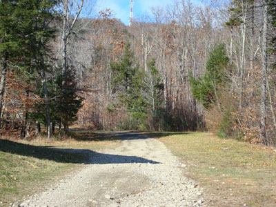
Looking up the Stonebar ski trail at the base of the Tiger Triple

Looking at the Sandwich and Ossipee Ranges from the Gunstock Mountain summit
Looking up the Blue Trail on the way to the Belknap Mountain summit
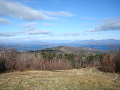
Looking at the Sandwich Range from the Belknap Mountain fire tower
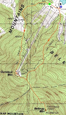

Directions to trailhead: Take Route 11A to Gunstock entrance, parking lot near the base lodge of the ski area.
Back to Gunstock Mountain Profile
Back to Belknap Mountain Profile
|