Home
States
Colorado
Connecticut
Maine
Massachusetts
New Hampshire
New York
Rhode Island
Utah
Vermont
View All
Lists
NE 4,000 Footers
NE 100 Highest
NH 4,000 Footers
NH 100 Highest
NH 52 With A View
NH Belknap Range
NH Ossipee 10
Links
Trail Conditions
Trip Log
Sunrises
Sunsets
About
|
Gunstock Mountain, Belknap Mountain
Gilmanton, NH, Gilford, NH
Trailheads, measurements, times, distances, and maps are all approximate and relative to the hike(s) as shown below.
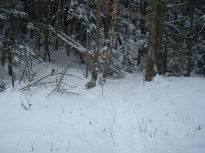
Looking up the Gunstock Mountain Trail
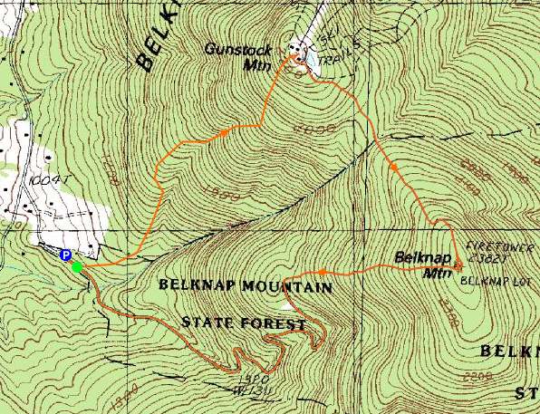
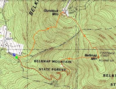
Route: Carriage Road, Gunstock Mountain Trail, (Gunstock Mountain), Saddle Trail, Blue Trail, (Belknap Mountain), Green Trail, Carriage Road
With the weather not looking that great, the Belknaps seemed like a good alternative to the Whites. Fortunately, the small parking area adjacent to the Carriage Road gate was plowed.
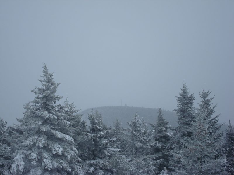
The Gunstock Mountain Trail had been broken out earlier in the day, so the snowshoeing wasn't overly challenging. The upper portion of the trail was quite neat, as there was a bit of rime on the trees. While we saw no one on the trail, the summit area was busy with skiers. Due to the continued light snow, the views were very limited - the only thing visible was Belknap Mountain.
After looking around for a minute for the trailhead to Belknap Mountain, we were soon on our way. While the Gunstock Mountain Trail hadn't appeared to be hit too hard by the recent ice storm, the Saddle and Blue trails seemed to suffer some damage. Nonetheless, we were able to clear most of the blowdowns and were soon on the summit of Belknap Mountain.
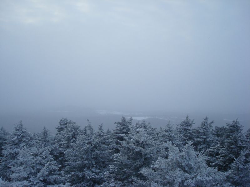
Once again, there wasn't much to see from the summit. While Gunstock and some fields were visible, not much else was. Though Piper had originally been part of the agenda, it was starting to get dark, so we descended down the Green Trail - the first unbroken section of the hike. Similar to the Saddle and Blue trails, there was some damage that needed to be cleared from the ice storm. Following the Green Trail, we descended down the Carriage Road, arriving at the parking area a little while after the (not visible) sunset.
Despite the last of sunlight and views, it was nonetheless another nice hike in the Belknaps.
| Hike Ratings |
|
Getting To Trailhead: |
Easy |
| Destination: |
Gunstock Mountain |
|
Length: |
Moderate |
|
Steepness: |
Moderate |
|
Navigation: |
Easy |
|
Views: |
Moderate (due to weather) |
|
Crowds: |
Heavy |
| Destination: |
Belknap Mountain |
|
Length: |
Moderate |
|
Steepness: |
Moderate |
|
Navigation: |
Moderate |
|
Views: |
Moderate (due to weather) |
|
Crowds: |
Minimal |
|
| Hike Stats |
|
Date Hiked: |
Saturday, December 20, 2008 |
| Hike Commenced: |
2:15 PM |
| Parking Elevation: |
1,030' |
| Destination: |
Gunstock Mountain |
| Ascent Commenced: |
2:16 PM |
| Summit Reached: |
2:59 PM |
| Time Elapsed: |
00:43 |
| Trailhead Elevation: |
1,020' |
| Summit Elevation: |
2,245' |
| Vertical Gain: |
1,225' |
| Destination: |
Belknap Mountain |
| Ascent Commenced: |
3:02 PM |
| Summit Reached: |
3:37 PM |
| Time Elapsed: |
00:35 |
| Trailhead Elevation: |
2,245' |
| Summit Elevation: |
2,382' |
| Vertical Gain: |
407' |
|
|
| Hike Ended: |
4:46 PM |
| Hike Time Elapsed: |
02:31 |
| Hike Vertical Gain: |
1,682' |
|
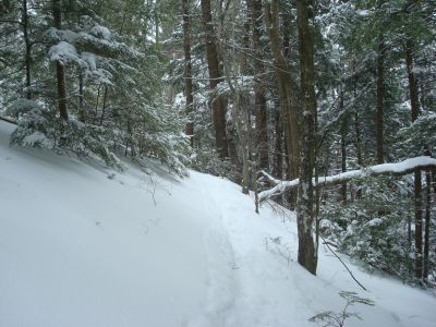
The Gunstock Mountain Trail trailhead on the Carriage Road
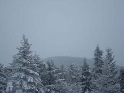
Looking at Belknap Mountain from Gunstock Mountain
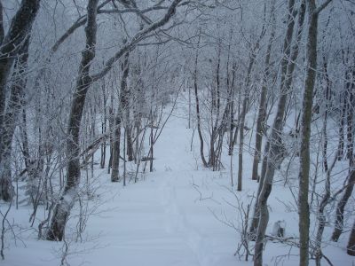
The Blue Trail between Gunstock Mountain and Belknap Mountain
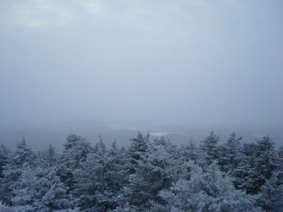
The weather-limited view from the Belknap Mountain fire tower

Directions to trailhead: From Route 11A East (from Route 3), take a right on Hoyt Road. Continue down this road as it becomes Belknap Mountain Road. Look for Carriage Road on your left - offseason parking is at the gate.
Back to Gunstock Mountain Profile
Back to Belknap Mountain Profile
|