Home
States
Colorado
Connecticut
Maine
Massachusetts
New Hampshire
New York
Rhode Island
Utah
Vermont
View All
Lists
NE 4,000 Footers
NE 100 Highest
NH 4,000 Footers
NH 100 Highest
NH 52 With A View
NH Belknap Range
NH Ossipee 10
Links
Trail Conditions
Trip Log
Sunrises
Sunsets
About
|
Hibbard Mountain, Wonalancet Hedgehog
Albany, NH, Waterville Valley, NH
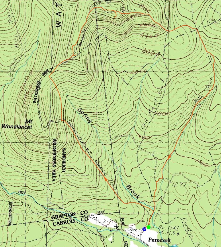
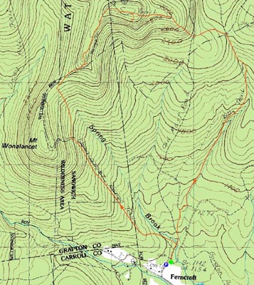
Trailheads, measurements, times, distances, and maps are all approximate and relative to the hike(s) as shown below.
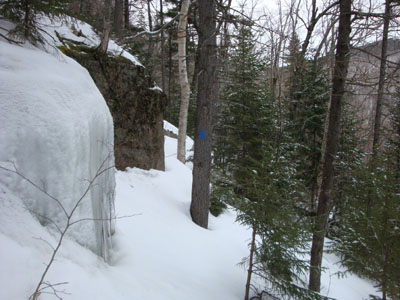
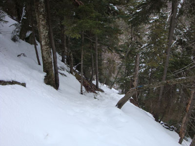
Looking up the Short Cut trail on the way to Hibbard Mountain
Route: Old Mast Road, Wonalancet Range Trail, Short Cut, Wonalancet Range Trail, (Hibbard Mountain), Wonalancet Range Trail, Walden Trail, (Wonalancet Hedgehog), spur path, Walden Trail, Lawrence Trail, Kelly Trail, Old Mast Road
I had been wanting to climb Wonalancet Hedgehog again as an after work hike for a few months. Now, with the extended afternoon daylight, the time seemed right. To make things a bit more interesting, I decided to head up the Wonalancet Range Trail.
While the short segment of Old Mast Road was well packed, the Wonalancet Range Trail was quite as mess down low, with random postholes and about an inch of sticky new snow over a somewhat solid spring snow base.
The steep ascent up the ledgy portion (read: blue ice) of the trail was a bit interesting, however the new snow and relatively warm temperatures made it somewhat easier than it could have been.
The Short Cut hadn't been used in recent times. Thus, I was crossing over relatively unbroken trail on a constant sidehill. This became vexing after awhile, but fortunately I reached the saddle and rejoined the Wonalancet Range Trail sooner rather than later.
The lower viewpoint on Hibbard Mountain provided good views as always, while the upper viewpoint provided some Whiteface views, thanks to the snow base.
The Wonalancet Range Trail dagged on a bit after this. Finally reaching the Walden Trail, I started the ascent to Wonalancet Hedgehog. Reaching a shoulder that at first tricked me into thinking I was near the summit, I bushwhacked a few hundred feet off the trail, reaching a southern viewpoint similar to the one near the real summit. Back on the trail, I continued up, reaching the big summit boulder. Beyond that, I took a right and headed down to the view ledge. Once again, I didn't step out onto the ledge, as it angles down to its cliff. Wet the previous visit, the snowy and icy nature of it this time was enough to keep me off it. Nonetheless, the views were still quite good, ranging from Foss Mountain to the east to Mt. Whiteface to the west.
Back on the trail again, I had to take my time descending the snow/ice covered ledge scrambles. Beyond the Four Way junction, I was descending on mostly untracked terrain on the Lawrence Trail, soon reaching the Oliverian Brook/Kelly Trail junction at Paugus Pass.
The Kelly Trail started off with some neat topography, with the trail heading down the middle of a gorge. Soon, things became dramatically more interesting - the trail dipped into a bowl surrounded with rocky ledges - also known as the Pleistocene Plunge Pool. After dipping in and then out of that, the trail followed a neat little brook. While the topography was quite nice, I found the lower portion of the trail dragged a bit - finally reaching a woods road, then cutting back into the woods and connecting to the Old Mast Road.
| Hike Ratings |
|
Getting To Trailhead: |
Easy |
| Destination: |
Hibbard Mountain |
|
Length: |
Moderate |
|
Steepness: |
Difficult |
|
Navigation: |
Easy |
|
Views: |
Excellent |
|
Crowds: |
Minimal |
Wonalancet Hedgehog |
|
Length: |
Moderate |
|
Steepness: |
Moderate |
|
Navigation: |
Moderate |
|
Views: |
Excellent |
|
Crowds: |
Minimal |
|
| Hike Stats |
|
Date Hiked: |
Tuesday, March 10, 2009 |
| Hike Commenced: |
3:21 PM |
| Parking Elevation: |
1,140' |
| Destination: |
Hibbard Mountain |
| Ascent Commenced: |
3:24 PM |
| Summit Reached: |
4:45 PM |
| Time Elapsed: |
01:21 |
| Trailhead Elevation: |
1,140' |
| Summit Elevation: |
2,940' |
| Distance: |
2.3 miles |
| Vertical Gain: |
1,875' |
| Destination: |
Wonalancet Hedgehog |
| Ascent Commenced: |
4:45 PM |
| Summit Reached: |
5:11 PM |
| Time Elapsed: |
00:26 |
| Trailhead Elevation: |
2,940' |
| Summit Elevation: |
3,140' |
| Distance: |
0.7 mile |
| Vertical Gain: |
280' |
|
|
| Hike Ended: |
7:08 PM |
| Hike Time Elapsed: |
03:47 |
| Hike Distance: |
6.3 miles |
| Hike Vertical Gain: |
2,395' |
|
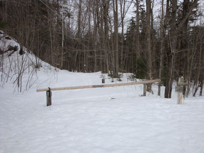
The Old Mast Road trailhead

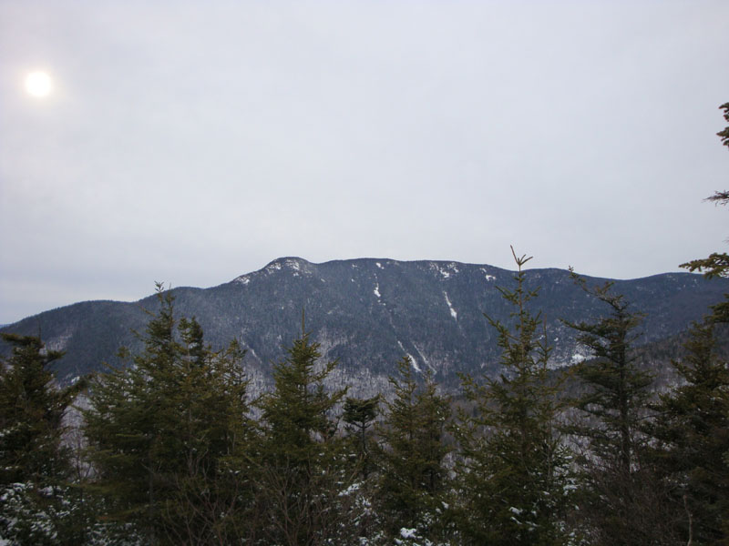
Looking at Mt. Whiteface from Hibbard Mountain
Looking down the Walden Trail on the way to the Four Way junction
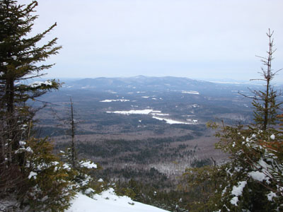
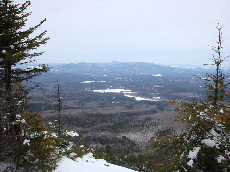
Looking at the Ossipees from the vista near the Wonalancet Hedgehog summit.

Directions to trailhead: Take Route 113A to Wonalancet, then take Ferncroft Road. The trailhead (the road) and parking lot are both on the right next to the pasture.
Back to Hibbard Mountain Profile
Back to Wonalancet Hedgehog Profile
|