Home
States
Colorado
Connecticut
Maine
Massachusetts
New Hampshire
New York
Rhode Island
Utah
Vermont
View All
Lists
NE 4,000 Footers
NE 100 Highest
NH 4,000 Footers
NH 100 Highest
NH 52 With A View
NH Belknap Range
NH Ossipee 10
Links
Trail Conditions
Trip Log
Sunrises
Sunsets
About
|
Iron Mountain
Jackson, NH, Bartlett, NH
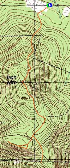
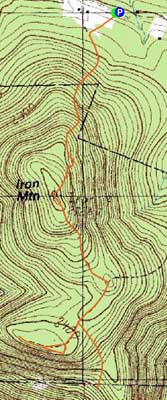
Trailheads, measurements, times, distances, and maps are all approximate and relative to the hike(s) as shown below.
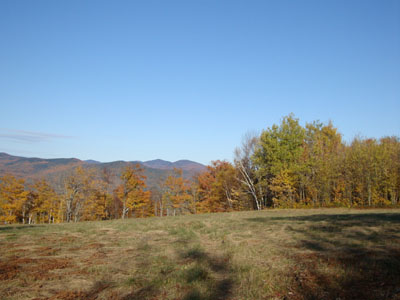
Looking across the fields near the beginning of the trail to Iron Mountain
Heading up north, it was cloudy to start with - that is, until I reached Conway. At that point, I could see that the mostly sunny day was still holding in the northern notches. Originally thinking about Pine Mountain, I decided to instead check out the southern cliffs of Iron Mountain.
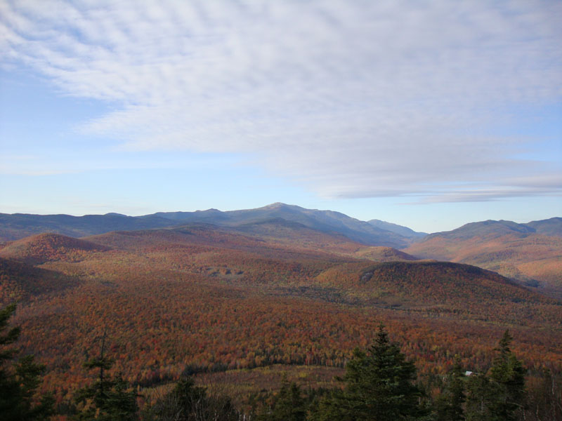
The views from the field at the bottom of the Iron Mountain Trail were tremendous - still some foliage hanging on in the valleys, along with a few patches of snow on Mt. Washington. Heading up the eroded Iron Mountain Trail, I stopped at the first viewpoint for some additional Presidential views. After a stop at the second view point (Wildcat-Carter views), I soon reached the nearly-viewless summit (though there is a narrow view of Mt. Washington if you stand on the benchmark).
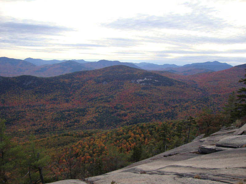
Dropping off the south side, I descended for awhile, steeply at times over ledges, before eventually reaching a cairned junction - no sign. Going right, I reached the dramatic southern cliffs of Iron Mountain - amazing views.
After spending some time exploring the vast ledges and cliffs, I checked the time and saw that I could possibly swing a side trip to the old mines. The descent was steep and slippery. While I saw piles of spoilage and a few shafts, I didn't explore for too long due to the waning daylight. Apparently there is a tunnel of some sort.
Reascending to the summit in the last stages of daylight, I found myself at the lower viewpoint around sunset. Despite the incoming clouds, I did manage to get some slight colors over the Montalban Ridge - a pleasant surprise.
The rest of the descent was non-eventful, though not necessarily quiet - a pack of coyotes was howling in the not so far distance, and a moose was thrashing around some marshy land near the trailhead. I decided to not investigate.
| Hike Ratings |
|
Getting To Trailhead: |
Easy |
| Destination: |
Iron Mountain |
|
Length: |
Moderate |
|
Steepness: |
Moderate |
|
Navigation: |
Easy |
|
Views: |
Moderate |
|
Crowds: |
Moderate |
| Destination: |
Iron Mountain Cliffs |
|
Length: |
Moderate |
|
Steepness: |
Difficult |
|
Navigation: |
Moderate |
|
Views: |
Excellent |
|
Crowds: |
Minimal |
|
| Hike Stats |
|
Date Hiked: |
Monday, October 12, 2009 |
| Hike Commenced: |
4:12 PM |
| Parking Elevation: |
1,910' |
| Destination: |
Iron Mountain |
| Ascent Commenced: |
4:12 PM |
| Summit Reached: |
4:38 AM |
| Time Elapsed: |
00:26 |
| Trailhead Elevation: |
1,910' |
| Summit Elevation: |
2,726' |
| Vertical Gain: |
826' |
|
|
| Hike Ended: |
6:37 PM |
| Hike Time Elapsed: |
02:25 |
| Hike Vertical Gain: |
1,592' |
|
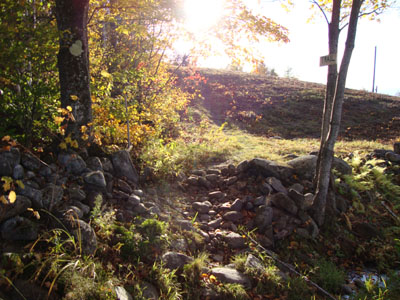
Trailhead to the Iron Mountain summit on Iron Mountain Road

Looking at Mt. Washington from the lower viewpoint north of Iron Mountain
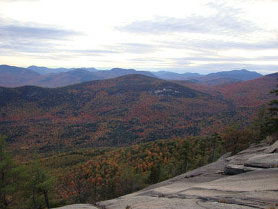
Looking at the Sandwich Range from the southern cliffs of Iron Mountain
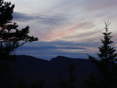
Sunset colors over Stairs Mountain as seen from the lower viewpoint north of Iron Mountain

Directions to trailhead: Take Route 16 North past the first covered bridge in Jackson. Almost immediately after, take a left onto Green Hill Road. Continue up this road, eventually bearing left onto a somewhat rough dirt Iron Mountain Road. There is a parking lot at the top of this road on the right hand side. Trailhead is just after, on the left.
Back to Iron Mountain Profile
|