Home
States
Colorado
Connecticut
Maine
Massachusetts
New Hampshire
New York
Rhode Island
Utah
Vermont
View All
Lists
NE 4,000 Footers
NE 100 Highest
NH 4,000 Footers
NH 100 Highest
NH 52 With A View
NH Belknap Range
NH Ossipee 10
Links
Trail Conditions
Trip Log
Sunrises
Sunsets
About
|
Iron Mountain
Jackson, NH, Bartlett, NH
Trailheads, measurements, times, distances, and maps are all approximate and relative to the hike(s) as shown below.
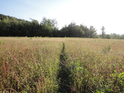
Looking across the fields near the beginning of the Iron Mountain Trail
With a few minutes to spare while in North Conway, I headed up to Jackson to Iron Mountain.
I was able to jog much of the Iron Mountain Trail, though I opted to walk the steep, eroded middle portion.
While there wasn't much to see from the summit, there were decent views from the viewpoints prior to it. Unfortunately, there wasn't enough time to head to the awesome southern ledges.
| Hike Ratings |
|
Getting To Trailhead: |
Easy |
| Destination: |
Iron Mountain |
|
Length: |
Moderate |
|
Steepness: |
Moderate |
|
Navigation: |
Easy |
|
Views: |
Excellent |
|
Crowds: |
Minimal |
|
| Hike Stats |
|
Date Hiked: |
Tuesday, July 27, 2010 |
| Hike Commenced: |
6:31 PM |
| Parking Elevation: |
1,910' |
| Destination: |
Iron Mountain |
| Ascent Commenced: |
6:31 PM |
| Summit Reached: |
6:47 PM |
| Time Elapsed: |
00:16 |
| Trailhead Elevation: |
1,910' |
| Summit Elevation: |
2,726' |
| Distance: |
0.8 mile |
| Vertical Gain: |
826' |
|
|
| Hike Ended: |
7:16 PM |
| Hike Time Elapsed: |
00:45 |
| Hike Vertical Gain: |
846' |
|
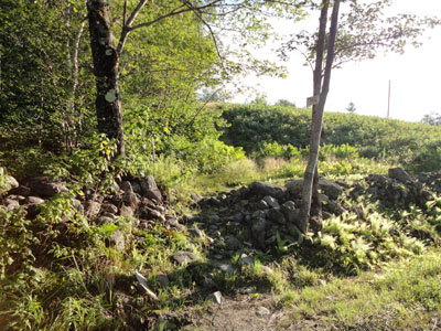
The Iron Mountain Trail trailhead

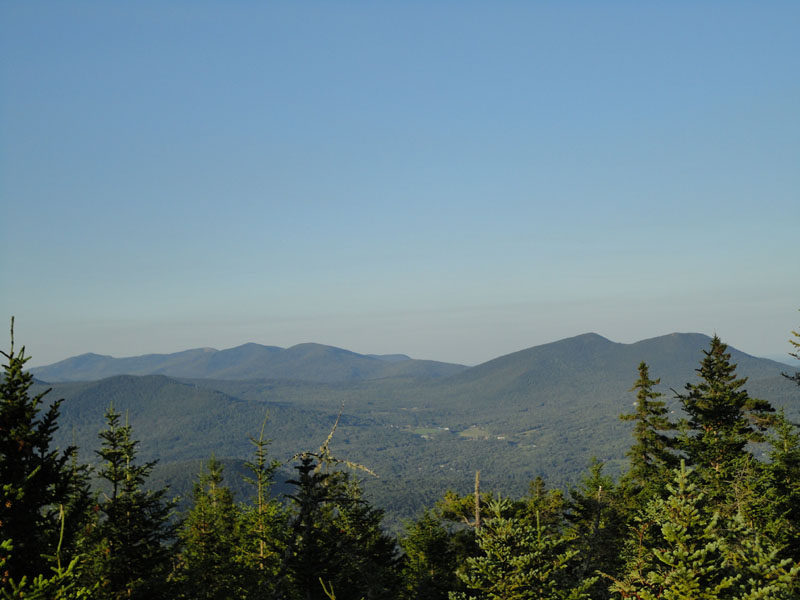
Looking at the Doubleheads and points north from one of the viewpoints below the summit of Iron Mountain
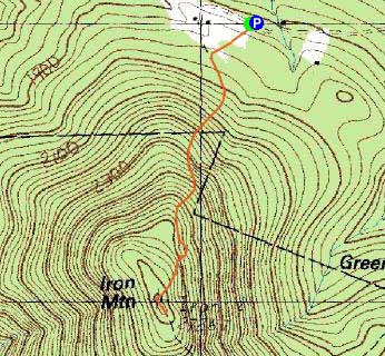

Directions to trailhead: Take Route 16 North past the first covered bridge in Jackson. Almost immediately after, take a left onto Green Hill Road. Continue up this road, eventually bearing left onto a somewhat rough dirt Iron Mountain Road. There is a parking lot at the top of this road on the right hand side. Trailhead is just after, on the left.
Back to Iron Mountain Profile
|