Home
States
Colorado
Connecticut
Maine
Massachusetts
New Hampshire
New York
Rhode Island
Utah
Vermont
View All
Lists
NE 4,000 Footers
NE 100 Highest
NH 4,000 Footers
NH 100 Highest
NH 52 With A View
NH Belknap Range
NH Ossipee 10
Links
Trail Conditions
Trip Log
Sunrises
Sunsets
About
|
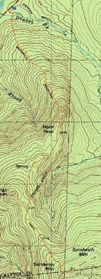
Noon Peak, Jennings Peak, Sandwich Mountain
Waterville Valley, NH
Trailheads, measurements, times, distances, and maps are all approximate and relative to the hike(s) as shown below.
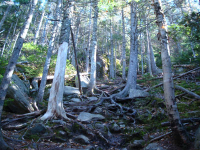
Looking up the Sandwich Mountain Trail during the steep ascent up Noon Peak
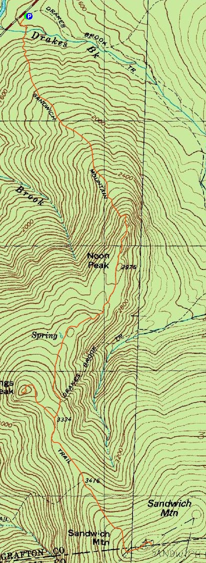
Route: Sandwich Mountain Trail, (Noon Peak), Sandwich Mountain Trail, spur trail, (Jennings Peak), spur trail, Sandwich Mountain Trail, (Sandwich Mountain), Sandwich Mountain Trail
With some comp time built up, I decided to take a half day and head over towards Waterville. I had been hoping to hike the Sandwich Dome for quite a long time, but had never actually set a date.
Starting at a nearly full (small!) parking lot, I quickly descended past the power station and to the brook crossing. After this, the Sandwich Mountain Trail starts a consistent moderate pitched ascent, all the way to the wilderness boundary. After the boundary, the trail is easy to moderate at best for a decent stretch, before coming instantly steep.
Though very steep, the ascent up Noon Peak is still certainly doable - no scrambling required. I found Noon Peak to be a bit confusing, however, as there didn't seem to be a clear cut summit. On topographic maps, the summit peak appears to be the third - not so obvious when you're going by it for the first time. My guess is that the high point is near the second trailside view.
After enjoying both view points on the Noon Peak area, I continued toward Jennings Peak, making a stop at a nice set of ledges a few tenths of a mile before the Jennings Peak spur path intersection.
The spur path starts off gently, before rounding a corner and becoming instantly steep for a quick ascent to the summit.
There are multiple nice ledges on the Jennings Peak summit, with the Tripyramids, Sandwich Mountain, and points south all in plain view.
After taking a few photos, I returned to the Sandwich Mountain trail and finished the easy to moderate ascent to the Sandwich Mountain summit. Surprisingly, I had the summit to myself. The views were superb - Mt. Tecumseh, the Osceolas, Mt. Washington, and the Tripyramids all in plain view from the summit rocks. I also took a quick walk to the back of the summit area and saw a very obstructed and hazy view of the lake and Ossipee Mountains.
I followed the same route on the descent (though no Jennings spur trail trip this time), listening to U2's The Joshua Tree and Sigur Ros's Agaetis Byrjun. From the Sandwich Dome to Noon Peak went by rather quickly, however the portion thereafter seemed to take forever. By the time I was back at the brook, I was more than ready to be heading home!
All in all, a nice warm day of fall hiking.
| Hike Ratings |
|
Getting To Trailhead: |
Easy |
| Destination: |
Noon Peak |
|
Length: |
Moderate |
|
Steepness: |
Difficult |
|
Navigation: |
Easy |
|
Views: |
Excellent |
|
Crowds: |
Minimal |
| Destination: |
Jennings Peak |
|
Length: |
Moderate |
|
Steepness: |
Difficult |
|
Navigation: |
Easy |
|
Views: |
Excellent |
|
Crowds: |
Moderate |
| Destination: |
Sandwich Mountain |
|
Length: |
Moderate |
|
Steepness: |
Moderate |
|
Navigation: |
Easy |
|
Views: |
Excellent |
|
Crowds: |
Minimal |
|
| Hike Stats |
|
Date Hiked: |
Thursday, October 4, 2007 |
| Hike Commenced: |
12:23 PM |
| Parking Elevation: |
1,420' |
| Destination: |
Jennings Peak |
| Ascent Commenced: |
12:23 PM |
| Summit Reached: |
1:54 PM |
| Time Elapsed: |
01:31 |
| Trailhead Elevation: |
1,420' |
| Summit Elevation: |
3,460' |
| Distance: |
2.7 miles |
| Vertical Gain: |
2,195' |
| Destination: |
Sandwich Mountain |
| Ascent Commenced: |
1:59 PM |
| Summit Reached: |
2:32 PM |
| Time Elapsed: |
00:33 |
| Trailhead Elevation: |
3,460' |
| Summit Elevation: |
3,980' |
| Distance: |
1.5 miles |
| Vertical Gain: |
725' |
|
|
| Hike Ended: |
4:53 PM |
| Hike Time Elapsed: |
04:30 |
| Hike Distance: |
8 miles |
| Hike Vertical Gain: |
3,090' |
|
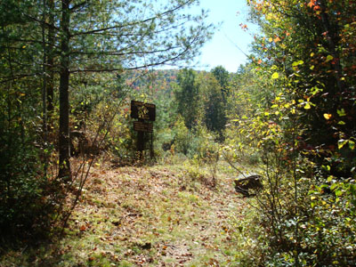
The Sandwich Mountain Trail trailhead near Route 49

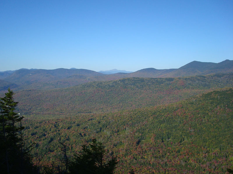
Looking at Mt. Washington from near the Noon Peak summit
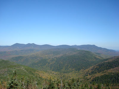
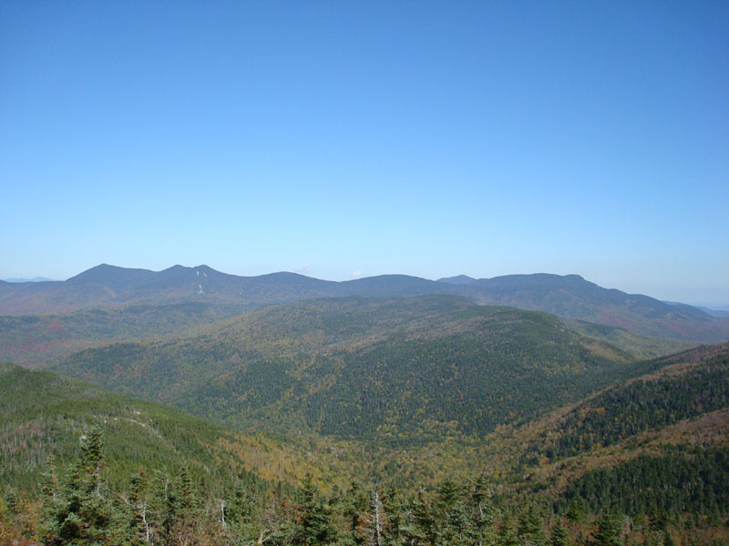
Looking northeast at the Tripyramids, Sleepers, and Mt. Whiteface from the Jennings Peak summit
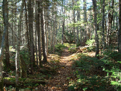
Looking down the Sandwich Mountain Trail on the way to Sandwich Mountain

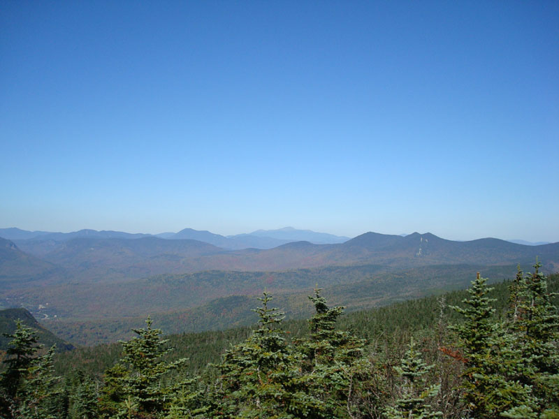
Looking northeast at Mt. Washington and the Tripyramids from the Sandwich Mountain summit

Directions to trailhead: Take Route 49 toward Waterville Valley. Take a right less than a mile before (south of) Tripoli Road. The small WMNF fee parking lot is straight ahead. The Sandwich Mountain Trail trailhead is located just before the parking lot on the right.
Back to Noon Peak Profile
Back to Jennings Peak Profile
Back to Sandwich Mountain Profile
|