Home
States
Colorado
Connecticut
Maine
Massachusetts
New Hampshire
New York
Rhode Island
Utah
Vermont
View All
Lists
NE 4,000 Footers
NE 100 Highest
NH 4,000 Footers
NH 100 Highest
NH 52 With A View
NH Belknap Range
NH Ossipee 10
Links
Trail Conditions
Trip Log
Sunrises
Sunsets
About
|
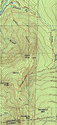
Noon Peak, Jennings Peak, Sandwich Mountain
Waterville Valley, NH
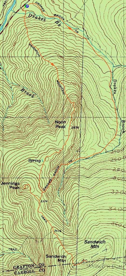
Trailheads, measurements, times, distances, and maps are all approximate and relative to the hike(s) as shown below.
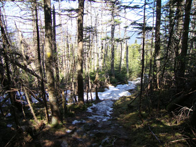
Looking up the Sandwich Mountain Trail on the way to Jennings Peak
Route: Sandwich Mountain Trail, (Noon Peak), Sandwich Mountain Trail, spur trail, (Jennings Peak), spur trail, Sandwich Mountain Trail, (Sandwich Mountain), Sandwich Mountain Trail, Drakes Brook Trail
With half of a day available and nice weather, I headed over to Waterville Valley to hike Sandwich Dome.
After parking in the small lot and walking by the power station, I made my way across the somewhat tricky water crossing. Thereafter, I continued up the moderate pitched Sandwich Mountain Trail, which eventually became steep for the final climb up to the Noon Peak area. Virtually snow free to this point, there were excellent views from the various vistas near Noon Peak. Some snow monorail popped up briefly near Jennings Peak, however by and large this ascent was snowfree as well.
The views from Jennings Peak were stunning - Mt. Washington was visible from the first vista, while Killington was easily seen from the final, grand ledge viewpoint. While it was tempting to hang out at the bug-free summit in nice conditions, I headed back down and worked my way up to Sandwich Dome, reaching consistent snow after the Smarts Brook junction.
The views from Sandwich Dome were excellent, though not as wide reaching as Jennings Peak. After taking in the views and doing some trail clean up on the way down to the junction, I took Drakes Brook Trail for the descent. Filled with blowdowns at first, the trail was smooth sailing once reaching the brookside. After a slightly tricky water crossing, I reached the final roadwalk back to the parking lot.
| Hike Ratings |
|
Getting To Trailhead: |
Easy |
| Destination: |
Noon Peak |
|
Length: |
Moderate |
|
Steepness: |
Difficult |
|
Navigation: |
Easy |
|
Views: |
Excellent |
|
Crowds: |
Minimal |
| Destination: |
Jennings Peak |
|
Length: |
Moderate |
|
Steepness: |
Difficult |
|
Navigation: |
Easy |
|
Views: |
Excellent |
|
Crowds: |
Minimal |
| Destination: |
Sandwich Mountain |
|
Length: |
Moderate |
|
Steepness: |
Moderate |
|
Navigation: |
Easy |
|
Views: |
Excellent |
|
Crowds: |
Minimal |
|
| Hike Stats |
|
Date Hiked: |
Saturday, April 24, 2010 |
| Hike Commenced: |
8:13 AM |
| Parking Elevation: |
1,420' |
| Destination: |
Jennings Peak |
| Ascent Commenced: |
8:13 AM |
| Summit Reached: |
9:52 AM |
| Time Elapsed: |
01:39 |
| Trailhead Elevation: |
1,420' |
| Summit Elevation: |
3,460' |
| Distance: |
2.7 miles |
| Vertical Gain: |
2,195' |
| Destination: |
Sandwich Mountain |
| Ascent Commenced: |
9:58 AM |
| Summit Reached: |
10:38 AM |
| Time Elapsed: |
00:40 |
| Trailhead Elevation: |
3,460' |
| Summit Elevation: |
3,980' |
| Distance: |
1.5 miles |
| Vertical Gain: |
725' |
|
|
| Hike Ended: |
1:14 PM |
| Hike Time Elapsed: |
05:01 |
| Hike Vertical Gain: |
2,980' |
|
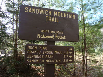
The Sandwich Mountain Trail trailhead near Route 49
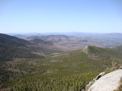
Looking southwest from Jennings Peak
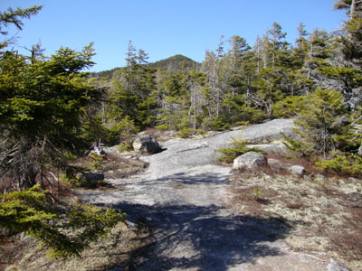
Looking down the Sandwich Mountain Trail on the way to Sandwich Mountain
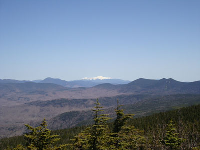
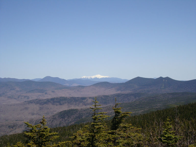
Looking northeast at Mt. Washington and the Tripyramids from the Sandwich Mountain summit
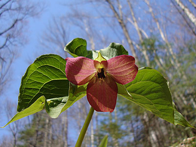
A trillium on the Drakes Brook Trail

Directions to trailhead: Take Route 49 toward Waterville Valley. Take a right less than a mile before (south of) Tripoli Road. The small WMNF fee parking lot is straight ahead. The Sandwich Mountain Trail trailhead is located just before the parking lot on the right.
Back to Noon Peak Profile
Back to Jennings Peak Profile
Back to Sandwich Mountain Profile
|