Home
States
Colorado
Connecticut
Maine
Massachusetts
New Hampshire
New York
Rhode Island
Utah
Vermont
View All
Lists
NE 4,000 Footers
NE 100 Highest
NH 4,000 Footers
NH 100 Highest
NH 52 With A View
NH Belknap Range
NH Ossipee 10
Links
Trail Conditions
Trip Log
Sunrises
Sunsets
About
|
King Pine
Madison, NH, Eaton, NH
Trailheads, measurements, times, distances, and maps are all approximate and relative to the hike(s) as shown below.

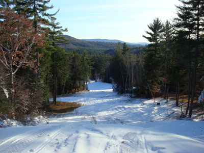
The King Pine ski trail
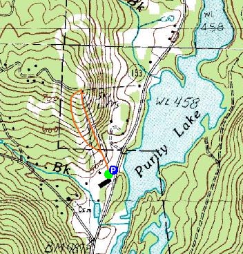
Route: King Pine, (King Pine summit), Pine Spills, King Pine
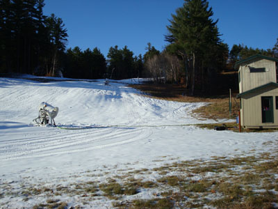
On my way back from hiking Mt. Cutler in Maine, I decided to stop by King Pine and see if they had started making snow (since we were in the midst of a cold spell). They had, so I decided to hike up and check out the top of the hill for the first time.
I hiked straight up the King Pine ski trail which, though a bit steep, isn't too bad due to the length.
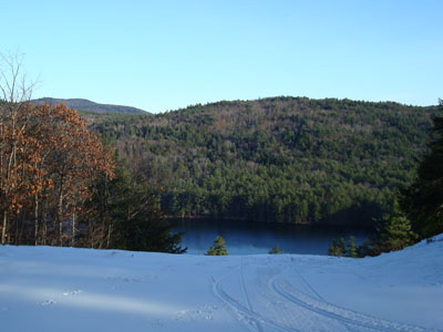
There isn't too much to see from the summit, since King Pine is in somewhat of a valley. Nonetheless, the views of Purity Lake are nice enough.
By the looks of it, they could open tomorrow, however there is no reason to push out the snow for one day of skiing, especially with mild weather behind it.
| Hike Ratings |
|
Getting To Trailhead: |
Easy |
| Destination: |
King Pine (ski area summit) |
|
Length: |
Easy |
|
Steepness: |
Moderate |
|
Navigation: |
Easy |
|
Views: |
Moderate |
|
Crowds: |
Minimal |
|
| Hike Stats |
|
Date Hiked: |
Saturday, November 24, 2007 |
| Hike Commenced: |
2:11 PM |
| Parking Elevation: |
460' |
| Destination: |
King Pine (ski area summit) |
| Ascent Commenced: |
2:12 PM |
| Summit Reached: |
2:21 PM |
| Time Elapsed: |
00:09 |
| Trailhead Elevation: |
460' |
| Summit Elevation: |
760' |
| Vertical Gain: |
300' |
|
|
| Hike Ended: |
2:37 PM |
| Hike Time Elapsed: |
00:26 |
| Hike Vertical Gain: |
300' |
|

Looking up the King Pine ski trail

Looking at Purity Lake from the King Pine summit


Directions to trailhead: Take Route 153 North from Route 25 to King Pine ski area
Back to King Pine Profile
|