Home
States
Colorado
Connecticut
Maine
Massachusetts
New Hampshire
New York
Rhode Island
Utah
Vermont
View All
Lists
NE 4,000 Footers
NE 100 Highest
NH 4,000 Footers
NH 100 Highest
NH 52 With A View
NH Belknap Range
NH Ossipee 10
Links
Trail Conditions
Trip Log
Sunrises
Sunsets
About
|
Ladd Mountain
Meredith, NH
Trailheads, measurements, times, distances, and maps are all approximate and relative to the hike(s) as shown below.
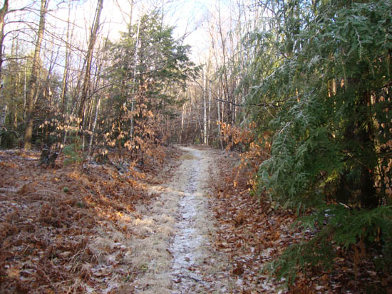
Looking up the old logging road to Ladd Mountain
Route: Unknown trail
With snow and black ice plaguing the region in the morning, I gladly stayed put and worked. After the sun started to break out in the afternoon, I decided to check out another new-to-me local peak.
Starting at on a logging road near the south end of Chemung Road, I headed up a dirt ramp of sorts and jogged onto an older grassy logging road with a fairly obvious footbed in the middle. While there was a good eighth of an inch of ice on everything, I was fortunately able to make it up the trail without wearing light traction.
While a road branched off the main road, it seemed generally obvious to follow, with good footing. Reaching a junction of sorts with a foot trail, I beared right and up a slightly steeper climb to the peak proper. Reaching the summit, I headed down to the view ledge, from where there were superb Lakes Region views.
For the descent, I decided to follow the foot trail I had seen at the junction. Though a nice trail, I probably won't take it again, as at least one (if not both) branch ends up in someone's back yard. Nonetheless, the old logging road route was more than adequate.
| Hike Ratings |
|
Getting To Trailhead: |
Moderate |
| Destination: |
Ladd Mountain |
|
Length: |
Easy |
|
Steepness: |
Moderate |
|
Navigation: |
Moderate |
|
Views: |
Excellent |
|
Crowds: |
Moderate |
|
| Hike Stats |
|
Date Hiked: |
Friday, November 26, 2010 |
| Hike Commenced: |
3:08 PM |
| Parking Elevation: |
965' |
| Destination: |
Ladd Mountain |
| Ascent Commenced: |
3:08 PM |
| Summit Reached: |
3:21 PM |
| Time Elapsed: |
00:13 |
| Trailhead Elevation: |
965' |
| Summit Elevation: |
1,330' |
| Vertical Gain: |
390' |
|
|
| Hike Ended: |
3:42 PM |
| Hike Time Elapsed: |
00:34 |
| Hike Vertical Gain: |
415' |
|
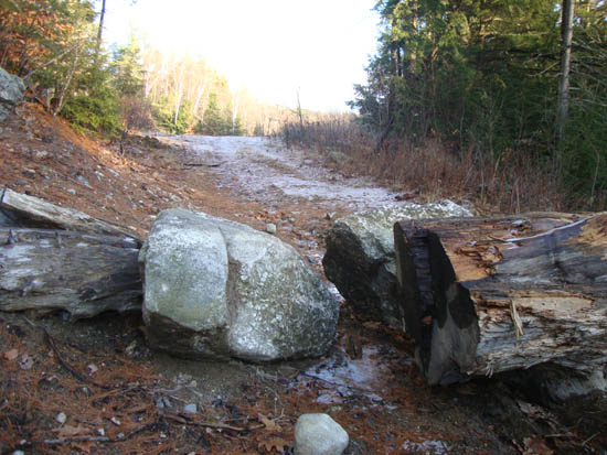
The start of the logging road off Chemung Road
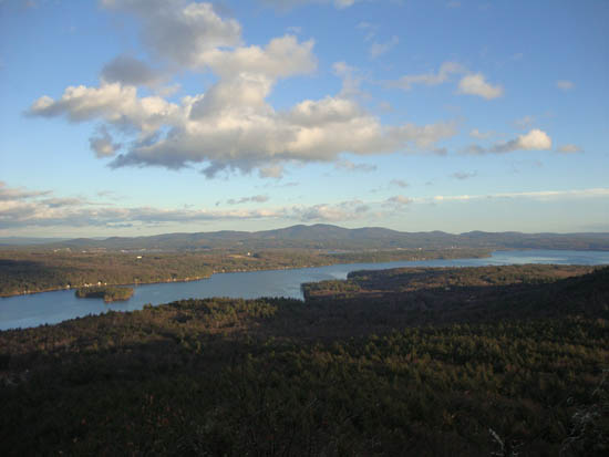
Looking east-southeast at the Belknaps from the Ladd Mountain ledge vista
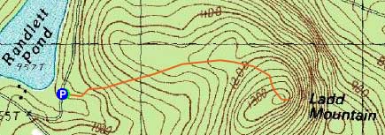

Directions to trailhead: Take Route 104 East from I-93 in New Hampton. Shortly after passing Wickwas Lake on the right, take a right onto Meredith Center Road. Shortly thereafter, take a right onto Chemung Road. A few minutes later, take a right to stay on Chemung Road (where Camp Waldron Road goes straight). Awhile after the road turns to dirt, Randlett Pond will be visible on the right. On the left, there will be a blocked off logging road with limited room for parking. The trail starts on the logging road.
Back to Ladd Mountain Profile
|

