Home
States
Colorado
Connecticut
Maine
Massachusetts
New Hampshire
New York
Rhode Island
Utah
Vermont
View All
Lists
NE 4,000 Footers
NE 100 Highest
NH 4,000 Footers
NH 100 Highest
NH 52 With A View
NH Belknap Range
NH Ossipee 10
Links
Trail Conditions
Trip Log
Sunrises
Sunsets
About
|
Ladd Mountain
Meredith, NH
Trailheads, measurements, times, distances, and maps are all approximate and relative to the hike(s) as shown below.
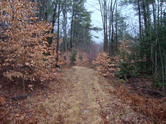
Looking up the old logging road to Ladd Mountain
Route: Unknown trail
With a break in the rain, I headed over to Ladd Mountain for a quick jog. As expected, the trail was a bit wet and muddy from the hours of rain.
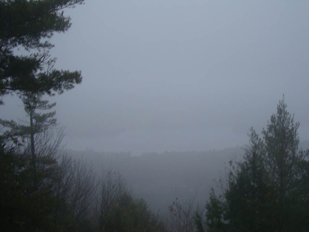
From the summit, there were slight views of Winnisquam - better than nothing at all.
| Hike Ratings |
|
Getting To Trailhead: |
Moderate |
| Destination: |
Ladd Mountain |
|
Length: |
Easy |
|
Steepness: |
Moderate |
|
Navigation: |
Moderate |
|
Views: |
Minimal (due to weather) |
|
Crowds: |
Minimal |
|
| Hike Stats |
|
Date Hiked: |
Monday, December 13, 2010 |
| Hike Commenced: |
3:30 PM |
| Parking Elevation: |
965' |
| Destination: |
Ladd Mountain |
| Ascent Commenced: |
3:30 PM |
| Summit Reached: |
3:40 PM |
| Time Elapsed: |
00:10 |
| Trailhead Elevation: |
965' |
| Summit Elevation: |
1,330' |
| Vertical Gain: |
390' |
|
|
| Hike Ended: |
3:54 PM |
| Hike Time Elapsed: |
00:24 |
| Hike Vertical Gain: |
415' |
|
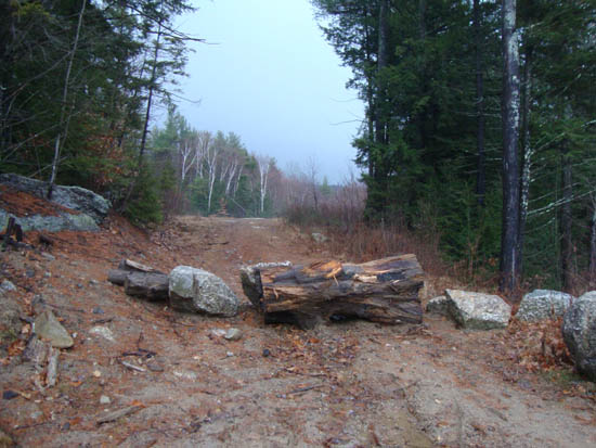
The start of the logging road off Chemung Road

Looking through the fog at Winnisquam Lake from the Ladd Mountain ledge vista
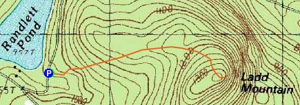

Directions to trailhead: Take Route 104 East from I-93 in New Hampton. Shortly after passing Wickwas Lake on the right, take a right onto Meredith Center Road. Shortly thereafter, take a right onto Chemung Road. A few minutes later, take a right to stay on Chemung Road (where Camp Waldron Road goes straight). Awhile after the road turns to dirt, Randlett Pond will be visible on the right. On the left, there will be a blocked off logging road with limited room for parking. The trail starts on the logging road.
Back to Ladd Mountain Profile
|