Home
States
Colorado
Connecticut
Maine
Massachusetts
New Hampshire
New York
Rhode Island
Utah
Vermont
View All
Lists
NE 4,000 Footers
NE 100 Highest
NH 4,000 Footers
NH 100 Highest
NH 52 With A View
NH Belknap Range
NH Ossipee 10
Links
Trail Conditions
Trip Log
Sunrises
Sunsets
About
|
Magalloway Mountain
Pittsburg, NH
Trailheads, measurements, times, distances, and maps are all approximate and relative to the hike(s) as shown below.
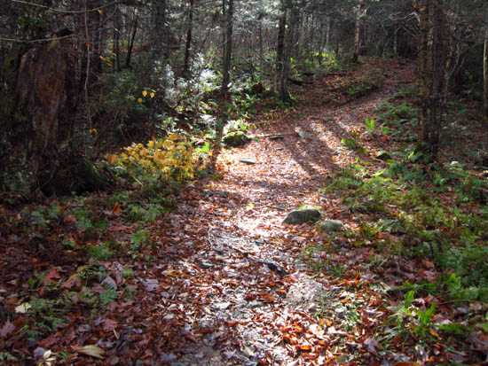
Looking up the Coot Trail
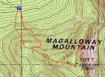
Route: Coot Trail, (Magalloway Mountain), Coot Trail, Bobcat Trail
The Coot Trail was essentially a jeep road to the summit - steep and eroded in places, but generally good going.
While there were excellent views from the fire tower, the views were more dramatic from atop the cliffs via a summit spur trail. The spur trail to the spring, on the other hand, was uneventful.
The Bobcat Trail provided a smoother, more scenic descent.
| Hike Ratings |
|
Getting To Trailhead: |
Moderate |
| Destination: |
Magalloway Mountain |
|
Length: |
Moderate |
|
Steepness: |
Difficult |
|
Navigation: |
Easy |
|
Views: |
Excellent |
|
Crowds: |
Easy |
|
| Hike Stats |
|
Date Hiked: |
Sunday, October 15, 2011 |
| Parking Elevation: |
2,600' |
| Destination: |
Magalloway Mountain |
| Time Elapsed: |
00:24 |
| Trailhead Elevation: |
2,600' |
| Summit Elevation: |
3,384' |
| Vertical Gain: |
804' |
|
|
| Hike Time Elapsed: |
01:23 |
| Hike Vertical Gain: |
1,154' |
|
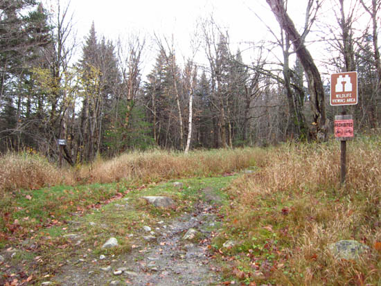
The Coot trailhead at the end of the logging road
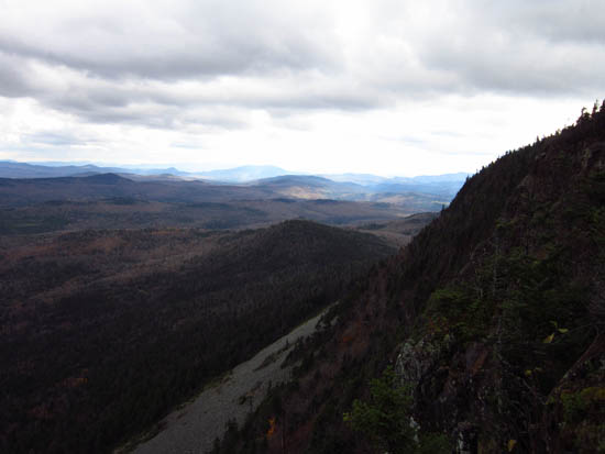
Looking toward Grafton Notch from near the summit of Magalloway Mountain

Directions to trailhead: The Coot Trail starts at the end of a logging road accessible from Magalloway Road. The Bobcat Trail starts just before the Coot Trail.
Back to Magalloway Mountain Profile
|

