Home
States
Colorado
Connecticut
Maine
Massachusetts
New Hampshire
New York
Rhode Island
Utah
Vermont
View All
Lists
NE 4,000 Footers
NE 100 Highest
NH 4,000 Footers
NH 100 Highest
NH 52 With A View
NH Belknap Range
NH Ossipee 10
Links
Trail Conditions
Trip Log
Sunrises
Sunsets
About
|
Middle Carter Mountain, South Carter Mountain
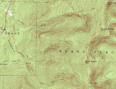
Green's Grant, NH, Bean's Purchase, NH
Trailheads, measurements, times, distances, and maps are all approximate and relative to the hike(s) as shown below.
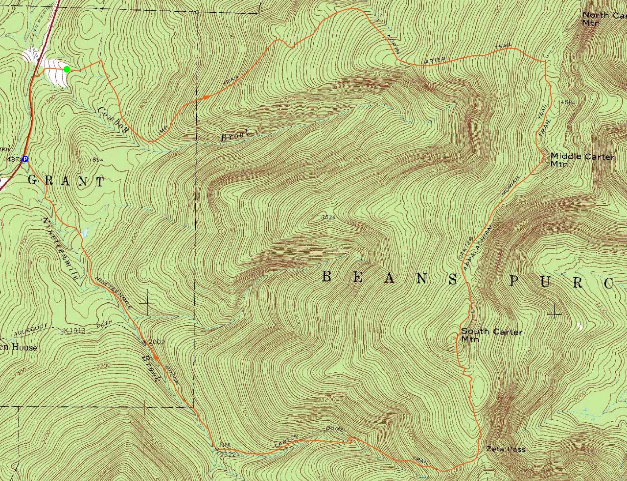
Looking up the Imp Trail on the way to Middle Carter
Route: Route 16, Camp Dodge road, unknown trail, Imp Trail, North Carter Trail, Carter-Moriah Trail, (Middle Carter Mountain), Carter-Moriah Trail, (South Carter Mountain), Carter-Moriah Trail, Carter Dome Trail, Nineteen Mile Brook Trail
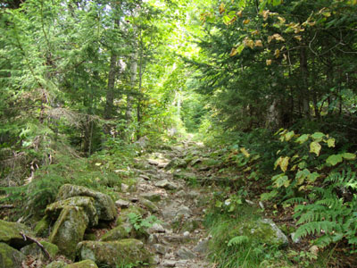
To mix things up a bit, and to ensure no after-dark-roadwalking, I decided to ascend the Carters via Camp Dodge. After walking from Nineteen Mile Brook to the camp, I worked my way straight up the road, to the left of a workshop of some sort, to the logging road to the Imp Trail. The beginning of the logging road was blocked by a recent blowdown, however the rest of it was in good shape.
The Imp Trail looked as if it was in the midst of moderate trail work - new waterbars, steps, etc. Reaching the North Carter Trail, it was dry for once - that us, until I neared the top, at which point it turned into its apparently normal, wet self.
The Carter-Moriah Trail was in good shape as I worked my way to Middle Carter. At one point, I spotted a potential herd path to Mt. Lethe - I followed it for a bit, but turned back as I was wearing shorts and didn't feel like getting cut up.
Though hazy and increasingly cloudy, the views from the area around Middle Carter were nonetheless good. Working my way to South Carter, the sky continued to cloud up. Reaching the summit, I did the very short bushwhack to the vista for some more views.
The descent was pretty bland as normal. I was able to arrive back at the parking lot well before the sunset.
| Hike Ratings |
|
Getting To Trailhead: |
Moderate |
| Destination: |
Middle Carter Mountain |
|
Length: |
Moderate |
|
Steepness: |
Difficult |
|
Navigation: |
Moderate |
|
Views: |
Excellent |
|
Crowds: |
Minimal |
| Destination: |
South Carter Mountain |
|
Length: |
Moderate |
|
Steepness: |
Difficult |
|
Navigation: |
Easy |
|
Views: |
Excellent |
|
Crowds: |
Minimal |
|
| Hike Stats |
|
Date Hiked: |
Thursday, August 20, 2009 |
| Hike Commenced: |
2:07 PM |
| Parking Elevation: |
1,485' |
| Destination: |
Middle Carter Mountain |
| Ascent Commenced: |
2:18 PM |
| Summit Reached: |
4:17 PM |
| Time Elapsed: |
01:59 |
| Trailhead Elevation: |
1,490' |
| Summit Elevation: |
4,610' |
| Vertical Gain: |
3,260' |
| Destination: |
South Carter Mountain |
| Ascent Commenced: |
4:17 PM |
| Summit Reached: |
4:49 PM |
| Time Elapsed: |
00:32 |
| Trailhead Elevation: |
4,610' |
| Summit Elevation: |
4,430' |
| Vertical Gain: |
415' |
|
|
| Hike Ended: |
6:57 PM |
| Hike Time Elapsed: |
04:50 |
| Hike Vertical Gain: |
3,835' |
|
The beginning of the logging road at Camp Dodge
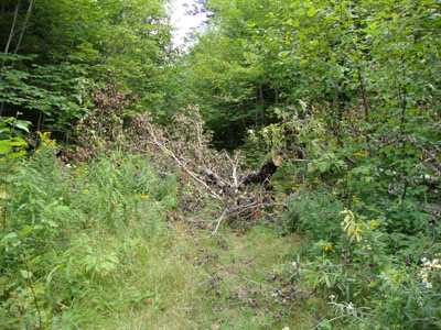
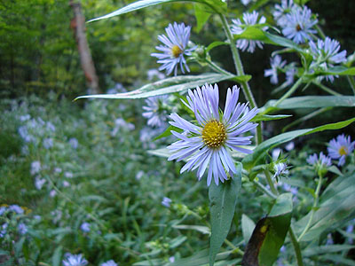
Flowers at Camp Dodge
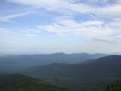
Looking at the Baldfaces from Middle Carter
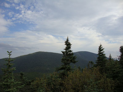
The Carter-Moriah Trail between South and Middle Carter
Wildflowers on the Carter Dome Trail
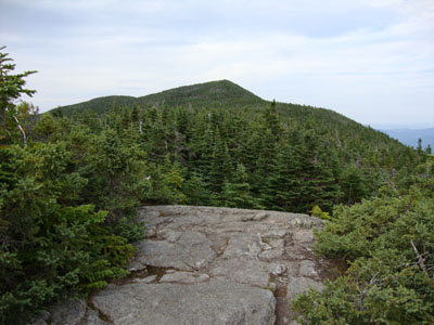
Looking at Mt. Hight and Carter Dome from South Carter

Directions to trailhead: Take Route 16 North past the Mt. Washington Auto Road entrance. Shortly thereafter, the Nineteen Mile Brook Trail WMNF fee parking area is on the right side of the road. A clockwise loop hike can be had by walking north on Route 16 to and then up Camp Dodge Road, bearing left at a junction, then walking straight up the road to a logging road (a workshop of some sort will be on the right next to the beginning of the logging road). The logging road leads to the Imp Trail.
Back to Middle Carter Mountain Profile
Back to South Carter Mountain Profile
|