Home
States
Colorado
Connecticut
Maine
Massachusetts
New Hampshire
New York
Rhode Island
Utah
Vermont
View All
Lists
NE 4,000 Footers
NE 100 Highest
NH 4,000 Footers
NH 100 Highest
NH 52 With A View
NH Belknap Range
NH Ossipee 10
Links
Trail Conditions
Trip Log
Sunrises
Sunsets
About
|
Middle Carter Mountain, South Carter Mountain
Green's Grant, NH, Bean's Purchase, NH
Trailheads, measurements, times, distances, and maps are all approximate and relative to the hike(s) as shown below.
The Carter-Moriah Trail near Middle Carter
Route: Camp Dodge road, unknown trail, Imp Trail, North Carter Trail, Carter-Moriah Trail, (Middle Carter Mountain), Carter-Moriah Trail, (South Carter Mountain), Carter-Moriah Trail, Carter Dome Trail, Carter-Moriah Trail, (Carter Dome), Carter-Moriah Trail, Carter Dome Trail, Nineteen Mile Brook Trail
Snowshoes were fine for Imp Trail, North Carter Trail, and the ridge. Top to bottom snowpack. Maybe 6" of snowpack at the base, increasing to 2 to 3 feet along the ridge, with some deeper drifts.
In between Middle Carter and South Carter, I decided to snowshoe jog to pick up the pace a bit. About a quarter of a mile or so into it, I felt a painful pop in the vicinity of my achilles. Thereafter, there was pain when my foot was flexed (ie less than a 90 degree angle), but I was okay if ascending on my toes, and descending as normal, so I kept a walking pace.
Reaching the flats on the Nineteen Mile Brook Trail, an awkward step or two caused it to flare up. The last half mile I was barely able to put weight on that leg.
Once back home, there was no pain when sitting/laying down. However, minimal walking and random movements caused pain and lack of strength. A later MRI revealed a partial tear of the achilles. Hooray.
| Hike Ratings |
|
Getting To Trailhead: |
Moderate |
| Destination: |
Middle Carter Mountain |
|
Length: |
Moderate |
|
Steepness: |
Difficult |
|
Navigation: |
Moderate |
|
Views: |
Excellent |
|
Crowds: |
Minimal |
| Destination: |
South Carter Mountain |
|
Length: |
Moderate |
|
Steepness: |
Difficult |
|
Navigation: |
Easy |
|
Views: |
Excellent |
|
Crowds: |
Minimal |
| Destination: |
Carter Dome |
|
Length: |
Moderate |
|
Steepness: |
Difficult |
|
Navigation: |
Easy |
|
Views: |
Excellent |
|
Crowds: |
Minimal |
|
| Hike Stats |
|
Date Hiked: |
Sunday, December 23, 2012 |
| Parking Elevation: |
1,485' |
| Destination: |
Middle Carter Mountain |
| Time Elapsed: |
02:30 |
| Trailhead Elevation: |
1,490' |
| Summit Elevation: |
4,610' |
| Vertical Gain: |
3,260' |
| Destination: |
South Carter Mountain |
| Time Elapsed: |
00:36 |
| Trailhead Elevation: |
4,610' |
| Summit Elevation: |
4,430' |
| Vertical Gain: |
415' |
| Destination: |
Carter Dome |
| Time Elapsed: |
01:06 |
| Trailhead Elevation: |
4,430' |
| Summit Elevation: |
4,832' |
| Vertical Gain: |
1,347' |
|
|
| Hike Time Elapsed: |
06:43 |
| Hike Vertical Gain: |
5,187' |
|
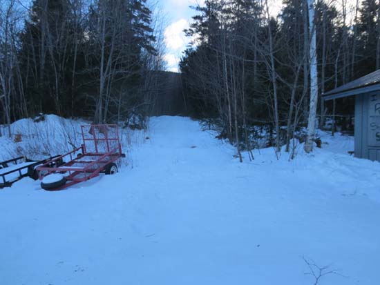
The beginning of the logging road at Camp Dodge
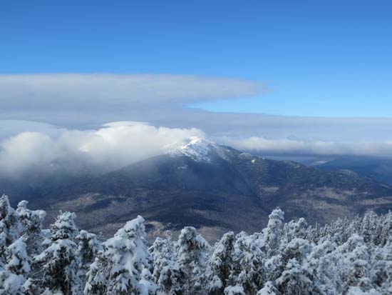
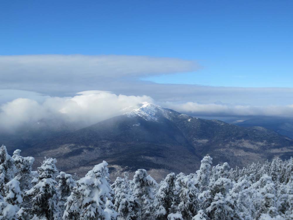
Mt. Madison as seen from near the summit of Middle Carter
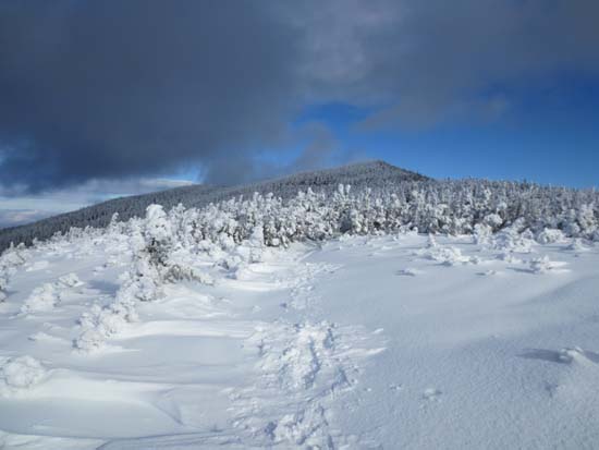
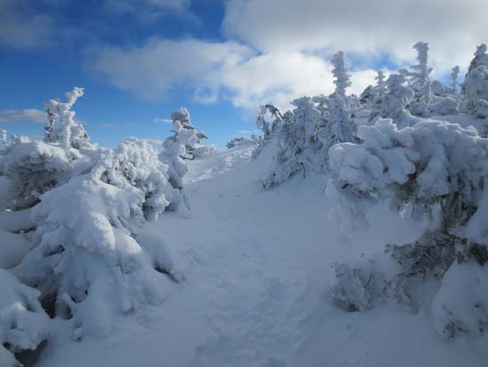
The Carter-Moriah Trail south of Middle Carter
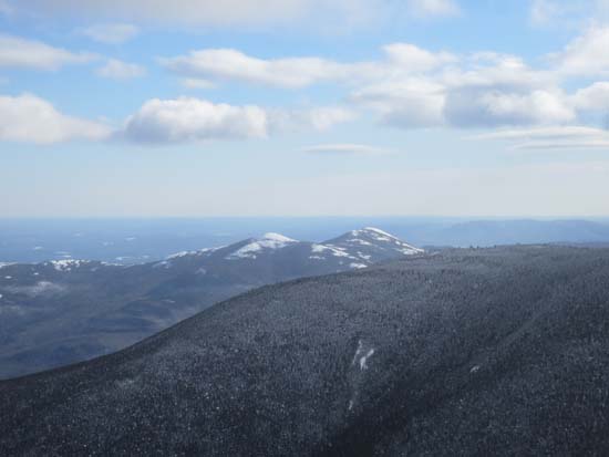
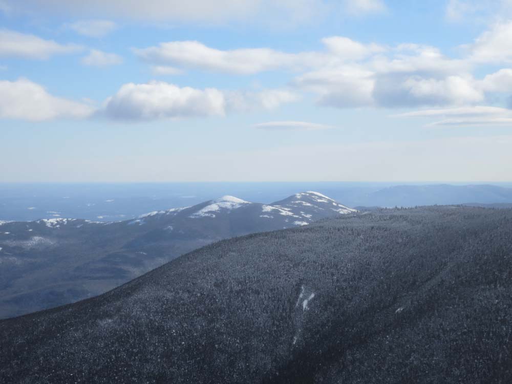
Looking at the Baldfaces from near the summit of South Carter
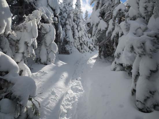
The Carter Dome Trail between South Carter and Carter Dome
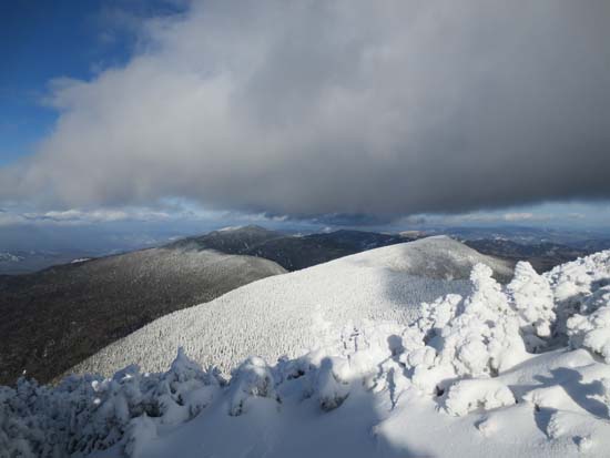
Looking at Mt. Hight and the Carters from near the summit of Carter Dome
Directions to trailhead: Take Route 16 North past the Mt. Washington Auto Road entrance. Shortly thereafter, the Nineteen Mile Brook Trail WMNF fee parking area is on the right side of the road. A clockwise loop hike can be had by walking north on Route 16 to and then up Camp Dodge Road, bearing left at a junction, then walking straight up the road to a logging road (a workshop of some sort will be on the right next to the beginning of the logging road). The logging road leads to the Imp Trail.
Back to Middle Carter Mountain Profile
Back to South Carter Mountain Profile
Back to Carter Dome Profile
|