Home
States
Colorado
Connecticut
Maine
Massachusetts
New Hampshire
New York
Rhode Island
Utah
Vermont
View All
Lists
NE 4,000 Footers
NE 100 Highest
NH 4,000 Footers
NH 100 Highest
NH 52 With A View
NH Belknap Range
NH Ossipee 10
Links
Trail Conditions
Trip Log
Sunrises
Sunsets
About
|
Middle Mountain, Rattlesnake Mountain
Conway, NH
Trailheads, measurements, times, distances, and maps are all approximate and relative to the hike(s) as shown below.
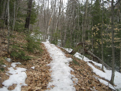
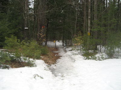
Looking up the Middle Mountain Trail
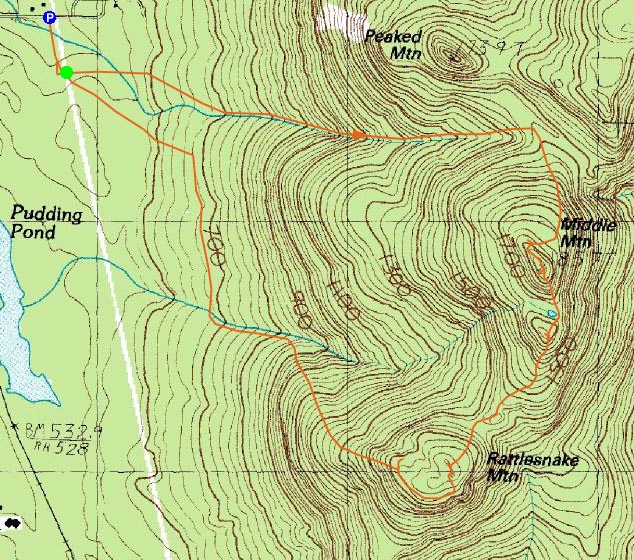
Route: Middle Mountain Trail, (Middle Mountain), bushwhack, (Rattlesnake Mountain, bushwhack
With a mediocre at best weather forecast, I decided to do some exploring in the North Conway area. While I knew I'd be able to bareboot to Middle Mountain, I also knew I wanted to do some bushwhacking. Thus, I donned my snowshoes for the trek.
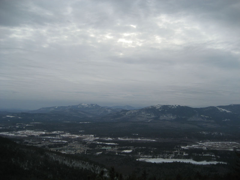
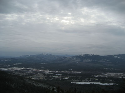
The Middle Mountain Trail was a hodgepodge of spring conditions - hardpack, blue ice, monorail, bare ground, mud. Though cloudy, the views from the summit were still quite good.
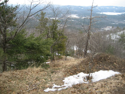
After checking out the views a bit, I strapped my snowshoes onto my backpack and began a light bushwhack past the small pond and to the south peak of Middle Mountain. From that peak, there were decent directional views from a ledge.
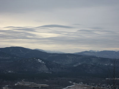
Past that peak, I descended into two cols, before strapping my snowshoes back on for the ascent up Rattlesnake Mountain. While there was a decent directional view from the highpoint, the best views were from the numerous ledges that wrap around much of the peak. In particular, there were some nice ledges on the southeast and west sides.
For my descent, I found a ledge shelf to get around the cliffs. Below that, I worked my way gradually back to the Middle Mountain Trail trailhead, passing some neat ledges and signs of wildlife along the way.
| Hike Ratings |
|
Getting To Trailhead: |
Easy |
| Destination: |
Middle Mountain |
|
Length: |
Moderate |
|
Steepness: |
Moderate |
|
Navigation: |
Easy |
|
Views: |
Excellent |
|
Crowds: |
Minimal |
| Destination: |
Rattlesnake Mountain |
|
Length: |
Moderate |
|
Steepness: |
Moderate |
|
Navigation: |
Difficult |
|
Views: |
Excellent |
|
Crowds: |
Minimal |
|
| Hike Stats |
|
Date Hiked: |
Thursday, March 26, 2009 |
| Hike Commenced: |
3:50 PM |
| Parking Elevation: |
535' |
| Destination: |
Middle Mountain |
| Ascent Commenced: |
3:54 PM |
| Summit Reached: |
4:44 PM |
| Time Elapsed: |
00:50 |
| Trailhead Elevation: |
545' |
| Summit Elevation: |
1,857' |
| Vertical Gain: |
1,342' |
| Destination: |
Rattlesnake Mountain |
| Ascent Commenced: |
4:51 PM |
| Summit Reached: |
5:25 PM |
| Time Elapsed: |
00:34 |
| Trailhead Elevation: |
1,857' |
| Summit Elevation: |
1,590' |
| Vertical Gain: |
300' |
|
|
| Hike Ended: |
6:54 PM |
| Hike Time Elapsed: |
03:04 |
| Hike Vertical Gain: |
1,752' |
|
Middle Mountain Trail trailhead under the power lines
Looking at Mt. Chocorua and South Moat from Middle Mountain
Looking down a herd path on the way to Rattlesnake Mountain
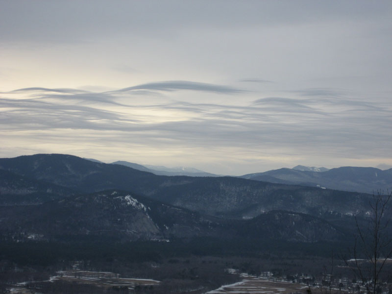
Looking at White Horse Ledge and Cathedral Ledge from Rattlesnake Mountain
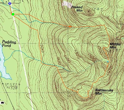

Directions to trailhead: From Routes 16/302 in North Conway, take Artist Falls Road past the railroad tracks. Take a right onto Thompson Road. A small Town of Conway-Pudding Pond Conservation Area signed parking lot will be on the right shortly thereafter.
Back to Middle Mountain Profile
Back to Rattlesnake Mountain Profile
|