Home
States
Colorado
Connecticut
Maine
Massachusetts
New Hampshire
New York
Rhode Island
Utah
Vermont
View All
Lists
NE 4,000 Footers
NE 100 Highest
NH 4,000 Footers
NH 100 Highest
NH 52 With A View
NH Belknap Range
NH Ossipee 10
Links
Trail Conditions
Trip Log
Sunrises
Sunsets
About
|
Middle Sugarloaf
Bethlehem, NH
Trailheads, measurements, times, distances, and maps are all approximate and relative to the hike(s) as shown below.
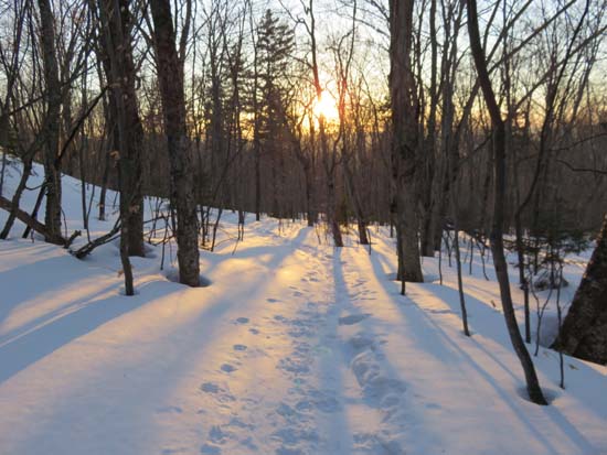
The Sugarloaf Trail
Route: Snowmobile trail, Zealand Road, Sugarloaf Trail
Snowmobile trail alongside US 302 from winter lot to Zealand Road entrance (gated) (0.2 mile) still had full coverage, though it looks like water is pooling on part of it (frozen this evening).
Zealand Road (1.0 mile) was plowed past the Sugarloaf Trail, but had about 2 inches of hardpack/ice on it. Barebootable for the ascent, but light traction a good idea for descent. I wore snowshoes and had no issues. One warm weather event could get a lot of it down to pavement.
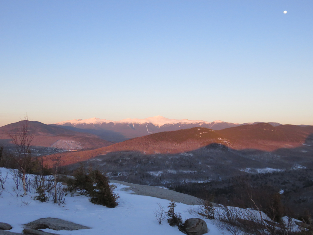
Sugarloaf Trail was generally a firm snowshoe width footbed with a few minor areas of postholes. Evidence of use heading down the Trestle Trail, as well as to North Sugarloaf. Ladder just below Middle Sugarloaf is snow covered, so that steep little pitch could pose an issue to those without some sort of traction. I found snowshoes to be fine from the road to the summit, but light traction would have been fine as well. Snowshoes will be a good idea when temperatures climb, as there's a good 2-3 feet of snowpack.
Nice sunset, but a brisk breeze on the open summit. Still feels like March!
| Hike Ratings |
|
Getting To Trailhead: |
Difficult |
| Destination: |
Middle Sugarloaf |
|
Length: |
Moderate |
|
Steepness: |
Difficult |
|
Navigation: |
Easy |
|
Views: |
Excellent |
|
Crowds: |
Minimal |
|
| Hike Stats |
|
Date Hiked: |
Wednesday, April 1, 2015 |
| Parking Elevation: |
1,480' |
| Time to Trailhead: |
00:16 |
| Destination: |
Middle Sugarloaf |
| Time Elapsed: |
00:27 |
| Trailhead Elevation: |
1,644' |
| Summit Elevation: |
2,539' |
| Distance: |
1.4 miles |
| Vertical Gain: |
915' |
|
|
| Hike Time Elapsed: |
01:42 |
| Hike Vertical Gain: |
1,159' |
|
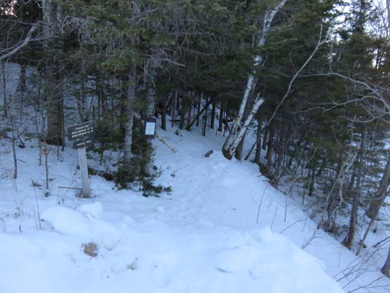
Sugarloaf Trail trailhead

The Presidentials as seen from Middle Sugarloaf
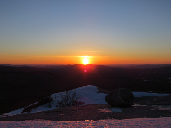
The sunset from Middle Sugarloaf
Directions to trailhead: Take US 302 west from Bartlett past Bretton Woods Ski Area. In winter, there is a plowed parking lot on the right, shortly after a bridge, just before the closed Zealand Road entrance appears on the left. In winter, to get to the trailhead from there, one can hike up Zealand Road.
Back to Middle Sugarloaf Profile
|