Home
States
Colorado
Connecticut
Maine
Massachusetts
New Hampshire
New York
Rhode Island
Utah
Vermont
View All
Lists
NE 4,000 Footers
NE 100 Highest
NH 4,000 Footers
NH 100 Highest
NH 52 With A View
NH Belknap Range
NH Ossipee 10
Links
Trail Conditions
Trip Log
Sunrises
Sunsets
About
|
Mt. Adams, Mt. Madison
Randolph, NH, Low and Burbank's Grant, NH, Thompson and Meserve's Purchase, NH
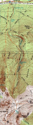
Trailheads, measurements, times, distances, and maps are all approximate and relative to the hike(s) as shown below.
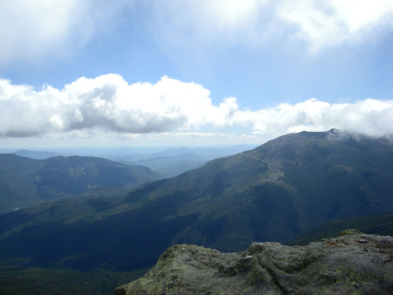
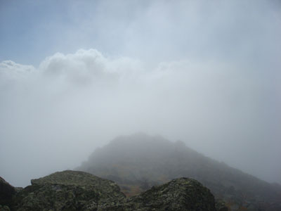
Looking down the Air Line trail as heavy clouds move in
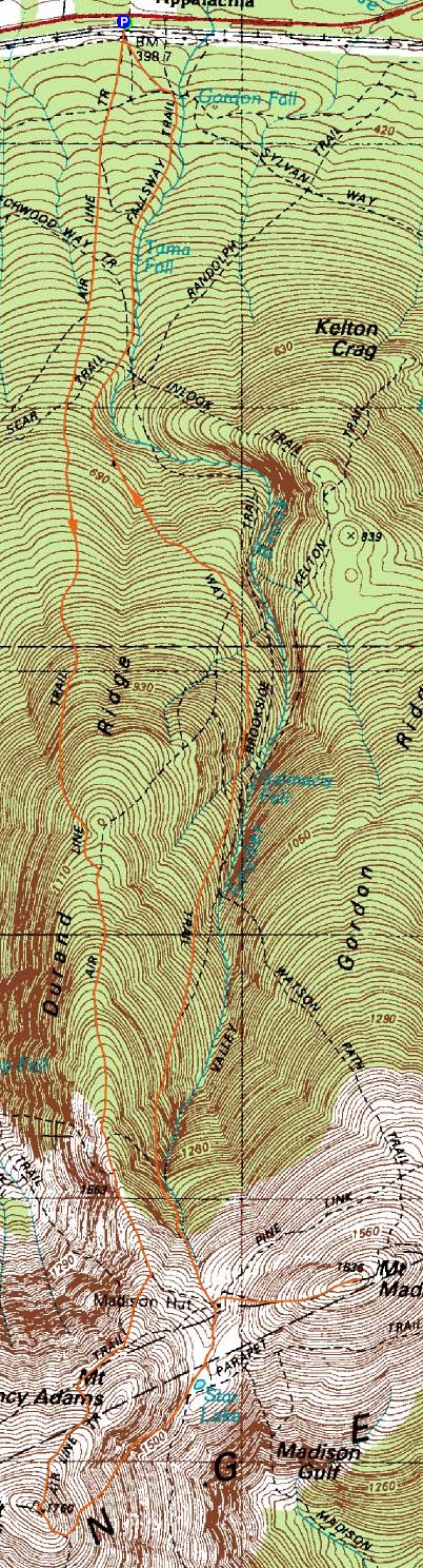
Route: Air Line Trail, (Mt. Adams), Star Lake Trail, Parapet Trail, Star Lake Trail, (Madison Spring Hut), Osgood Trail, (Mt. Madison), Osgood Trail, Valley Way
With the summer quickly ending, I decided it was finally time to do some more Northern Presidentials.
I arrived at the trailhead just before 7 AM - I had intended to start earlier, but discovered an episode of All in the Family was on when I awoke, so my schedule was of course pushed back.
The weather was clear - the entire Presidential Range was easily seen as I drove up Route 16 - until I arrived at the trailhead. Soon enough, some clouds were rolling in from the west.
During the ascent up wooded part of the Air Line trail, I was in a race against the clouds - hoping they'd lift or pass faster than I ascended. Upon clearing the treeline, the contest quickly changed - I had a good glimpse of the west and saw even larger clouds moving in at warp speed - thus, I was hoping I'd make it to the summit before they swallowed the mountain. I lost.
While the Air Line trail is certainly a workout, it didn't seem as tough as I had imagined. Though there are a few sections in which you need to scramble, and a few others in which you're on the side of a large drop off, there are also some flat portions that allow you to catch your breath. Other than stopping for photos/to put my winter stuff on, I was able to hike it non-stop without needing a break.
Boy did it ever get cold! I was glad I brought my gloves/winter hat/fleece, as the temperatures were in the upper 30s at the summit, along with winds of 30-50 miles per hour. The winds made it especially slow going starting just below the Gulf Side Trail.
While I had great scenery for the first portion of above treeline hiking, there was nothing to be seen from the summit. Noting that the forecast was mostly sunny, I decided to hang out on the summit for awhile. Half an hour passed and it was still the same - and I was getting cold and impatient, so I latched on with a group and headed down the Star Lake Trail.
There were some views on this descent - a rocky, steep path - for very brief moments - so brief, that I didn't even have time to turn on my camera to capture them.
After checking out the large quartz rock on the Parapet Trail, we went into the hut.
Not wanting to do this entire hike without a decent summit view, I decided to wait out the weather and have a very long, leisurely lunch. Just before noon, I noticed the cloud cover was starting to wane a bit.
The ascent up Mt. Madison was another steep one - basically like walking up a traprock hill - made more difficult by a sore back and legs from the long layovers.
Arriving at the summit, I was greeted with, once again, no views. I waited half an hour - a period in which over a dozen other hikes came and left - before finally, I saw a break in the clouds to the west. Sure enough, things cleared up rather well, making for great views in all directions. Content, I headed back, this time down Valley Way.
Valley Way was more gradual than the Air Line Trail - and somewhat busy, with a bunch of late risers heading up for good views. The soundtrack of my descent was Tired of Hanging Around by the Zutons, Songs for Silverman by Ben Folds, and Abbey Road by the Beatles.
Only a few more Presidentials left on my to-do list now. Overall, a nice hike, though I do feel the need to go back and summit Adams again when there are views to be had.
| Hike Ratings |
|
Getting To Trailhead: |
Easy |
| Destination: |
Mt. Adams |
|
Length: |
Moderate |
|
Steepness: |
Very Difficult |
|
Navigation: |
Easy |
|
Views: |
Minimal due to weather |
|
Crowds: |
Minimal |
| Destination: |
Mt. Madison |
|
Length: |
Difficult |
|
Steepness: |
Very Difficult |
|
Navigation: |
Easy |
|
Views: |
Excellent |
|
Crowds: |
Heavy |
|
| Hike Stats |
|
Date Hiked: |
Saturday, September 1, 2007 |
| Hike Commenced: |
6:50 AM |
| Parking Elevation: |
1,311' |
| Destination: |
Mt. Adams |
| Ascent Commenced: |
6:50 AM |
| Summit Reached: |
9:42 AM |
| Time Elapsed: |
02:52 |
| Trailhead Elevation: |
1,311' |
| Summit Elevation: |
5,774' |
| Distance: |
4.3 miles |
| Vertical Gain: |
4,513' |
| Destination: |
Madison Spring Hut |
| Descent Commenced: |
10:14 AM |
| Hut Reached: |
11:02 AM |
| Time Elapsed: |
00:48 |
| Trailhead Elevation: |
5,774' |
| Hut Elevation: |
4,800' |
| Distance: |
1 mile |
| Vertical Gain: |
35' |
| Destination: |
Mt. Madison |
| Ascent Commenced: |
12:00 PM |
| Summit Reached: |
12:19 PM |
| Time Elapsed: |
00:19 |
| Trailhead Elevation: |
4,800' |
| Summit Elevation: |
5,367 |
| Distance: |
.5 mile |
| Vertical Gain: |
572' |
|
|
| Hike Ended: |
3:29 PM |
| Hike Time Elapsed: |
08:39 |
| Hike Distance: |
10 miles |
| Hike Vertical Gain: |
5,255' |
|
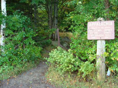
The Air Line/Valley Way trailhead at Appalachia
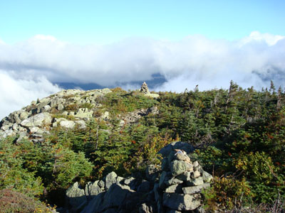
The only small break in the clouds for half an hour on the side of Mt. Adams
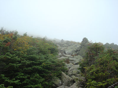
Looking up the Osgood Trail on Mt. Madison
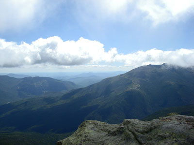
Looking south from Mt. Madison at Wildcat ski area and the Mt. Washington Auto Road

Directions to trailhead: Take US 2 West from Gorham to the Appalachia trailhead/parking lot
Back to Mt. Adams Profile
Back to Mt. Madison Profile
|