Home
States
Colorado
Connecticut
Maine
Massachusetts
New Hampshire
New York
Rhode Island
Utah
Vermont
View All
Lists
NE 4,000 Footers
NE 100 Highest
NH 4,000 Footers
NH 100 Highest
NH 52 With A View
NH Belknap Range
NH Ossipee 10
Links
Trail Conditions
Trip Log
Sunrises
Sunsets
About
|
Mt. Adams
Randolph, NH, Low and Burbank's Grant, NH, Thompson and Meserve's Purchase, NH
Trailheads, measurements, times, distances, and maps are all approximate and relative to the hike(s) as shown below.
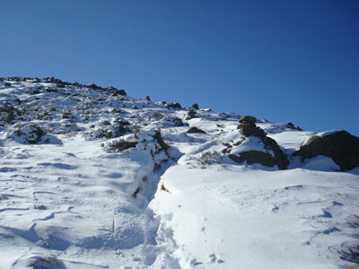
Looking up the Air Line Trail
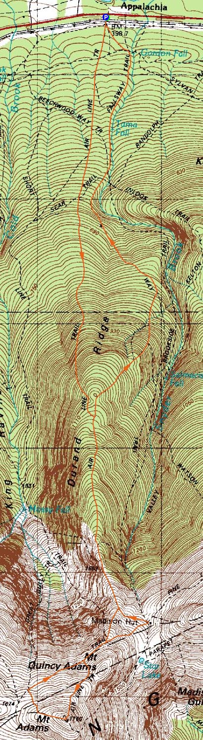
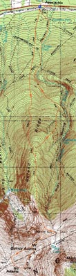
Route: Air Line, (Mt. Adams), Lowe's Path, Gulfside Trail, Air Line Cutoff, Air Line, Scar Trail, Valley Way
My plan was to do a nice fall hike up Adams and over to Madison. I knew I'd perhaps be dealing with a little bit of snow, but likely not much.
Arriving at the nearly empty Appalachia parking area, I quickly set foot up the Air Line Trail. The first mile or so was fairly dry fall hiking. Part way up that mile, I awoke some future Thanksgiving dinners, which had nestled up in the leaves along the trail. Thereafter, though, winter started.
Near treeline, I passed some folks descending, who had turned around due to snow drifts. Doh. In the woods, there was 1-3" or so of snow. Clearing treeline, it quickly changed to 4-6". Time to try Microspikes for the first time.
After crossing the Gulfside Trail, depths increased to 6-8", with drifts up to 2 feet. Unfortunately for me, no one had been up the Air Line above the Gulfside, so it was slow going. It seemed like I was going through a mine field - I had to plan every step, as holes between rocks were concealed with drifts of snow.
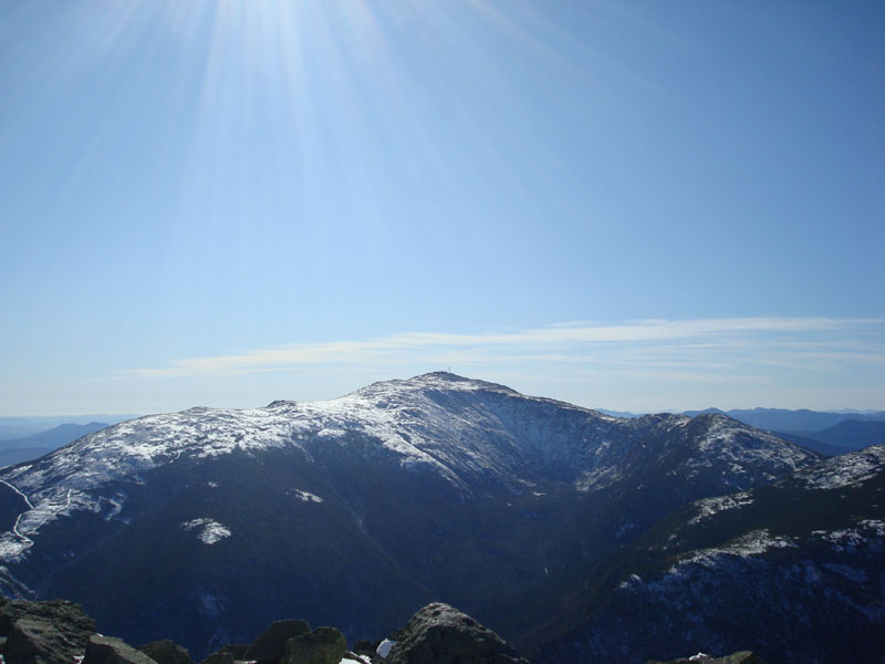
The views from the summit were tremendous - particularly neat was to see the trails at the Wildcat Ski Area covered in white. With warm temperatures and minimal winds, I was able to remain in my tee shirt while eating lunch at the summit.
Since I didn't want to go back down the rough top part of the Air Line Trail, I decided to descend the Lowe's Path, and use the slightly better, but .3 miles longer Gulfside Trail. This worked out pretty well, as I made decent time down to the hut.
Once at the hut, I noticed the Osgood Trail to Madison wasn't broken out. While I still had plenty of daylight and the weather was good, I had a gut feeling that I should forget about Madison and call it a day. Perhaps part of that had to do with my wet socks, as I had forgotten to pack my gaitors. While I had two more pairs of socks, I still didn't feel like going to the peak.
I decided to check out a few of the many trails on the northern slopes, zig zagging from the hut back to the Air Line Trail, then back to the Valley Way trail via the Scar Trail. While it is neat to be able to mix things up a bit and see some of the neat natural features, it still seems to be that there are a few too many trails down low.
Despite the snow, it was a nice day for a hike. Hopefully I won't have to deal with winter conditions again until December.
| Hike Ratings |
|
Getting To Trailhead: |
Easy |
| Destination: |
Mt. Adams |
|
Length: |
Moderate |
|
Steepness: |
Very Difficult |
|
Navigation: |
Easy |
|
Views: |
Excellent |
|
Crowds: |
Minimal |
|
| Hike Stats |
|
Date Hiked: |
Friday, October 24, 2008 |
| Hike Commenced: |
9:16 AM |
| Parking Elevation: |
1,311' |
| Destination: |
Mt. Adams |
| Ascent Commenced: |
9:16 AM |
| Summit Reached: |
12:20 PM |
| Time Elapsed: |
03:04 |
| Trailhead Elevation: |
1,311' |
| Summit Elevation: |
5,774' |
| Distance: |
4.3 miles |
| Vertical Gain: |
4,513' |
|
|
| Hike Ended: |
4:02 PM |
| Hike Time Elapsed: |
06:46 |
| Hike Vertical Gain: |
4,623' |
|
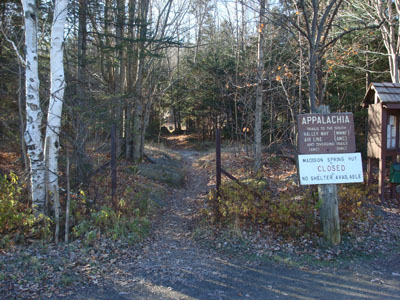
The Air Line Trail trailhead at Appalachia
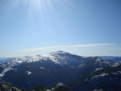
Mt. Washington as seen from the summit of Mt. Adams

Directions to trailhead: Take US 2 West from Gorham to the Appalachia trailhead/parking lot.
Back to Mt. Adams Profile
|