Home
States
Colorado
Connecticut
Maine
Massachusetts
New Hampshire
New York
Rhode Island
Utah
Vermont
View All
Lists
NE 4,000 Footers
NE 100 Highest
NH 4,000 Footers
NH 100 Highest
NH 52 With A View
NH Belknap Range
NH Ossipee 10
Links
Trail Conditions
Trip Log
Sunrises
Sunsets
About
|
Mt. Adams, Mt. Sam Adams
Randolph, NH, Low and Burbank's Grant, NH, Thompson and Meserve's Purchase, NH
Trailheads, measurements, times, distances, and maps are all approximate and relative to the hike(s) as shown below.
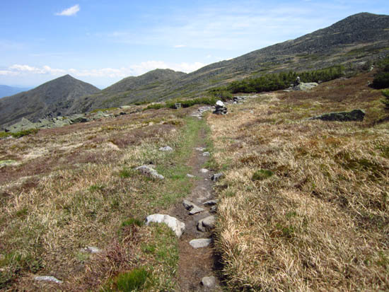
Lowes Path on the way to Mt. Adams
Route: Lowes Path, (Mt. Adams), Lowes Path, Gulfside, bushwhack, (Mt. Sam Adams), bushwhack, Gulfside, Israel Ridge Path, Randolph Path, Grey Knob Trail, Spur Trail, King Ravine, Lowes Path
Lowes Path was generally dry and in good shape. Some moist or muddy sections, but almost always easily passed with stepping stones.
"Bushwhacked" from Thunderstorm Junction to Mt. Sam Adams, and back, finding it pretty easy to stay on rocks and thus not trample alpine growth.
Grey Knob Trail was pretty tedious - subpar footing from Israel Ridge Path to Grey Knob cabin. Below there, some areas of standing and running water.
Spur was pretty smooth sailing.
Lower King Ravine Trail had some annoying end-of-day ups and downs, but generally a forgiving footbed. One brief muddy area.
Lots of diapensia in bloom above treeline. Quite a few patches of Lapland Rosebay off trail on Mt. Sam Adams (and also a few snow fields). Also a nice patch of Lapland Rosebay on Israel Ridge Path. Alpine Azalea scattered throughout as well.
| Hike Ratings |
|
Getting To Trailhead: |
Easy |
| Destination: |
Mt. Adams |
|
Length: |
Moderate |
|
Steepness: |
Difficult |
|
Navigation: |
Easy |
|
Views: |
Excellent |
|
Crowds: |
Moderate |
| Destination: |
Mt. Sam Adams |
|
Length: |
Moderate |
|
Steepness: |
Difficult |
|
Navigation: |
Difficult |
|
Views: |
Excellent |
|
Crowds: |
Minimal |
|
| Hike Stats |
|
Date Hiked: |
Sunday, May 27, 2012 |
| Parking Elevation: |
1,311' |
| Destination: |
Mt. Adams |
| Time Elapsed: |
04:35 |
| Trailhead Elevation: |
1,385' |
| Summit Elevation: |
5,774' |
| Vertical Gain: |
4,439' |
| Destination: |
Mt. Sam Adams |
| Time Elapsed: |
00:25 |
| Trailhead Elevation: |
5,774' |
| Summit Elevation: |
5,585' |
| Vertical Gain: |
95' |
|
|
| Hike Time Elapsed: |
09:29 |
| Hike Vertical Gain: |
4,684' |
|
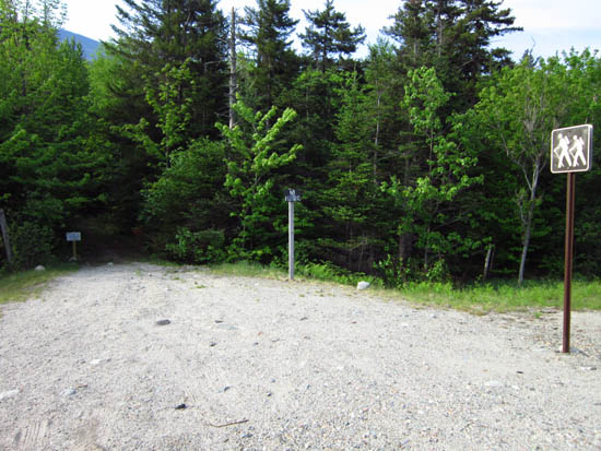
The Lowes Path trailhead off US 2
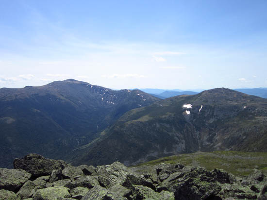
Mt. Washington and Mt. Jefferson as seen from the summit of Mt. Adams
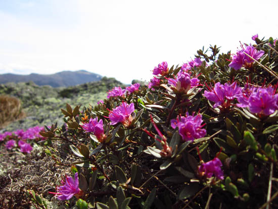
Lapland Rosebay on the side of Mt. Sam Adams
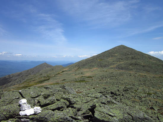
Mt. Madison and Mt. Adams as seen from Mt. Sam Adams
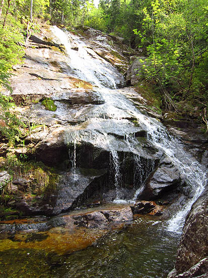
Chandler Fall
Directions to trailhead: Take US 2 West from Gorham past the Appalachia trailhead/parking lot. Lowes Store will soon be on the right. As of spring 2012, there was a $1 fee to park at Lowes Store. The Lowes Path trailhead is just west of the store, across US 2.
Back to Mt. Adams Profile
Back to Mt. Sam Adams Profile
|


