Home
States
Colorado
Connecticut
Maine
Massachusetts
New Hampshire
New York
Rhode Island
Utah
Vermont
View All
Lists
NE 4,000 Footers
NE 100 Highest
NH 4,000 Footers
NH 100 Highest
NH 52 With A View
NH Belknap Range
NH Ossipee 10
Links
Trail Conditions
Trip Log
Sunrises
Sunsets
About
|
Mt. Cabot, The Bulge, The Horn
Kilkenny, NH, Berlin, NH
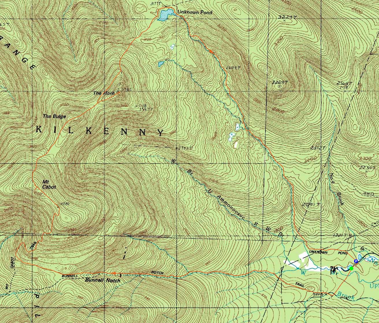
Trailheads, measurements, times, distances, and maps are all approximate and relative to the hike(s) as shown below.
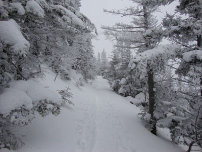
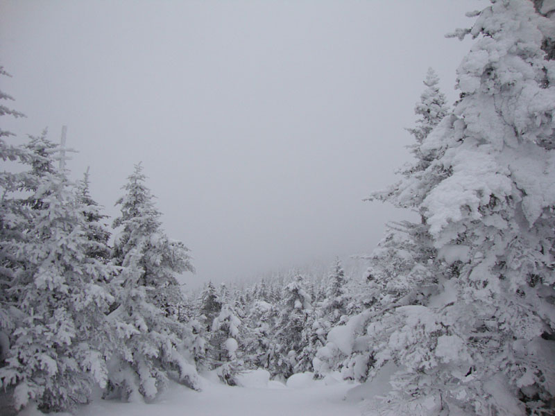
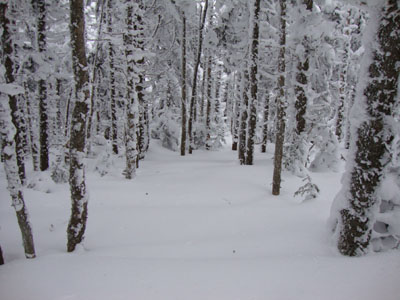
The Kilkenny Ridge Trail on the way to Mt. Cabot
Route: York Pond Trail, Bunnell Notch Trail, Kilkenny Ridge Trail, (Mt. Cabot), bushwhack, Kilkenny Ridge Trail, (The Bulge), Kilkenny Ridge Trail, Horn spur, (The Horn), Horn spur, Kilkenny Ridge Trail, Unknown Pond Trail
As the day neared, the forecast deteriorated. Nonetheless, it looked like a reasonable day for Mt. Cabot.
The York Pond-Bunnell Notch-Kilkenny Ridge ascent went fairly smoothly, as the route was nicely packed. Though the wind was ramping up overhead, the ascent to the ridge was fairly calm. Nearing the cabin, the winds started to hit, as well as colder temperatures. Unfortunately there were no views, as the area was in the midst of snow flurries.
After reaching the highpoint, we continued following some tracks off Cabot. This was a mistake - the tracks ended up dead-ending a hundred or so vertical feet off the peak, nowhere near the trail. Not wanting to reclimb, we opted to do a traversing bushwhack with the hope of crossing the trail corridor (and not dropping off either end of the ridge. This technique eventually worked, as we hit the trail about fifty vertical feet up the Bulge.
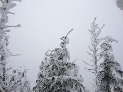
Beyond the Bulge, we were able to follow the unbroken trail with relative ease to the Horn spur junction. Above the junction, the spur trail was hard to follow in a few places, however the terrain was easy enough to interpret. Reaching the ledgy summit, we had brief decent views as clouds blew through with the brisk winds.
Back in the col, we set off for Unknown Pond. While the first portion of the trail was easy enough to follow, we soon ran into trailfinding issues upon reaching the glades and gullies. This continued for some time, until we finally neared the pond. From there, we hopped onto the Unknown Pond Trail and worked our way down, eventually hitting broken trail, then the old railgrade, then leaving the railgrade and reaching the parking lot just after sunset. A long day with lots of trailbreaking!
| Hike Ratings |
|
Getting To Trailhead: |
Easy |
| Destination: |
Mt. Cabot |
|
Length: |
Moderate |
|
Steepness: |
Moderate |
|
Navigation: |
Easy |
|
Views: |
Minimal (due to weather) |
|
Crowds: |
Moderate |
| Destination: |
The Bulge |
|
Length: |
Very Difficult |
|
Steepness: |
Moderate |
|
Navigation: |
Very Difficult |
|
Views: |
Minimal |
|
Crowds: |
Minimal |
| Destination: |
The Horn |
|
Length: |
Very Difficult |
|
Steepness: |
Difficult |
|
Navigation: |
Difficult |
|
Views: |
Moderate (due to weather) |
|
Crowds: |
Minimal |
|
| Hike Stats |
|
Date Hiked: |
Sunday, February 14, 2010 |
| Hike Commenced: |
7:52 AM |
| Parking Elevation: |
1,680' |
| Destination: |
Mt. Cabot |
| Ascent Commenced: |
7:54 AM |
| Summit Reached: |
11:30 AM |
| Time Elapsed: |
03:36 |
| Trailhead Elevation: |
1,670' |
| Summit Elevation: |
4,170' |
| Distance: |
4.8 miles |
| Vertical Gain: |
2,780' |
| Destination: |
The Bulge |
| Ascent Commenced: |
11:39 AM |
| Summit Reached: |
12:48 PM |
| Time Elapsed: |
01:09 |
| Trailhead Elevation: |
4,170' |
| Summit Elevation: |
3,950' |
| Vertical Gain: |
265' |
| Destination: |
The Horn |
| Ascent Commenced: |
12:48 PM |
| Summit Reached: |
1:29 PM |
| Time Elapsed: |
00:41 |
| Trailhead Elevation: |
3,950' |
| Summit Elevation: |
3,905' |
| Vertical Gain: |
255' |
|
|
| Hike Ended: |
5:26 PM |
| Hike Time Elapsed: |
09:34 |
| Hike Vertical Gain: |
3,605' |
|
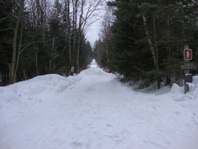
The York Pond Trail trailhead
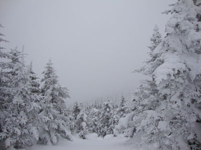
Clouds as seen from near the summit of Mt. Cabot
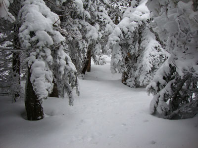
The Kilkenny Ridge Trail between Mt. Cabot and the Bulge
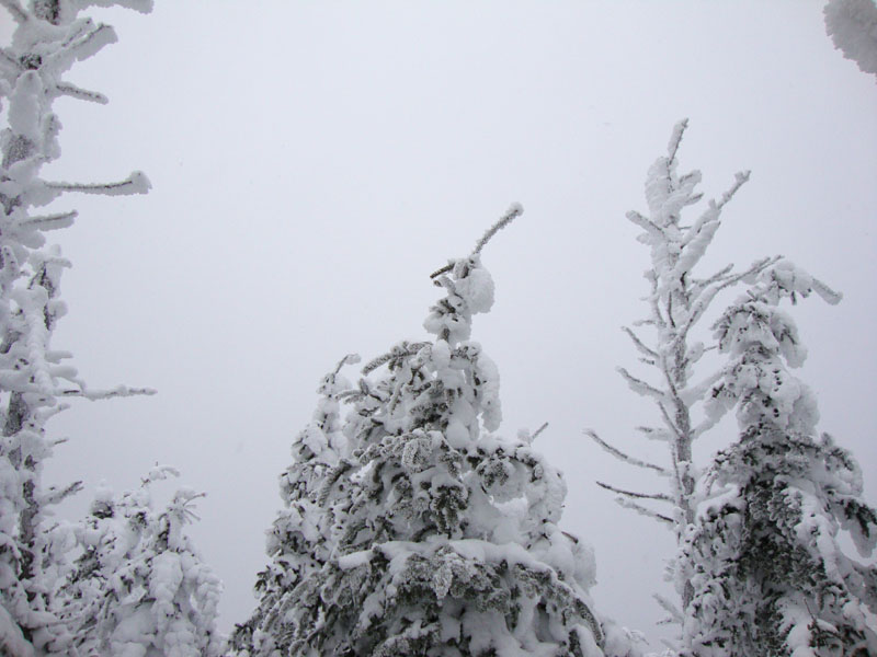
A lack of views from the Bulge
The Kilkenny Ridge Trail between the Bulge and the Horn

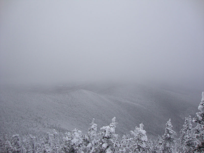
The Pilot Range as seen from the Horn
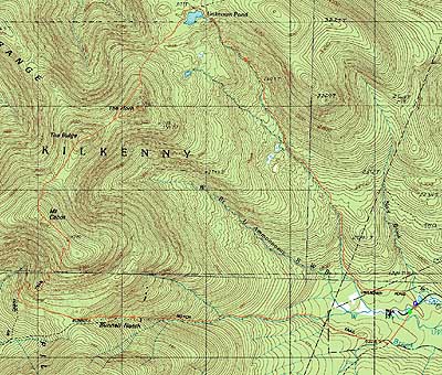

Directions to trailhead: Take Route 16 to Berlin, then take Route 110 west. York Pond Road will eventually be on the left. Continue through the Fish Hatchery (do be aware that the gates are signed only open during the day, usually 8 AM - 4 PM). The York Pond Trail trailhead and small parking area will eventually be on the left, shortly after passing the Unknown Pond Trail parking area on the right.
Back to Mt. Cabot Profile
Back to The Bulge Profile
Back to The Horn Profile
|