Home
States
Colorado
Connecticut
Maine
Massachusetts
New Hampshire
New York
Rhode Island
Utah
Vermont
View All
Lists
NE 4,000 Footers
NE 100 Highest
NH 4,000 Footers
NH 100 Highest
NH 52 With A View
NH Belknap Range
NH Ossipee 10
Links
Trail Conditions
Trip Log
Sunrises
Sunsets
About
|
Mt. Cardigan, Firescrew
Orange, NH
Trailheads, measurements, times, distances, and maps are all approximate and relative to the hike(s) as shown below.
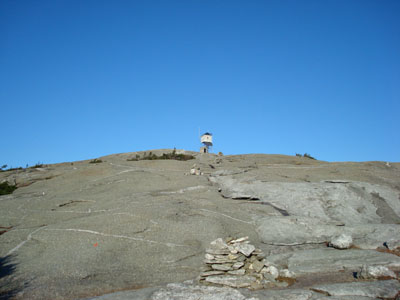
Looking up the West Ridge Trail
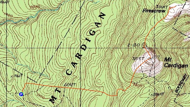
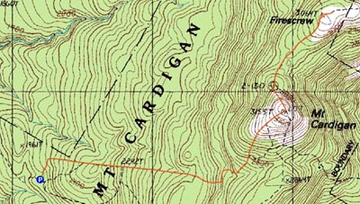
Route: West Ridge Trail, (Mt. Cardigan), Mowglis Trail, (Firescrew), Mowglis Trail, (Mt. Cardigan), West Ridge Trail
I had a narrow window - sunset before 6, Red Sox game at 8. Solution? Mt. Cardigan and Firescrew.
Starting at the West Ridge Trail parking area, the hike is pretty easy at first - a few short moderate stretches, but mostly flats and dips.
Once I reached the steeper terrain, I was shocked how quickly it went by - before I knew it, I was at the bridge over the brook. It's amazing how much faster a hike can be when you're not snowshoeing from the road (as I had in March).
Soon after the bridge, I was at the fun part of the hike - the ledges. There's just about half a mile of ledge walking from here to the tower.
Once at the summit (the tower was closed, as it was when I was here in March), I was greeted with tremendous views - west to Killington, south to Monadnock, east to the Ossipee Range, and north/northeast at the Franconia Ridge and Mt. Washington.
After taking a few photos, I checked the time and headed on to the Firescrew. I had originally intended to check this peak out in March, however due to limited views and oncoming bad weather, I decided at that point to pass.
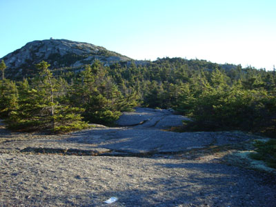
The initial descent to Firescrew is very steep - dropping down the summit ledges of Mt. Caridgan. Soon thereafter, there's a very brief walk through some woods, before the trail comes back out onto the ledges.
Once at the high point, I walked around to a few other view points - all with rather similar views to those from Mt. Cardigan.
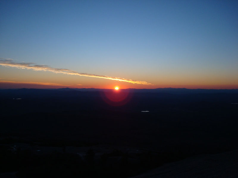
After heading back to Mt. Cardigan, I sat down at the high point and began to prepare for the sunset - completely forgetting about the full moon rise! With the summit to myself, I looked at my back and quickly realized the moon was rising over the Ossipee Range! Soon, the sun started to set just south of Killington. Though rather cold (my guess is that it was in the 30s with the wind chill at this point), the colours made the wait worthwhile.
After watching the sunset, I turned on my headlamp and headed down. The entire descent featured a neat orange/red backlight from the remainder of the sunset.
A great night for a sunset hike!
| Hike Ratings |
|
Getting To Trailhead: |
Easy |
| Destination: |
Mt. Cardigan |
|
Length: |
Moderate |
|
Steepness: |
Moderate |
|
Navigation: |
Easy |
|
Views: |
Excellent |
|
Crowds: |
Moderate |
| Destination: |
Firescrew |
|
Length: |
Moderate |
|
Steepness: |
Difficult |
|
Navigation: |
Easy |
|
Views: |
Excellent |
|
Crowds: |
Minimal |
|
| Hike Stats |
|
Date Hiked: |
Thursday, October 25, 2007 |
| Hike Commenced: |
4:00 PM |
| Parking Elevation: |
1,760' |
| Destination: |
Mt. Cardigan |
| Ascent Commenced: |
4:00 PM |
| Summit Reached: |
4:36 PM |
| Time Elapsed: |
00:36 |
| Trailhead Elevation: |
1,760' |
| Summit Elevation: |
3,155' |
| Distance: |
1.5 miles |
| Vertical Gain: |
1,430' |
| Destination: |
Firescrew |
| Ascent Commenced: |
4:41 PM |
| Summit Reached: |
4:57 PM |
| Time Elapsed: |
00:16 |
| Trailhead Elevation: |
3,155' |
| Summit Elevation: |
3,064' |
| Vertical Gain: |
184' |
|
|
| Hike Ended: |
6:36 PM |
| Hike Time Elapsed: |
02:36 |
| Hike Vertical Gain: |
1,974' |
|
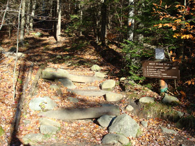
The West Ridge Trail trailhead
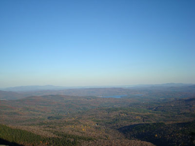
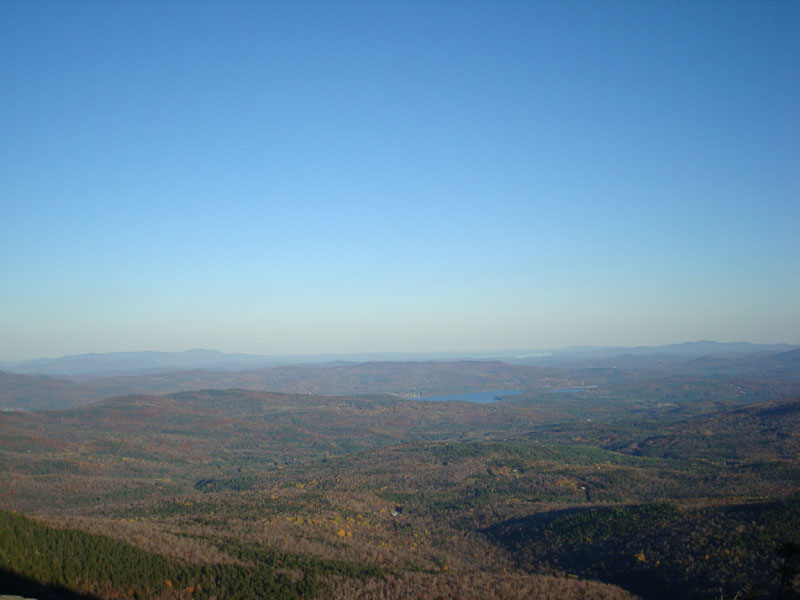
Looking east towards the Ossipee Range, Lake Winnipesaukee, and the Belknap Range from the Mt. Cardigan summit
Looking down the Mowglis Trail
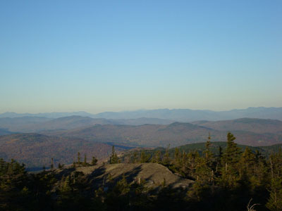
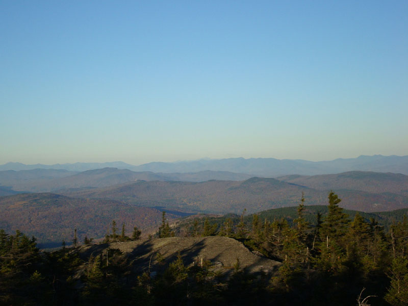
Looking northeast from the Firescrew at the White Mountains (the Presidentials barely visible in the distance)
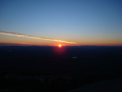
Looking at the sunset over the Green Mountains from the Mt. Cardigan summit

Directions to trailhead: Take Burnt Hill Road up to the green Cardigan Mtn post next to the access road gate. If access road is closed, park across the road from the gate; otherwise, there is parking at the picnic area.
Back to Mt. Cardigan Profile
Back to Firescrew Profile
|