Home
States
Colorado
Connecticut
Maine
Massachusetts
New Hampshire
New York
Rhode Island
Utah
Vermont
View All
Lists
NE 4,000 Footers
NE 100 Highest
NH 4,000 Footers
NH 100 Highest
NH 52 With A View
NH Belknap Range
NH Ossipee 10
Links
Trail Conditions
Trip Log
Sunrises
Sunsets
About
|
Mt. Cardigan
Orange, NH, Alexandria, NH
Trailheads, measurements, times, distances, and maps are all approximate and relative to the hike(s) as shown below.
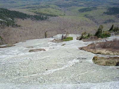
Looking down the Holt Trail just before it drops into the steep scrambles
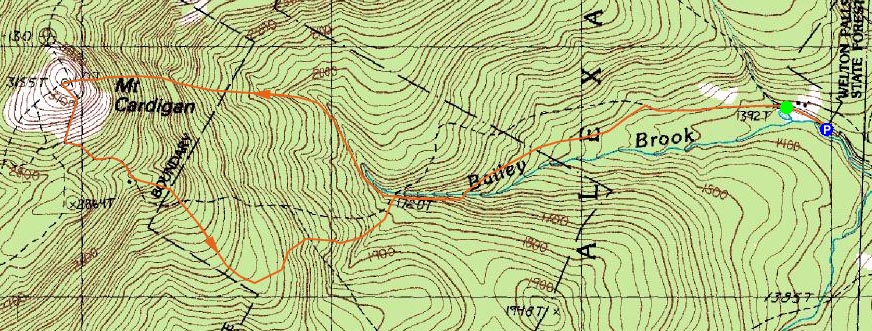
Route: Manning Trail, Holt Trail, (Mt. Cardigan), Clark Trail, Cathedral Forest Trail, Holt Trail, Manning Trail
While I had originally planned to do some hiking further north, I didn't have the energy to deal with a lot of driving. Since it was a nice day, I decided to head over to Cardigan for the first time this year.
Starting at the AMC facility, I headed up the relatively tame trail to Grand Junction, and then continued on the Holt Trail (Steve Holt!).
From there, the trail meanders as it follows a brook, before turning and steepening. Though there was a wet section, things fortunately dried up as I reached the first scramble. After evening out a bit, the trail scrambles in a progressively steeper fashion as it ascends the ledges up to the summit. While I was skeptical of the AMC Southern New Hampshire guide saying the trail is one of the most challenging in the state, it certainly delivered - I would never want to be on this trail when wet or covered in snow/ice. While the north slide of Mt. Tripyramid is tough, it does provide plenty of hand/foot holds. This scramble, however, has a few sections in which you just have to lean forward and hope your shoes grip!
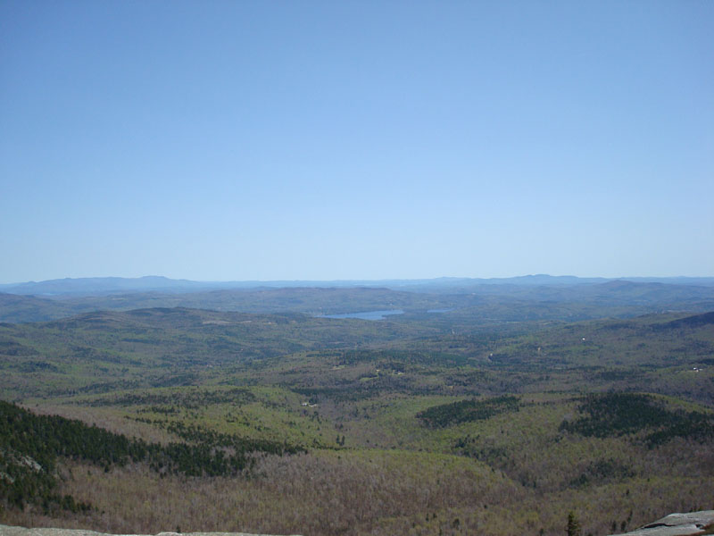
The fire tower at the summit was open and I was able to check out the great views from it. Due to the nature of Mt. Cardigan, the views are just as good from the ledges. The clear day revealed Killington to the west, Mt. Monadnock to the south, the Ossipees and beyond to the east, and Mt. Washington and the Franconia Ridge up north.
Since there was no way in heck I was going to try to descend the open ledges of the Holt Trail, I chose the Clark Trail. I had considered heading out toward the south peak, however I was feeling tired and wanted to go home and take a nap.
The Clark Trail and the rest of the descent weren't overly steep. A few patches of snow existed up high while some nice patches of flowers were blooming down low.
Despite the summer-like weather, the bugs were not noticable!
| Hike Ratings |
|
Getting To Trailhead: |
Easy |
| Destination: |
Mt. Cardigan |
|
Length: |
Moderate |
|
Steepness: |
Very Difficult |
|
Navigation: |
Moderate |
|
Views: |
Excellent |
|
Crowds: |
Moderate |
|
| Hike Stats |
|
Date Hiked: |
Sunday, May 11, 2008 |
| Parking Elevation: |
1,365' |
| Destination: |
Mt. Cardigan |
| Time Elapsed: |
01:16 |
| Trailhead Elevation: |
1,380' |
| Summit Elevation: |
3,155' |
| Distance: |
2.2 miles |
| Vertical Gain: |
1,850' |
|
|
| Hike Time Elapsed: |
03:05 |
| Hike Vertical Gain: |
1,925' |
|
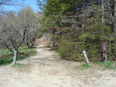
The Manning Trail trailhead near the AMC facility
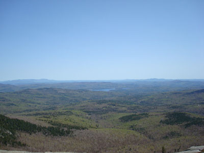
Looking east towards the Ossipee Range, Lake Winnipesaukee, and the Belknap Range from the Mt. Cardigan summit
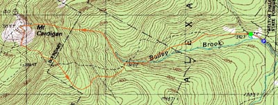

Directions to trailhead: From Bristol, take Route 3A North briefly, then take a left onto Bristol Hill Road. Eventually bear left onto Plummer Hill Road, then take a left onto Thissell Road, then take a right onto Town Pond Road. Town Pond Road eventually joins Mt. Cardigan Road. Mt. Cardigan Road becomes Shem Valley Road at a sharp turn - go straight on it. Parking is located across from the AMC facility. One can also find the AMC Lodge with more ease from Alexandria by following the AMC Lodge signs.
Back to Mt. Cardigan Profile
|