Home
States
Colorado
Connecticut
Maine
Massachusetts
New Hampshire
New York
Rhode Island
Utah
Vermont
View All
Lists
NE 4,000 Footers
NE 100 Highest
NH 4,000 Footers
NH 100 Highest
NH 52 With A View
NH Belknap Range
NH Ossipee 10
Links
Trail Conditions
Trip Log
Sunrises
Sunsets
About
|
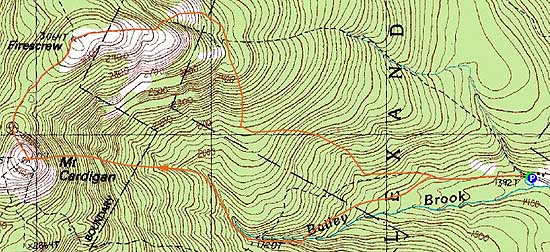
Mt. Cardigan, Firescrew
Alexandria, NH, Orange, NH
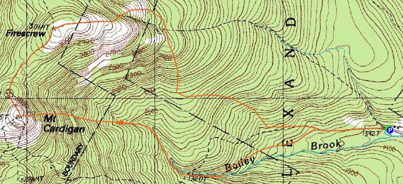
Trailheads, measurements, times, distances, and maps are all approximate and relative to the hike(s) as shown below.
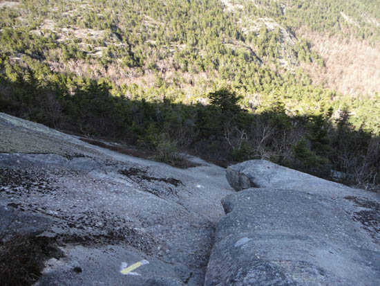
Looking down the Holt Trail
Route: Holt Trail, (Mt. Cardigan), Mowglis Trail, (Firescrew), Manning Trail, Holt Trail
Holt Trail to summit was snow free and mostly dry. Ledges generally dry as well (thankfully...would not want to descend this trail, or attempt it if wet). A few minor muddy areas. Glacier ice on Manning Trail, either side of top of Dukes. Decent variety of wildflowers - bellwort, trout lily, yellow violet, trillium.
| Hike Ratings |
|
Getting To Trailhead: |
Easy |
| Destination: |
Mt. Cardigan |
|
Length: |
Moderate |
|
Steepness: |
Very Difficult |
|
Navigation: |
Easy |
|
Views: |
Excellent |
|
Crowds: |
Minimal |
| Destination: |
Firescrew |
|
Length: |
Moderate |
|
Steepness: |
Difficult |
|
Navigation: |
Easy |
|
Views: |
Excellent |
|
Crowds: |
Minimal |
|
| Hike Stats |
|
Date Hiked: |
Monday, May 9, 2011 |
| Parking Elevation: |
1,392' |
| Destination: |
Mt. Cardigan |
| Time Elapsed: |
01:00 |
| Trailhead Elevation: |
1,392' |
| Summit Elevation: |
3,155' |
| Distance: |
2.2 miles |
| Vertical Gain: |
1,850' |
| Destination: |
Firescrew |
| Time Elapsed: |
00:10 |
| Trailhead Elevation: |
3,155' |
| Summit Elevation: |
3,064' |
| Vertical Gain: |
184' |
|
|
| Hike Time Elapsed: |
02:51 |
| Hike Vertical Gain: |
2,074' |
|
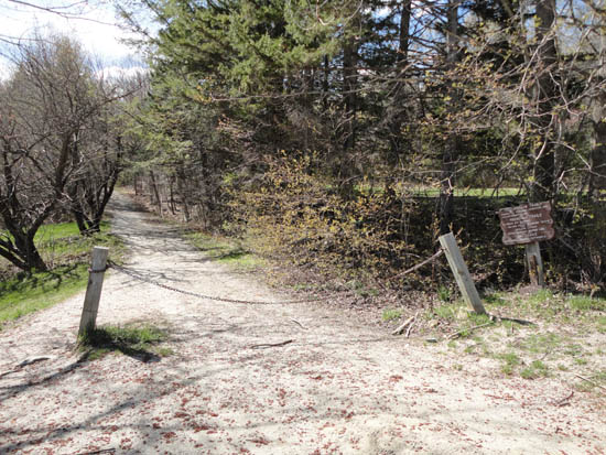
The Holt Trail trailhead
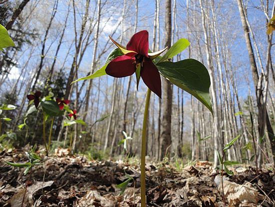
Trillium
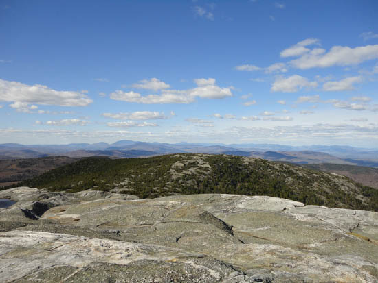
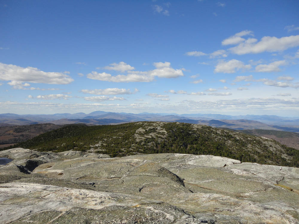
Looking north over the Firescrew at the White Mountains from Mt. Cardigan
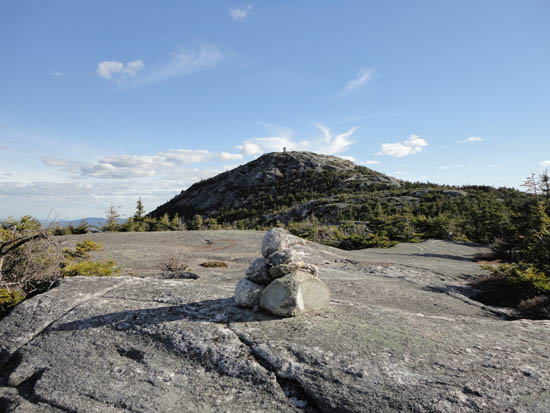
The Mowglis Trail between Mt. Cardigan and the Firescrew
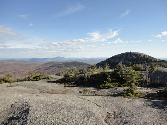
Ragged, Kearsarge, and Cardigan as seen from near the summit of the Firescrew
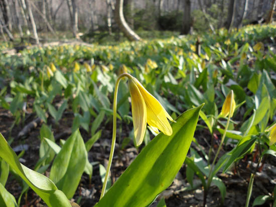
Trout lily on the Manning Trail

Directions to trailhead: From Bristol, take Route 3A North briefly, then take a left onto Bristol Hill Road. Eventually bear left onto Plummer Hill Road, then take a left onto Thissell Road, then take a right onto Town Pond Road. Town Pond Road eventually joins Mt. Cardigan Road. Mt. Cardigan Road becomes Shem Valley Road at a sharp turn - go straight on it. Parking is located across from the AMC facility. One can also find the AMC Lodge with more ease from Alexandria by following the AMC Lodge signs.
Back to Mt. Cardigan Profile
Back to Firescrew Profile
|