Home
States
Colorado
Connecticut
Maine
Massachusetts
New Hampshire
New York
Rhode Island
Utah
Vermont
View All
Lists
NE 4,000 Footers
NE 100 Highest
NH 4,000 Footers
NH 100 Highest
NH 52 With A View
NH Belknap Range
NH Ossipee 10
Links
Trail Conditions
Trip Log
Sunrises
Sunsets
About
|
Mt. Cube
Orford, NH
Trailheads, measurements, times, distances, and maps are all approximate and relative to the hike(s) as shown below.
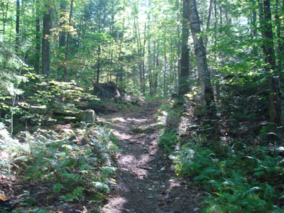
Looking up the Mt. Cube Trail
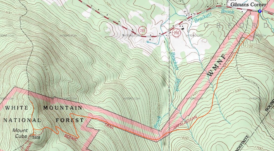
Route: Mt. Cube Trail, (Mt. Cube), Mt. Cube Trail, North Peak Side Trail, (Mt. Cube North Peak), North Peak Side Trail, Mt. Cube Trail
Finally it was time for Mt. Cube. This hike had been in my queue for a year or so - and multiple times I had literally come within minutes of getting ready to drive to it, only to change my mind and do something else. Not wanting this to loom over me any longer, I got out of work an hour early and headed up.
At first, I thought there was an issue with the trailhead, as I saw a No Trespassing sign near the parking area. Fortunately, this wasn't the trail, but rather a logging road near it.
The first portion of the Mt. Cube Trail was rather gradual with good footing. After crossing a dirt road, the trail became slightly more rough, but still very gradual. In fact, the trail didn't get steep until after two brook crossings - and even then, it wasn't too bad as there were switchbacks.
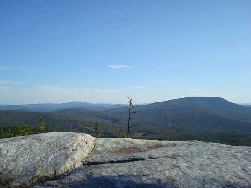
Upon reaching the col, I took a left and headed to the summit. I was amazed as how broad the views were and how neat the ledges were. Unfortunately, the late day sun made the views slightly hazy, but still decent.
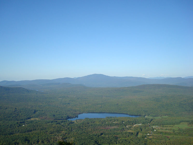
Back on the trail, I decided to check out the North Peak. While I almost decided to skip it, I was very glad I didn't - the views were tremendous! Though slightly lower than the south peak, the north peak provided great views to the north, east, and southeast. I couldn't resist sitting on the ledge for awhile, taking in the dramatic view of Mt. Moosilauke.
On the way down, I suddenly saw a large object in front of me. Faster than I could grab my camera, a huge bull moose took off into the woods. I tried pursuing him, but he was already pretty deep into the undergrowth. Heading further down the trail, I almost successfully cut him off, but he took off deeper into the woods before I could get close enough for a photo. A neat way to end a hike!
| Hike Ratings |
|
Getting To Trailhead: |
Easy |
| Destination: |
Mt. Cube |
|
Length: |
Moderate |
|
Steepness: |
Moderate |
|
Navigation: |
Easy |
|
Views: |
Excellent |
|
Crowds: |
Minimal |
|
| Hike Stats |
|
Date Hiked: |
Wednesday, September 17, 2008 |
| Hike Commenced: |
3:24 PM |
| Parking Elevation: |
900' |
| Destination: |
Mt. Cube |
| Ascent Commenced: |
3:24 PM |
| Summit Reached: |
4:49 PM |
| Time Elapsed: |
01:15 |
| Trailhead Elevation: |
900' |
| Summit Elevation: |
2,909' |
| Distance: |
3.3 miles |
| Vertical Gain: |
2,149' |
|
|
| Hike Ended: |
6:48 PM |
| Hike Time Elapsed: |
03:24 |
| Hike Vertical Gain: |
2,409' |
|
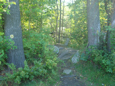
The Mt. Cube Trail trailhead
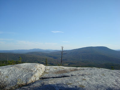
Looking south at Cardigan, Kearsarge, and Smarts Mountain from the Mt. Cube summit
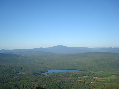
Looking at Mt. Moosilauke from the north peak of Mt. Cube
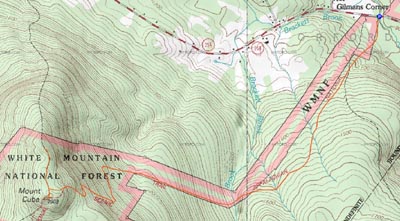

Directions to trailhead: Take Route 25A West from Wentworth. Shortly after passing a camp and some ponds on the left, and immediately after crossing a small bridge, a small dirt parking area will be on the left. The Mt. Cube Trail trailhead is here as well.
Back to Mt. Cube Profile
|