Home
States
Colorado
Connecticut
Maine
Massachusetts
New Hampshire
New York
Rhode Island
Utah
Vermont
View All
Lists
NE 4,000 Footers
NE 100 Highest
NH 4,000 Footers
NH 100 Highest
NH 52 With A View
NH Belknap Range
NH Ossipee 10
Links
Trail Conditions
Trip Log
Sunrises
Sunsets
About
|
Mt. Osceola (East Peak), Mt. Osceola
Lincoln, NH, Livermore, NH
Trailheads, measurements, times, distances, and maps are all approximate and relative to the hike(s) as shown below.
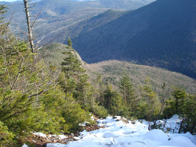
Looking down the slide on the way up the Mt. Osceola Trail to Mt. Osceola's East Peak
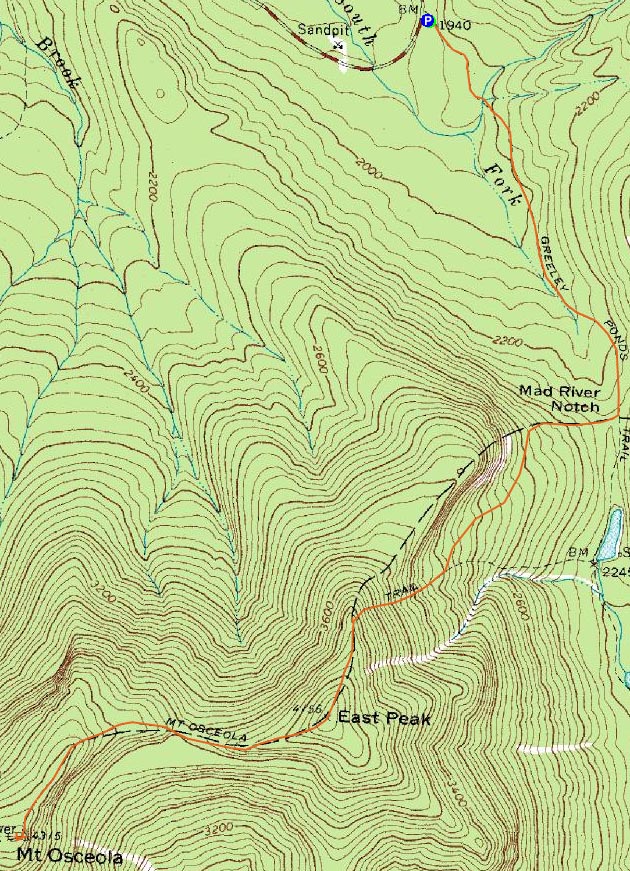
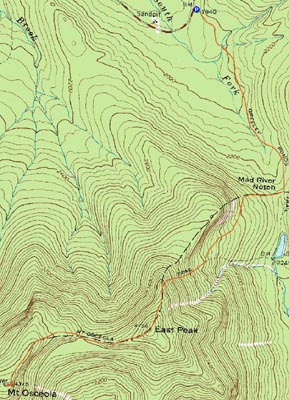
Route: Greeley Ponds Trail, Mt. Osceola Trail, (Mt. Osceola - East Peak), Mt. Osceola Trail, (Mt. Osceola), Mt. Osceola Trail, (Mt. Osceola - East Peak), Mt. Osceola Trail, Greeley Ponds Trail
While I've wanted to hike the Osceolas this fall, I find the approach from Tripoli Road a bit rough and dull. If the trail had good footing, it'd be an absolute blast. Since that's not likely to change anytime soon, I decided to check out the approach from the Kancamagus Highway.
The Greeley Ponds Trail, though wet, was a pretty quick walk, as the footing was decent and there weren't any significant ups or downs. While the tiny Greeley Ponds parking area had a few cars in it when I started, I was soon "breaking trail" as I started up the Mt. Osceola Trail. The lower portion of the trail was fairly tame (and didn't have much snow or ice on it) - and somewhat scenic, as there were neat views of some nearby cliffs towering overhead. Soon, however, things became steep (and icy). I was able to get up the steeps without traction, though I probably should have put something on for the short ascent up the slide.
After the slide, the trail continued to be steep, finally becoming gradual when it cleared the ridge. From there, it was a short and gradual walk until I reached the final steep ascent, just prior to the East Osceola summit. While there aren't any views from the summit, there is a slightly obstructed viewpoint nearby that looks at points to the east.
Descending into the col, there was a decent amount of ice and a continued inch or so of snow. Fortunately, the chimney was virtually ice free and thus was a relatively easy and fun climb.
After reaching the highpoint of the main peak and checking out the viewpoint near it, I headed down to the big ledge and had some lunch. While there was some audible wind, it wasn't quite hitting this area, making it a nice place to take in the scenery.
On the return trip, I followed a short spur path on the ridge just past East Osceola (just before where the Mt. Osceola Trail starts its dive toward the Greeley Ponds Trail), and found a great set of viewpoints a few feet off the trail.
While it had been a fairly quiet morning, there were hoards of people on the trails as I finished my descent. Not only that, but the parking lot was overflowing onto the Kanc - a sight I've often seen, but wasn't expecting at this point in the season.
| Hike Ratings |
|
Getting To Trailhead: |
Easy |
| Destination: |
Mt. Osceola (East Peak) |
|
Length: |
Moderate |
|
Steepness: |
Very Difficult |
|
Navigation: |
Easy |
|
Views: |
Moderate |
|
Crowds: |
Minimal |
| Destination: |
Mt. Osceola |
|
Length: |
Moderate |
|
Steepness: |
Very Difficult |
|
Navigation: |
Easy |
|
Views: |
Excellent |
|
Crowds: |
Minimal |
|
| Hike Stats |
|
Date Hiked: |
Saturday, November 1, 2008 |
| Hike Commenced: |
8:20 AM |
| Parking Elevation: |
1,940' |
| Destination: |
Mt. Osceola (East Peak) |
| Ascent Commenced: |
8:20 AM |
| Summit Reached: |
9:53 AM |
| Time Elapsed: |
01:33 |
| Trailhead Elevation: |
1,940' |
| Summit Elevation: |
4,156' |
| Distance: |
2.8 miles |
| Vertical Gain: |
2,331' |
| Destination: |
Mt. Osceola |
| Ascent Commenced: |
9:55 AM |
| Summit Reached: |
10:34 AM |
| Time Elapsed: |
00:39 |
| Trailhead Elevation: |
4,156' |
| Summit Elevation: |
4,340' |
| Distance: |
1 mile |
| Vertical Gain: |
560' |
|
|
| Hike Ended: |
1:13 PM |
| Hike Time Elapsed: |
04:53 |
| Hike Distance: |
7.6 miles |
| Hike Vertical Gain: |
3,392' |
|
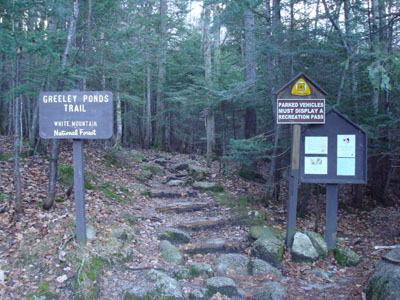
The Greeley Ponds Trail trailhead
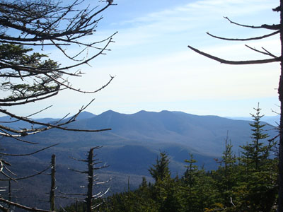
Looking at Mt. Tripyramid from near the summit of East Osceola
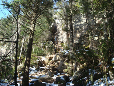
Looking at the chiminey along the Mt. Osceola Trail
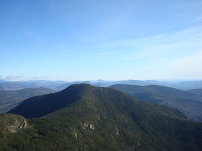
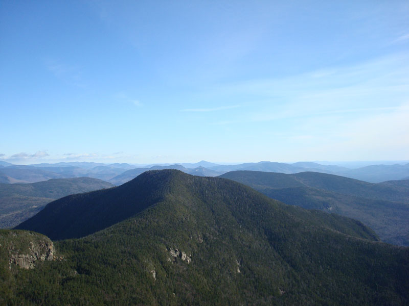
Looking at the East Peak of Mt. Osceola from the ledges near the summit of Mt. Osceola

Directions to trailhead: Take Route 112 west from Conway. After passing the Hancock Trail trailhead and parking lot, the Greeley Ponds trailhead and WMNF fee parking area will be on the left a few minutes later.
Back to Mt. Osceola (East Peak) Profile
Back to Mt. Osceola Profile
|