Home
States
Colorado
Connecticut
Maine
Massachusetts
New Hampshire
New York
Rhode Island
Utah
Vermont
View All
Lists
NE 4,000 Footers
NE 100 Highest
NH 4,000 Footers
NH 100 Highest
NH 52 With A View
NH Belknap Range
NH Ossipee 10
Links
Trail Conditions
Trip Log
Sunrises
Sunsets
About
|
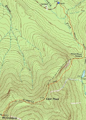
Mt. Osceola (East Peak), Mt. Osceola
Lincoln, NH, Livermore, NH
Trailheads, measurements, times, distances, and maps are all approximate and relative to the hike(s) as shown below.
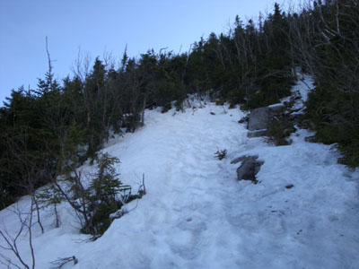
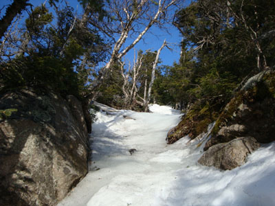
Looking up the Mt. Osceola Trail while crossing the slide
Route: Greeley Ponds Trail, Mt. Osceola Trail, (Mt. Osceola - East Peak), Mt. Osceola Trail, (Mt. Osceola), Mt. Osceola Trail, (Mt. Osceola - East Peak), Mt. Osceola Trail, Greeley Ponds Trail
Since it was a nice, warm spring day, I was eager to get outside and enjoy the weather. With a mediocre forecast for the following day, I decided a late finish followed by a late start wouldn't be a bad idea.
Arriving at the Greeley Ponds Trail parking area, I quickly set foot in Microspikes up the snow monorail. Though the largest water crossing was a bit tricky, the brooks were nonetheless rock hoppable.
Once I reached the steeps of the Mt. Osceola Trail, I was forced to switch over to crampons, as there was a fairly adequate amount of blue ice. The views from the limited vista on the East Peak were nice - the clouds were particularly interesting.
With a decent amount of blue ice, I remained in crampons as I headed over to the main peak. Once at the highpoint, I decided to kill some time while I waited for some clouds to move out from in front of the sun. After waiting awhile while taking the decent, though dark views, I decided to head back. Back at East Osceola, the sun broke through again, lighting up the eastern views.
The rest of the descent was decent, with some faint but interesting colors to the east from the sunset. Not a bad afternoon/evening for the Osceolas!
| Hike Ratings |
|
Getting To Trailhead: |
Easy |
| Destination: |
Mt. Osceola (East Peak) |
|
Length: |
Moderate |
|
Steepness: |
Very Difficult |
|
Navigation: |
Easy |
|
Views: |
Excellent |
|
Crowds: |
Minimal |
| Destination: |
Mt. Osceola |
|
Length: |
Moderate |
|
Steepness: |
Very Difficult |
|
Navigation: |
Easy |
|
Views: |
Excellent |
|
Crowds: |
Minimal |
|
| Hike Stats |
|
Date Hiked: |
Friday, April 17, 2009 |
| Hike Commenced: |
4:00 PM |
| Parking Elevation: |
1,940' |
| Destination: |
Mt. Osceola (East Peak) |
| Ascent Commenced: |
4:00 PM |
| Summit Reached: |
5:37 PM |
| Time Elapsed: |
01:37 |
| Trailhead Elevation: |
1,940' |
| Summit Elevation: |
4,156' |
| Distance: |
2.8 miles |
| Vertical Gain: |
2,331' |
| Destination: |
Mt. Osceola |
| Ascent Commenced: |
5:37 PM |
| Summit Reached: |
6:14 PM |
| Time Elapsed: |
00:37 |
| Trailhead Elevation: |
4,156' |
| Summit Elevation: |
4,340' |
| Distance: |
1 mile |
| Vertical Gain: |
560' |
|
|
| Hike Ended: |
8:38 PM |
| Hike Time Elapsed: |
04:38 |
| Hike Distance: |
7.6 miles |
| Hike Vertical Gain: |
3,392' |
|
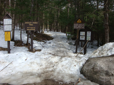
The Greeley Ponds Trail trailhead
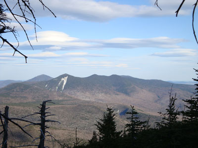
Looking at Mt. Tripyramid from near the summit of East Osceola
The Mt. Osceola Trail between the east and main peak
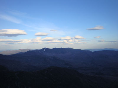
Looking at the Tripyramids from the Mt. Osceola ledges

Directions to trailhead: Take Route 112 west from Conway. After passing the Hancock Trail trailhead and parking lot, the Greeley Ponds trailhead and WMNF fee parking area will be on the left a few minutes later.
Back to Mt. Osceola (East Peak) Profile
Back to Mt. Osceola Profile
|