Home
States
Colorado
Connecticut
Maine
Massachusetts
New Hampshire
New York
Rhode Island
Utah
Vermont
View All
Lists
NE 4,000 Footers
NE 100 Highest
NH 4,000 Footers
NH 100 Highest
NH 52 With A View
NH Belknap Range
NH Ossipee 10
Links
Trail Conditions
Trip Log
Sunrises
Sunsets
About
|
Mt. Osceola (East Peak)
Lincoln, NH, Livermore, NH
Trailheads, measurements, times, distances, and maps are all approximate and relative to the hike(s) as shown below.
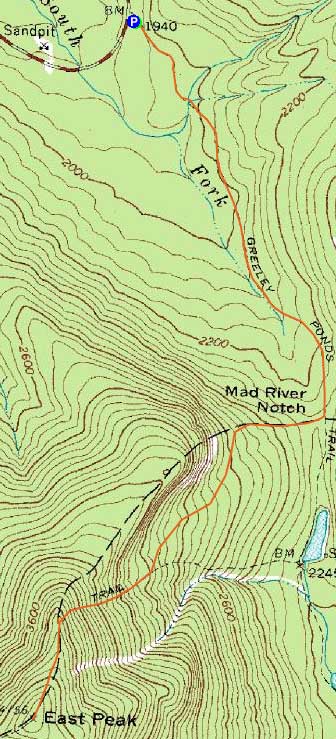
The Greeley Ponds Trail
Route: Greeley Ponds Trail, Mt. Osceola Trail, (Mt. Osceola - East Peak), Mt. Osceola Trail, Greeley Ponds Trail
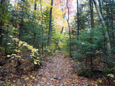
After downpours throughout the day, the radar was starting to clear. Reaching the Greeley Ponds Trail trailhead, I was happy to see that the rain had let up for the most part. While the trails were wet, slippery, and muddy, the foliage down low was nice.
The Mt. Osceola Trail steeps were pretty rough - wet, slippery rock with water running down parts. To add to the joy, my lower back all of a sudden started to act up. Reaching the summit, I had no views.
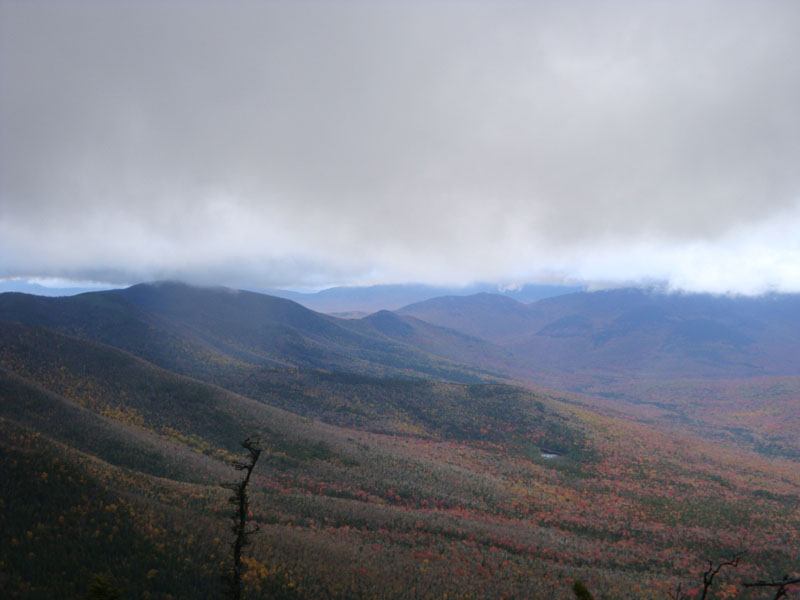
Descending back down the ridge, I had halfway decent views from the northern viewpoint, adjacent to where the trail drops steeply down the eastern shoulder. I was fortunate enough to make it down the steeps prior to needing a headlamp - it's never much fun to go down difficult terrain in the dark. Back on the Greeley Ponds Trail, it was a long, dull headlamp walk out.
| Hike Ratings |
|
Getting To Trailhead: |
Easy |
| Destination: |
Mt. Osceola (East Peak) |
|
Length: |
Moderate |
|
Steepness: |
Very Difficult |
|
Navigation: |
Easy |
|
Views: |
Minimal (due to weather) |
|
Crowds: |
Minimal |
|
| Hike Stats |
|
Date Hiked: |
Wednesday, October 7, 2009 |
| Hike Commenced: |
4:12 PM |
| Parking Elevation: |
1,940' |
| Destination: |
Mt. Osceola (East Peak) |
| Ascent Commenced: |
4:12 PM |
| Summit Reached: |
5:36 PM |
| Time Elapsed: |
01:24 |
| Trailhead Elevation: |
1,940' |
| Summit Elevation: |
4,156' |
| Distance: |
2.8 miles |
| Vertical Gain: |
2,331' |
|
|
| Hike Ended: |
7:14 PM |
| Hike Time Elapsed: |
03:02 |
| Hike Distance: |
5.6 miles |
| Hike Vertical Gain: |
2,446' |
|
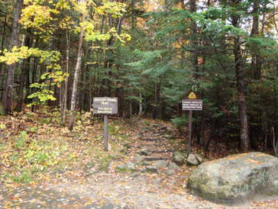
The Greeley Ponds Trail trailhead
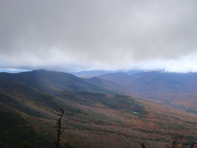
Looking northwest from the northern viewpoint on the East Osceola ridge
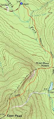

Directions to trailhead: Take Route 112 west from Conway. After passing the Hancock Trail trailhead and parking lot, the Greeley Ponds trailhead and WMNF fee parking area will be on the left a few minutes later.
Back to Mt. Osceola (East Peak) Profile
|