Home
States
Colorado
Connecticut
Maine
Massachusetts
New Hampshire
New York
Rhode Island
Utah
Vermont
View All
Lists
NE 4,000 Footers
NE 100 Highest
NH 4,000 Footers
NH 100 Highest
NH 52 With A View
NH Belknap Range
NH Ossipee 10
Links
Trail Conditions
Trip Log
Sunrises
Sunsets
About
|
Mt. Osceola (East Peak), Mt. Osceola
Lincoln, NH, Livermore, NH
Trailheads, measurements, times, distances, and maps are all approximate and relative to the hike(s) as shown below.
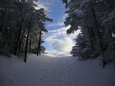
Looking up the Greeley Ponds Trail on the way to Mt. Osceola's East Peak
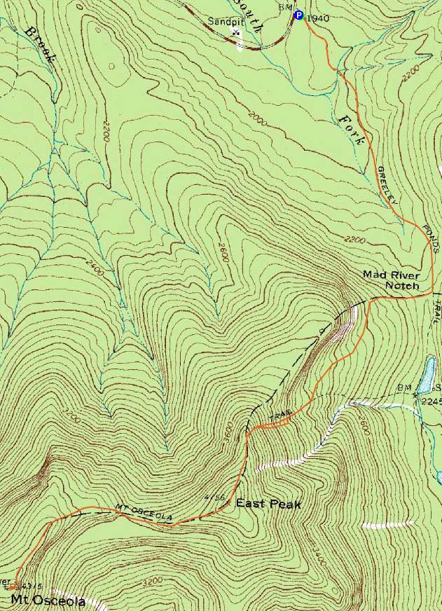
Route: Greeley Ponds Trail, Mt. Osceola Trail, (Mt. Osceola - East Peak), Mt. Osceola Trail, (Mt. Osceola), Mt. Osceola Trail, (Mt. Osceola - East Peak), Mt. Osceola Trail, Greeley Ponds Trail
Though I had hiked five consecutive days already, I opted to enjoy the partly sunny skies the afternoon had brought.
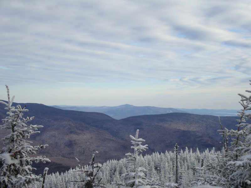
A bit tired, I worked my way up the Greeley Ponds Trail. Once on the steeps of the Mt. Osceola Trail, the juices started to flow. Reaching the viewpoint, things were looking quite nice in the distance. The views were nicer than normal, thanks to a few feet of snow lifting me that much higher over the dead trees.
Other than the chimney area, the walk to Mt. Osceola was fairly nice snowshoeing. The chimney bypass was somewhat bare, though there was a little snow and ice mixed in - it would have been easier had I removed my snowshoes for that section.
Passing the view ledges and reaching the summit area, I had excellent views from the vista near the older fire tower footings. After falling into a spruce trap, I worked my way back to the main view ledges, where the scenery was also quite nice. Wanting to get down the steeps before dark, I didn't loiter long.
The descent off East Osceola was fairly slow going - there was just enough loose powder on top of the hardpack that I wasn't willing to even consider putting on crampons. Fortunately, my Flex Alps snowshoes provided adequate traction. Nonetheless, one leg was somewhat sore by the end of it.
For the final walk out, I had some glimpses through the trees of a superb sunset - too bad I wasn't close to a vista for a clear view.
| Hike Ratings |
|
Getting To Trailhead: |
Easy |
| Destination: |
Mt. Osceola (East Peak) |
|
Length: |
Moderate |
|
Steepness: |
Very Difficult |
|
Navigation: |
Difficult |
|
Views: |
Excellent |
|
Crowds: |
Moderate |
| Destination: |
Mt. Osceola |
|
Length: |
Moderate |
|
Steepness: |
Very Difficult |
|
Navigation: |
Easy |
|
Views: |
Excellent |
|
Crowds: |
Minimal |
|
| Hike Stats |
|
Date Hiked: |
Monday, February 15, 2010 |
| Hike Commenced: |
1:55 PM |
| Parking Elevation: |
1,940' |
| Destination: |
Mt. Osceola (East Peak) |
| Ascent Commenced: |
1:55 PM |
| Summit Reached: |
3:25 PM |
| Time Elapsed: |
01:30 |
| Trailhead Elevation: |
1,940' |
| Summit Elevation: |
4,156' |
| Distance: |
2.8 miles |
| Vertical Gain: |
2,331' |
| Destination: |
Mt. Osceola |
| Ascent Commenced: |
3:25 PM |
| Summit Reached: |
3:56 PM |
| Time Elapsed: |
00:31 |
| Trailhead Elevation: |
4,156' |
| Summit Elevation: |
4,340' |
| Distance: |
1 mile |
| Vertical Gain: |
560' |
|
|
| Hike Ended: |
5:35 PM |
| Hike Time Elapsed: |
03:40 |
| Hike Distance: |
7.6 miles |
| Hike Vertical Gain: |
3,392' |
|
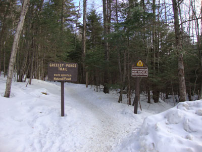
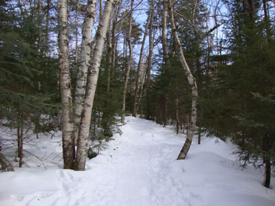
The Greeley Ponds Trail trailhead

Looking at Mt. Shaw from near the summit of East Osceola
Looking up the Mt. Osceola Trail near the summit of Mt. Osceola
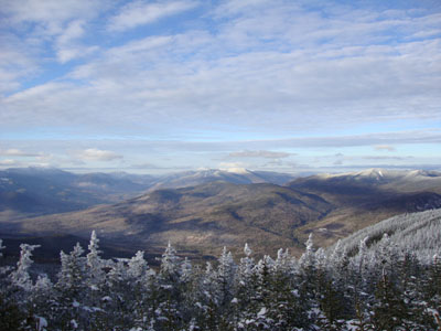
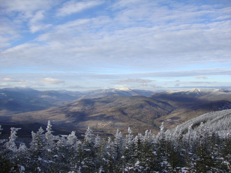
Looking into the Pemi from Mt. Osceola

Directions to trailhead: Take Route 112 west from Conway. After passing the Hancock Trail trailhead and parking lot, the Greeley Ponds trailhead and WMNF fee parking area will be on the left a few minutes later.
Back to Mt. Osceola (East Peak) Profile
Back to Mt. Osceola Profile
|