Home
States
Colorado
Connecticut
Maine
Massachusetts
New Hampshire
New York
Rhode Island
Utah
Vermont
View All
Lists
NE 4,000 Footers
NE 100 Highest
NH 4,000 Footers
NH 100 Highest
NH 52 With A View
NH Belknap Range
NH Ossipee 10
Links
Trail Conditions
Trip Log
Sunrises
Sunsets
About
|
Mt. Osceola (East Peak), Mt. Osceola
Lincoln, NH, Livermore, NH
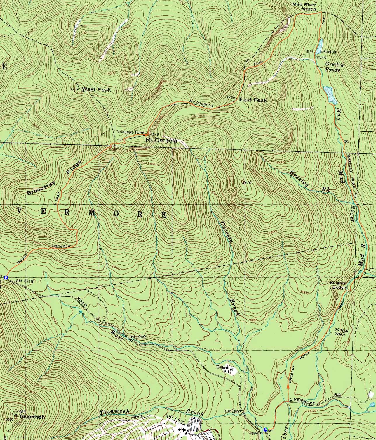
Trailheads, measurements, times, distances, and maps are all approximate and relative to the hike(s) as shown below.
The Greeley Ponds Trail
Route: Greeley Ponds Trail, Mt. Osceola Trail, (Mt. Osceola - East Peak), Mt. Osceola Trail, (Mt. Osceola), Mt. Osceola Trail, (Mt. Osceola - East Peak), Mt. Osceola Trail, Greeley Ponds Trail
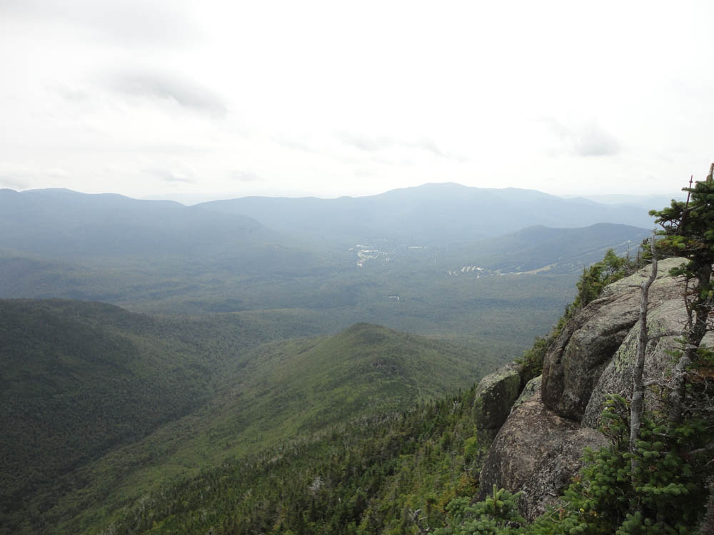
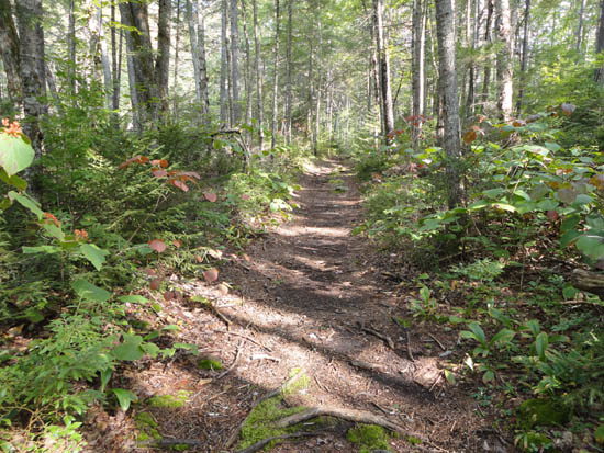
One last hike before the hurricane. After spotting a car at the Mt. Osceola Trail trailhead, we headed to the Livermore lot and took the Greeley Ponds Trail from the Livermore Trail. The grades were generally gentle and the footing decent. Excellent views from the ponds. The Mt. Osceola Trail was steep as usual to East Osceola, and rough as usual for the last mile or so to the Mt. Osceola parking lot.
| Hike Ratings |
|
Getting To Trailhead: |
Easy |
| Destination: |
Mt. Osceola (East Peak) |
|
Length: |
Moderate |
|
Steepness: |
Very Difficult |
|
Navigation: |
Easy |
|
Views: |
Moderate |
|
Crowds: |
Minimal |
| Destination: |
Mt. Osceola |
|
Length: |
Moderate |
|
Steepness: |
Very Difficult |
|
Navigation: |
Easy |
|
Views: |
Excellent |
|
Crowds: |
Heavy |
|
| Hike Stats |
|
Date Hiked: |
Saturday, August 27, 2011 |
| Parking Elevation: |
1,940' |
| Destination: |
Mt. Osceola (East Peak) |
| Time Elapsed: |
02:48 |
| Trailhead Elevation: |
1,560' |
| Summit Elevation: |
4,156' |
| Distance: |
5.6 miles |
| Vertical Gain: |
2,716' |
| Destination: |
Mt. Osceola |
| Time Elapsed: |
01:08 |
| Trailhead Elevation: |
4,156' |
| Summit Elevation: |
4,340' |
| Distance: |
1 mile |
| Vertical Gain: |
560' |
|
|
| Hike Time Elapsed: |
05:32 |
| Hike Distance: |
9.8 miles |
| Hike Vertical Gain: |
3,286' |
|
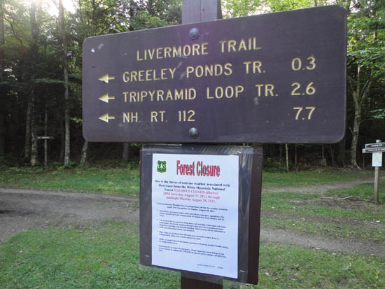
The Livermore Trail trailhead
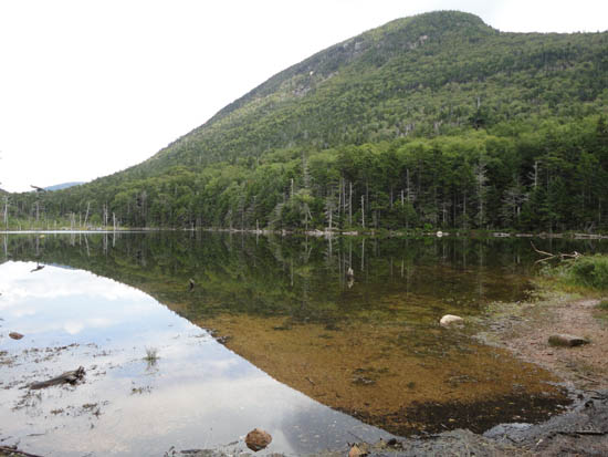
Lower Greeley Pond
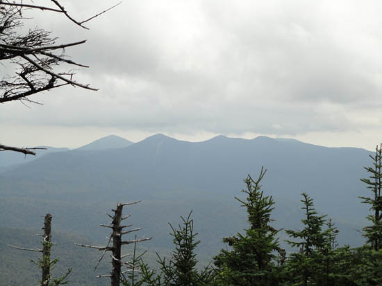
The Tripyramids as seen from East Osceola
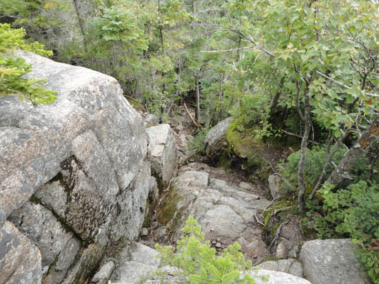
The chimney between the peaks
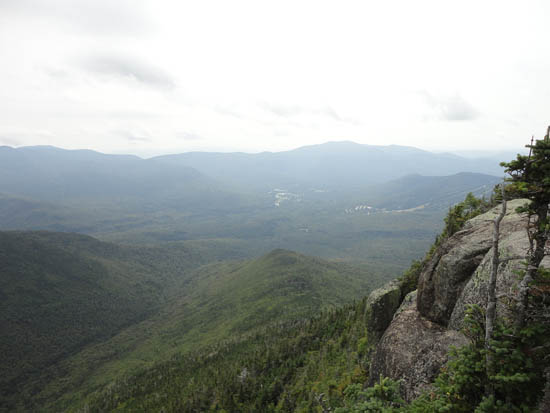
Waterville Valley as seen from the Mt. Osceola ledges
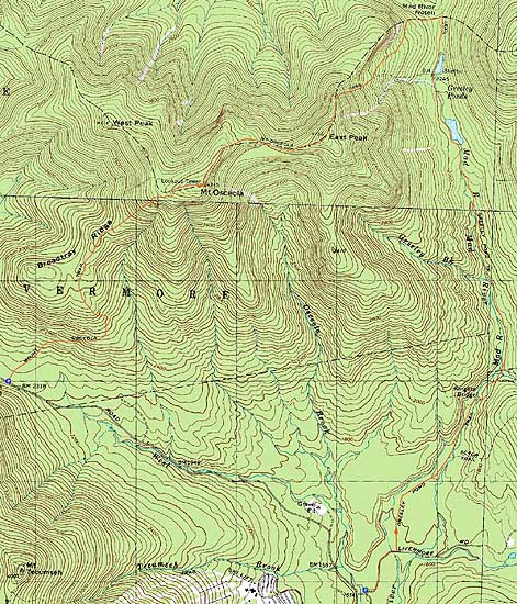

Directions to trailhead: Take Tripoli Road from the Waterville Valley ski area entrance to Livermore Road. Bear right at the Tripoli Road seasonal gate, then take an immediate to get to the Livermore WMNF fee parking lot. To get to the Mt. Osceola parking area, head up Tripoli Road, just past the height of land. The WMNF fee parking lot will be on the right.
Back to Mt. Osceola (East Peak) Profile
Back to Mt. Osceola Profile
|