Home
States
Colorado
Connecticut
Maine
Massachusetts
New Hampshire
New York
Rhode Island
Utah
Vermont
View All
Lists
NE 4,000 Footers
NE 100 Highest
NH 4,000 Footers
NH 100 Highest
NH 52 With A View
NH Belknap Range
NH Ossipee 10
Links
Trail Conditions
Trip Log
Sunrises
Sunsets
About
|
Mt. Osceola (East Peak)
Lincoln, NH, Livermore, NH
Trailheads, measurements, times, distances, and maps are all approximate and relative to the hike(s) as shown below.
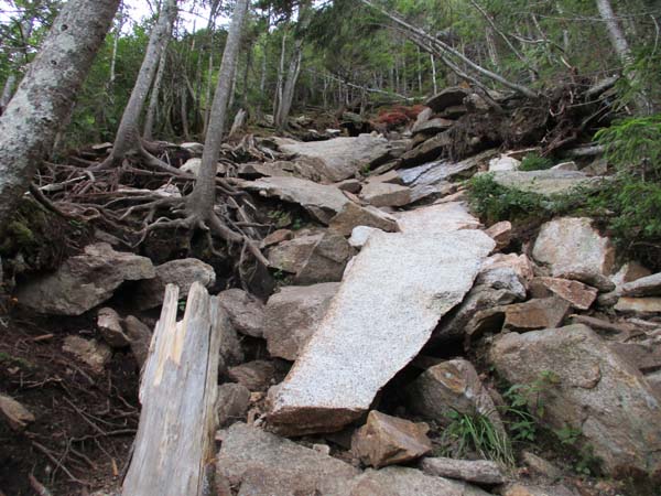
The heavily eroded Greeley Ponds Trail
Route: Greeley Ponds Trail, Mt. Osceola Trail, (Mt. Osceola - East Peak), Mt. Osceola Trail, Greeley Ponds Trail
Greeley Ponds Trail had some mud pits and some dry stretches. Bog bridges falling apart.
Lots of unmitigated erosion on the Mt. Osceola Trail up to the ridge. Trail can't take many more major storms. Some large stone not secure.
| Hike Ratings |
|
Getting To Trailhead: |
Easy |
| Destination: |
Mt. Osceola (East Peak) |
|
Length: |
Moderate |
|
Steepness: |
Very Difficult |
|
Navigation: |
Easy |
|
Views: |
Moderate |
|
Crowds: |
Moderate |
|
| Hike Stats |
|
Date Hiked: |
Monday, August 20, 2018 |
| Parking Elevation: |
1,940' |
| Destination: |
Mt. Osceola (East Peak) |
| Time Elapsed: |
01:06 |
| Trailhead Elevation: |
1,940' |
| Summit Elevation: |
4,156' |
| Distance: |
2.8 miles |
| Vertical Gain: |
2,331' |
|
|
| Hike Time Elapsed: |
02:16 |
| Hike Distance: |
5.6 miles |
| Hike Vertical Gain: |
2,446' |
|
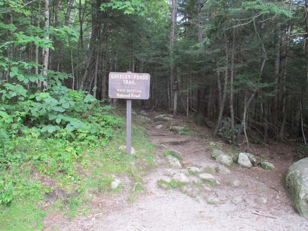
The Greeley Ponds Trail trailhead
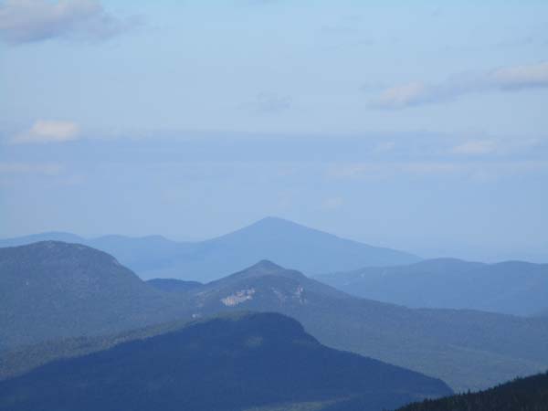
Looking at Kearsarge North from near the summit of East Osceola
Directions to trailhead: Take Route 112 west from Conway. After passing the Hancock Trail trailhead and parking lot, the Greeley Ponds trailhead and WMNF fee parking area will be on the left a few minutes later.
Back to Mt. Osceola (East Peak) Profile
|

