Home
States
Colorado
Connecticut
Maine
Massachusetts
New Hampshire
New York
Rhode Island
Utah
Vermont
View All
Lists
NE 4,000 Footers
NE 100 Highest
NH 4,000 Footers
NH 100 Highest
NH 52 With A View
NH Belknap Range
NH Ossipee 10
Links
Trail Conditions
Trip Log
Sunrises
Sunsets
About
|
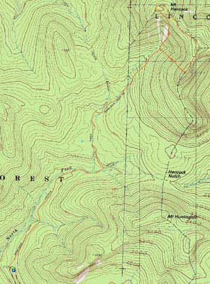
Mt. Hancock (North Peak), Mt. Hancock (South Peak)
Lincoln, NH, Livermore, NH
Trailheads, measurements, times, distances, and maps are all approximate and relative to the hike(s) as shown below.
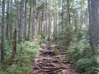
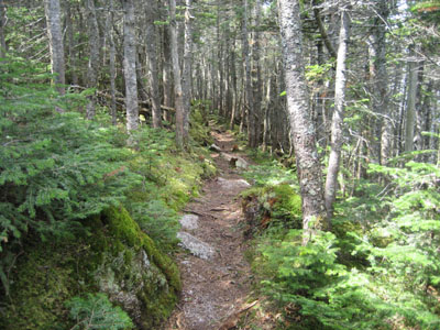
Looking up the Hancock Loop Trail prior to the split
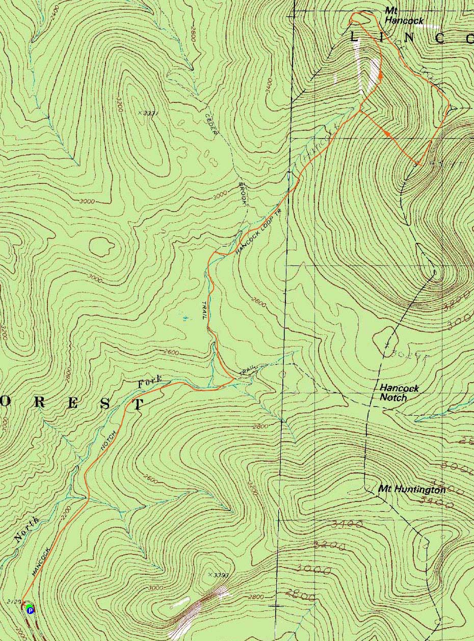
Route: Hancock Notch Trail, Cedar Brook Trail, Hancock Loop Trail, (Mt. Hancock North Peak), Hancock Loop Trail, (Mt. Hancock South Peak), Hancock Loop Trail, Cedar Brook Trail, Hancock Notch Trail
With a poor weather forecast, I decided to try and make a go of the Hancocks prior to the predicted thunderstorms.
Down low, I was glad to see the water crossings were doable. I noted that the first set on the Cedar Brook Trail were blocked off in favor of the herd path. Official?
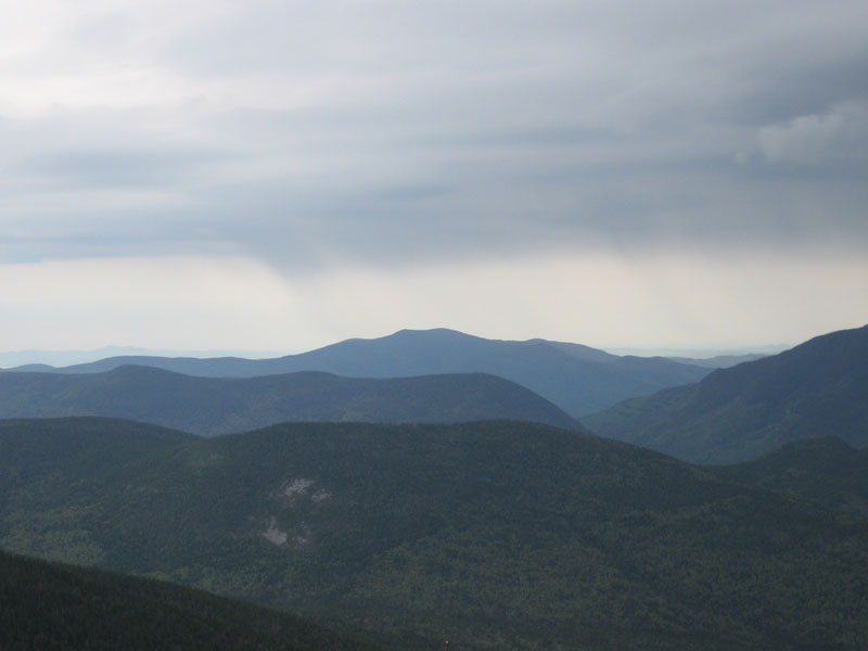
The weather alternated between sun sprinkles for much of the hike. As I ascended the steep northern portion of the Hancock Loop Trail, my achilles made their issues known - perhaps I should have done something a bit more tame. Nonetheless, I arrived at the summit in one piece, with decent views from the northern outlook.
Part of the way to the south peak, I was started by a trailside grouse. Though we didn't end up tangling, she or he did make some throaty warning noises as I passed.
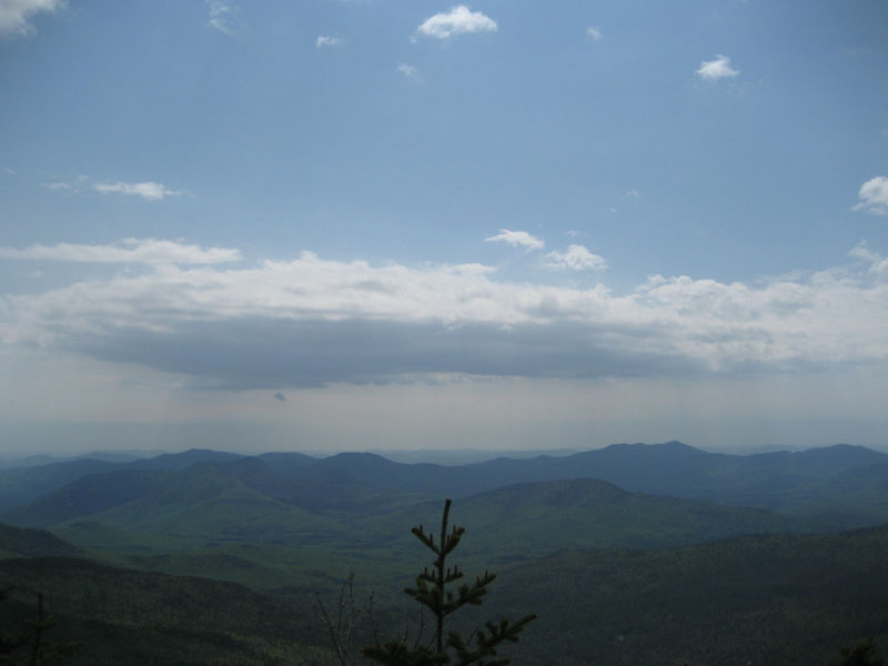
Arriving at the south peak, I headed down to the outlook for some decent views to the east. I didn't linger too long, however, as I could see some dark clouds to the west.
The flats went by pretty slowly as I made my way back to the trailhead. Having gone nonstop, my feet were a bit sore by the time I reached the Hancock Notch Trail. Nonetheless, I wanted to beat out the weather, so I only paused briefly. My timing was decent, as I made it back to the trailhead just before the skies burst open.
| Hike Ratings |
|
Getting To Trailhead: |
Easy |
| Destination: |
Mt. Hancock (North Peak) |
|
Length: |
Moderate |
|
Steepness: |
Very Difficult |
|
Navigation: |
Easy |
|
Views: |
Excellent |
|
Crowds: |
Heavy |
| Destination: |
Mt. Hancock (South Peak) |
|
Length: |
Moderate |
|
Steepness: |
Difficult |
|
Navigation: |
Easy |
|
Views: |
Excellent |
|
Crowds: |
Minimal |
|
| Hike Stats |
|
Date Hiked: |
Sunday, May 31, 2009 |
| Hike Commenced: |
7:54 AM |
| Parking Elevation: |
2,140' |
| Destination: |
Mt. Hancock (North Peak) |
| Ascent Commenced: |
7:54 AM |
| Summit Reached: |
9:55 AM |
| Time Elapsed: |
02:01 |
| Trailhead Elevation: |
2,140' |
| Summit Elevation: |
4,420' |
| Vertical Gain: |
2,470' |
| Destination: |
Mt. Hancock (South Peak) |
| Ascent Commenced: |
9:57 AM |
| Summit Reached: |
10:30 AM |
| Time Elapsed: |
00:33 |
| Trailhead Elevation: |
4,420' |
| Summit Elevation: |
4,319' |
| Distance: |
1.4 miles |
| Vertical Gain: |
534' |
|
|
| Hike Ended: |
12:34 PM |
| Hike Time Elapsed: |
04:40 |
| Hike Vertical Gain: |
3,154' |
|
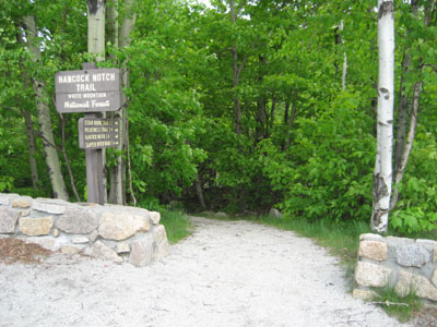
The Hancock Notch Trail trailhead
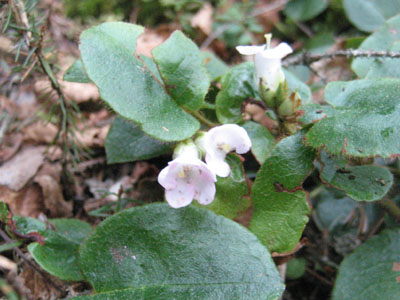
Wildflowers along the Hancock Loop Trail
Looking at the Sandwich Dome from Mt. Hancock's North Peak viewpoint
Looking down the Hancock Loop Trail on the way to Mt. Hancock's South Peak
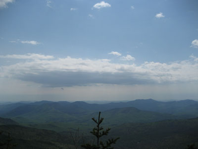
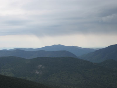
Looking at the Moats and Mt. Chocorua from the viewpoint near Mt. Hancock's South Peak

Directions to trailhead: Take Route 112 west from Route 16. After going over the pass, continue down hill a bit. The Hancock WMNF fee parking area will be on the left, just before a hairpin turn.
Back to Mt. Hancock (North Peak) Profile
Back to Mt. Hancock (South Peak) Profile
|