Home
States
Colorado
Connecticut
Maine
Massachusetts
New Hampshire
New York
Rhode Island
Utah
Vermont
View All
Lists
NE 4,000 Footers
NE 100 Highest
NH 4,000 Footers
NH 100 Highest
NH 52 With A View
NH Belknap Range
NH Ossipee 10
Links
Trail Conditions
Trip Log
Sunrises
Sunsets
About
|
Mt. Hancock (North Peak), Mt. Hancock (South Peak)
Lincoln, NH, Livermore, NH
Trailheads, measurements, times, distances, and maps are all approximate and relative to the hike(s) as shown below.
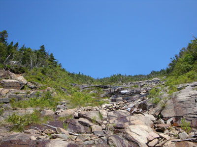
Looking up the Arrow Slide on the way to North Hancock
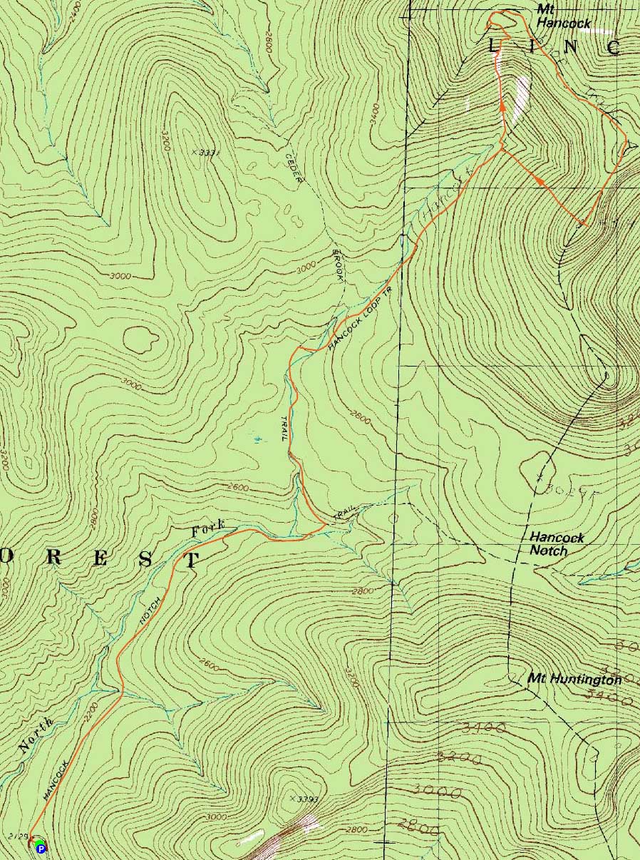
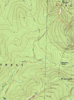
Route: Hancock Notch Trail, Cedar Brook Trail, Hancock Loop Trail, bushwhack, Arrow Slide, bushwhack, (Mt. Hancock North Peak), Hancock Loop Trail, (Mt. Hancock South Peak), Hancock Loop Trail, Cedar Brook Trail, Hancock Notch Trail
Good weather aligned with some time off, so we decided to check out the Hancocks via the Arrow Slide. Making our way to the Hancock Loop Trail in increasingly hot weather, we were surprised at how many people were out on the trails. Taking a left at the loop junction, we headed down to the dry brook bed. We took this down to a fire ring, then bushwhacked uphill into the drainage of the bottom of the slide.
The first portion of the slide was a gradual set of boulders. As we wound our way up this section, things soon steepened and loosened up with a few small scrambles.
The slide soon opened up and we were working our way up progressively steep terrain. Reaching a large set of wet slabs, we were forced to bushwhack around them. Back on the slide, we worked our way up to an impressively random cairn and then up to the top of the (facing uphill) right branch.
The views from the slide were tremendous and unique - a great experience. Perhaps with some drier weather preceeding, it would be an easier climb.
Above the slide, we bushwhacked uphill in open woods for a bit, then cut along the contour to the Hancock Loop Trail, thus avoiding a fir wave of blowdowns and other random junk.
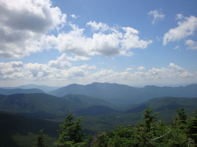
We had good views from a crowded vista for lunch. The next stop, after a muddy ridgewalk, was the south peak, where we once again had good views from the vista.
The walk out was non eventful, as we pondered how this non-traditional ascent route was by far superior to the normal Hancock Loop.
| Hike Ratings |
|
Getting To Trailhead: |
Easy |
| Destination: |
Mt. Hancock (North Peak) |
|
Length: |
Moderate |
|
Steepness: |
Very Difficult |
|
Navigation: |
Easy |
|
Views: |
Excellent |
|
Crowds: |
Heavy |
| Destination: |
Mt. Hancock (South Peak) |
|
Length: |
Moderate |
|
Steepness: |
Difficult |
|
Navigation: |
Easy |
|
Views: |
Excellent |
|
Crowds: |
Heavy |
|
| Hike Stats |
|
Date Hiked: |
Friday, August 14, 2009 |
| Hike Commenced: |
8:58 AM |
| Parking Elevation: |
2,140' |
| Destination: |
Mt. Hancock (North Peak) |
| Ascent Commenced: |
8:58 AM |
| Summit Reached: |
12:13 PM |
| Time Elapsed: |
03:15 |
| Trailhead Elevation: |
2,140' |
| Summit Elevation: |
4,420' |
| Vertical Gain: |
2,480' |
| Destination: |
Mt. Hancock (South Peak) |
| Ascent Commenced: |
12:41 PM |
| Summit Reached: |
1:22 PM |
| Time Elapsed: |
00:41 |
| Trailhead Elevation: |
4,420' |
| Summit Elevation: |
4,319' |
| Distance: |
1.4 miles |
| Vertical Gain: |
534' |
|
|
| Hike Ended: |
3:45 PM |
| Hike Time Elapsed: |
06:47 |
| Hike Vertical Gain: |
3,164' |
|
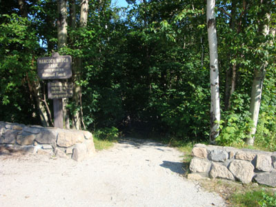
The Hancock Notch Trail trailhead
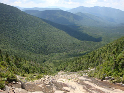
Looking down the Arrow Slide near the top

The Osceolas as seen from Mt. Hancock's North Peak viewpoint
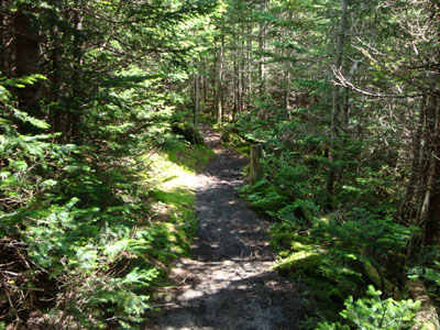
The Hancock Loop Trail between the peaks
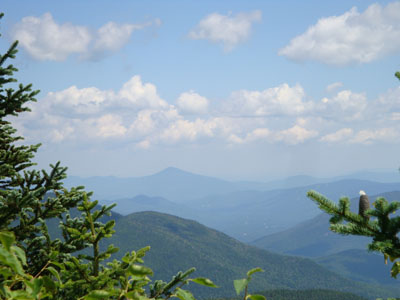
Looking at Kearsarge North Mountain from the viewpoint near Mt. Hancock's South Peak

Directions to trailhead: Take Route 112 west from Route 16. After going over the pass, continue down hill a bit. The Hancock WMNF fee parking area will be on the left, just before a hairpin turn.
Back to Mt. Hancock (North Peak) Profile
Back to Mt. Hancock (South Peak) Profile
|