Home
States
Colorado
Connecticut
Maine
Massachusetts
New Hampshire
New York
Rhode Island
Utah
Vermont
View All
Lists
NE 4,000 Footers
NE 100 Highest
NH 4,000 Footers
NH 100 Highest
NH 52 With A View
NH Belknap Range
NH Ossipee 10
Links
Trail Conditions
Trip Log
Sunrises
Sunsets
About
|
Mt. Hancock (North Peak), Mt. Hancock (South Peak)
Lincoln, NH, Livermore, NH
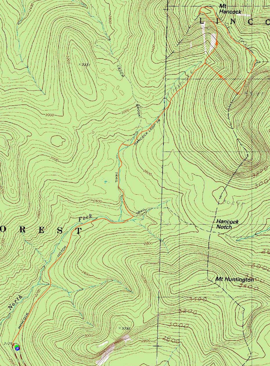
Trailheads, measurements, times, distances, and maps are all approximate and relative to the hike(s) as shown below.
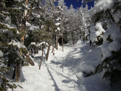
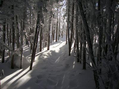
Looking up the Hancock Loop Trail
Route: Hancock Notch Trail, Cedar Brook Trail, Hancock Loop Trail, (Mt. Hancock North Peak), Hancock Loop Trail, (Mt. Hancock South Peak), Hancock Loop Trail, Cedar Brook Trail, Hancock Notch Trail
A bit windy to be above treeline, I decided to make the most of an otherwise nice day and do some hiking off the Kanc. For the morning, the plan was the Hancocks.
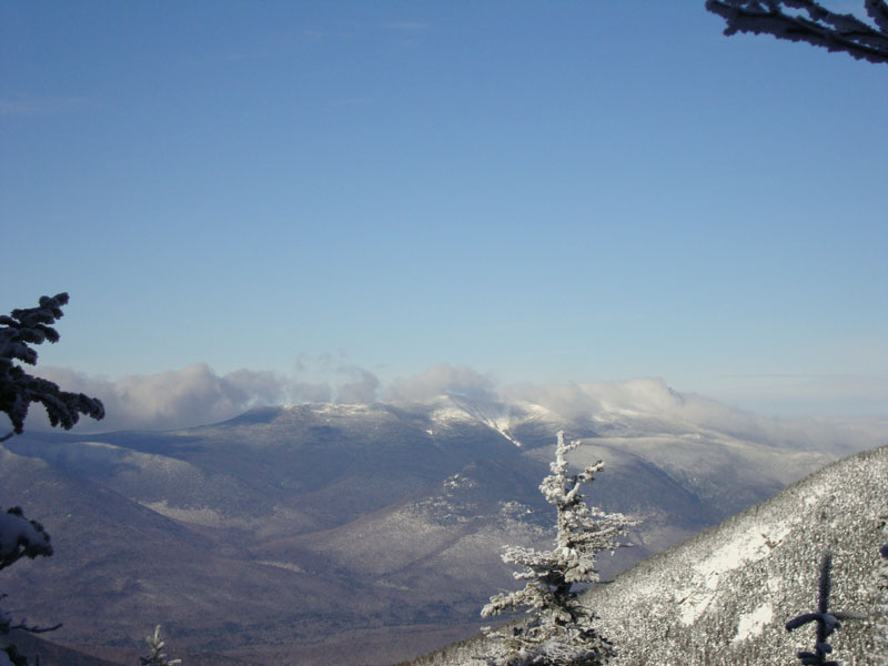
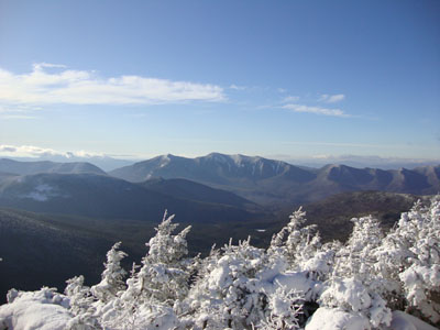
The trails were just about perfect - well packed, no ice, and great for snowshoeing. Most of the water crossings were snowbridged. Reaching the summit of North Hancock, I had excellent views of the Osceolas and Scar Ridge. Continuing to South Hancock, I had to be careful to stay on trail, as the footbed had been drifted over in some places. From South Hancock, the views weren't quite as strong, but nonetheless quite good.
The descent went smoothly - since I was the first one down the south branch on this day, I was able to get good traction with my snowshoes (vs. trying to get down a slick buttslided trail).
A nice morning on the Hancocks.
| Hike Ratings |
|
Getting To Trailhead: |
Easy |
| Destination: |
Mt. Hancock (North Peak) |
|
Length: |
Moderate |
|
Steepness: |
Very Difficult |
|
Navigation: |
Easy |
|
Views: |
Excellent |
|
Crowds: |
Minimal |
| Destination: |
Mt. Hancock (South Peak) |
|
Length: |
Moderate |
|
Steepness: |
Difficult |
|
Navigation: |
Moderate |
|
Views: |
Excellent |
|
Crowds: |
Minimal |
|
| Hike Stats |
|
Date Hiked: |
Saturday, January 16, 2010 |
| Hike Commenced: |
7:40 AM |
| Parking Elevation: |
2,140' |
| Destination: |
Mt. Hancock (North Peak) |
| Ascent Commenced: |
7:40 AM |
| Summit Reached: |
9:33 AM |
| Time Elapsed: |
01:53 |
| Trailhead Elevation: |
2,140' |
| Summit Elevation: |
4,420' |
| Vertical Gain: |
2,470' |
| Destination: |
Mt. Hancock (South Peak) |
| Ascent Commenced: |
9:35 AM |
| Summit Reached: |
10:10 AM |
| Time Elapsed: |
00:35 |
| Trailhead Elevation: |
4,420' |
| Summit Elevation: |
4,319' |
| Distance: |
1.4 miles |
| Vertical Gain: |
534' |
|
|
| Hike Ended: |
11:38 AM |
| Hike Time Elapsed: |
03:58 |
| Hike Vertical Gain: |
3,154' |
|
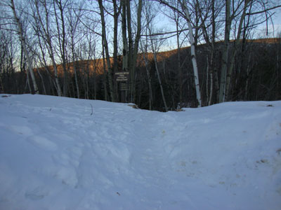
The Hancock Notch Trail trailhead
The Osceolas as seen from the North Hancock viewpoint
The Hancock Loop Trail between the peaks

The Franconia Ridge as seen from near the South Hancock summit
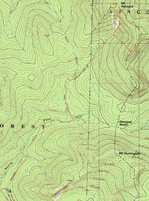

Directions to trailhead: Take Route 112 west from Route 16. After going over the pass, continue down hill a bit. The Hancock WMNF fee parking area will be on the left, just before a hairpin turn.
Back to Mt. Hancock (North Peak) Profile
Back to Mt. Hancock (South Peak) Profile
|