Home
States
Colorado
Connecticut
Maine
Massachusetts
New Hampshire
New York
Rhode Island
Utah
Vermont
View All
Lists
NE 4,000 Footers
NE 100 Highest
NH 4,000 Footers
NH 100 Highest
NH 52 With A View
NH Belknap Range
NH Ossipee 10
Links
Trail Conditions
Trip Log
Sunrises
Sunsets
About
|
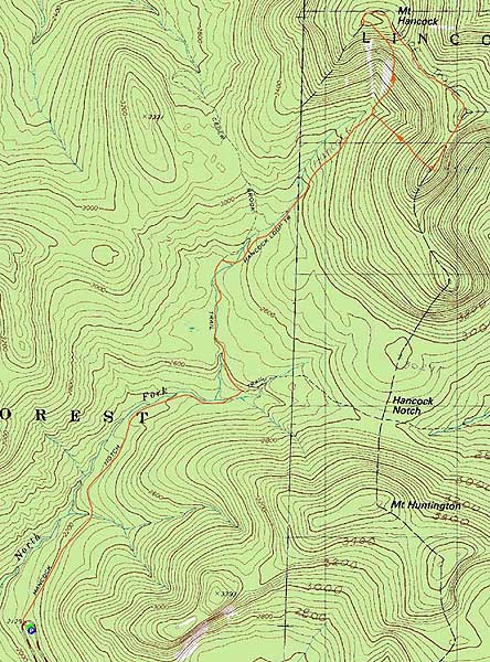
Mt. Hancock (North Peak), Mt. Hancock (South Peak)
Lincoln, NH, Livermore, NH
Trailheads, measurements, times, distances, and maps are all approximate and relative to the hike(s) as shown below.
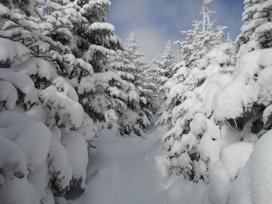
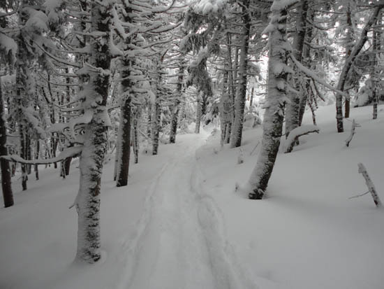
Looking up the Hancock Loop Trail
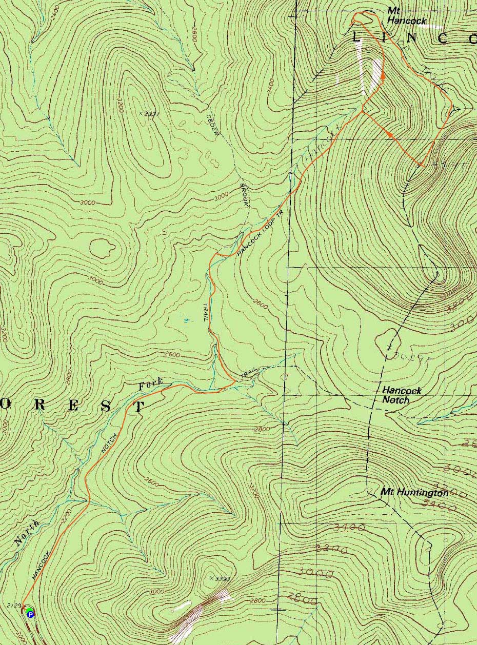
Route: Hancock Notch Trail, Cedar Brook Trail, Hancock Loop Trail, (Mt. Hancock North Peak), Hancock Loop Trail, (Mt. Hancock South Peak), Hancock Loop Trail, Cedar Brook Trail, Hancock Notch Trail
With a halfway decent forecast, we headed out to the Hancocks.
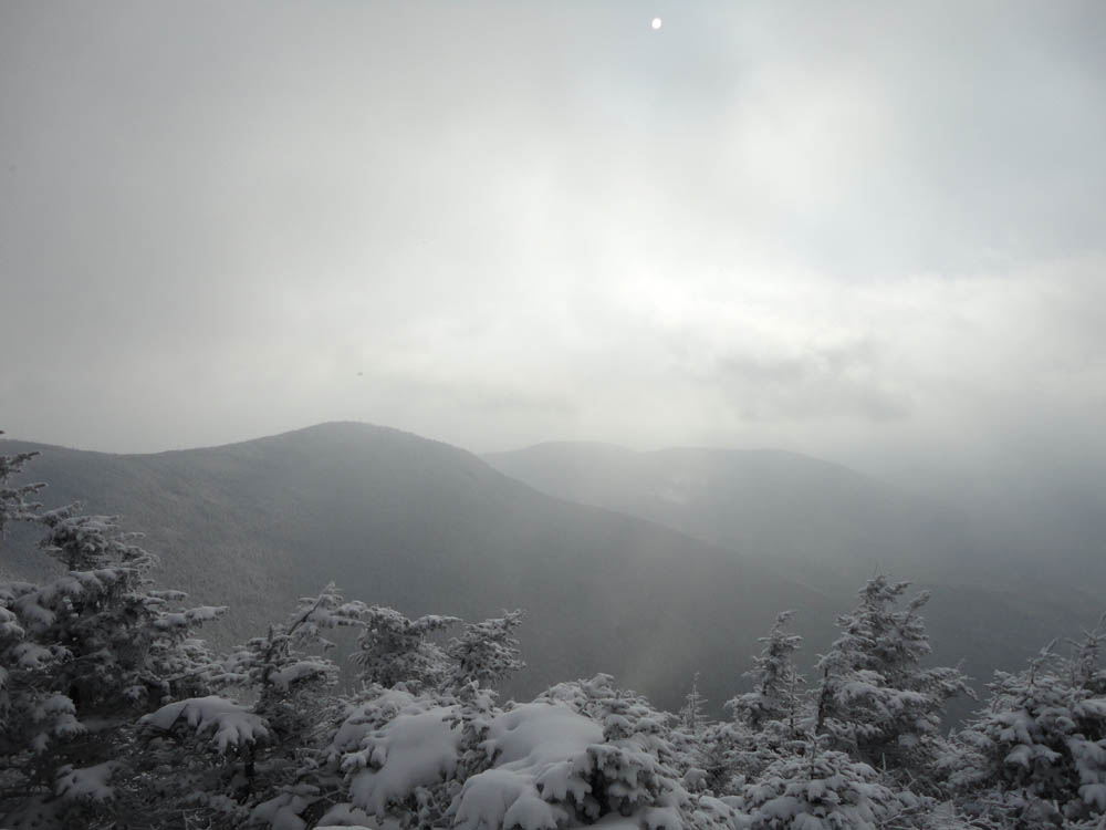
Thanks to the recent snow and subsequent hikers, the Hancock Notch and Cedar Brook Trails featured packed powder conditions. By the time we reached the Hancock Loop Trail, there were a few inches of new snow. Reaching the summit of North Hancock, views were a little bit restricted due to passing flurries.
The coldest part of the day was between Middle and South Hancock, where brisk winds dropped the temperatures. While we had some decent looks at the Arrow Slide from either side of South Hancock, the near summit viewpoint to the east was a bit hazy due to the weather.
The descent was a bit tricky, as 1-4" of new powder resulted in minimal downhill traction on snowshoes.
| Hike Ratings |
|
Getting To Trailhead: |
Easy |
| Destination: |
Mt. Hancock (North Peak) |
|
Length: |
Moderate |
|
Steepness: |
Very Difficult |
|
Navigation: |
Easy |
|
Views: |
Moderate (due to weather) |
|
Crowds: |
Minimal |
| Destination: |
Mt. Hancock (South Peak) |
|
Length: |
Moderate |
|
Steepness: |
Difficult |
|
Navigation: |
Easy |
|
Views: |
Excellent |
|
Crowds: |
Minimal |
|
| Hike Stats |
|
Date Hiked: |
Sunday, January 16, 2011 |
| Hike Commenced: |
8:22 AM |
| Parking Elevation: |
2,140' |
| Destination: |
Mt. Hancock (North Peak) |
| Ascent Commenced: |
8:22 AM |
| Summit Reached: |
11:29 AM |
| Time Elapsed: |
03:07 |
| Trailhead Elevation: |
2,140' |
| Summit Elevation: |
4,420' |
| Vertical Gain: |
2,470' |
| Destination: |
Mt. Hancock (South Peak) |
| Ascent Commenced: |
11:43 AM |
| Summit Reached: |
12:32 PM |
| Time Elapsed: |
00:49 |
| Trailhead Elevation: |
4,420' |
| Summit Elevation: |
4,319' |
| Distance: |
1.4 miles |
| Vertical Gain: |
534' |
|
|
| Hike Ended: |
2:44 PM |
| Hike Time Elapsed: |
06:22 |
| Hike Vertical Gain: |
3,154' |
|
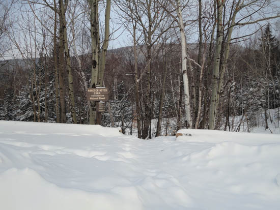
The Hancock Notch Trail trailhead

Somewhat limited views due to snowfall from the North Hancock viewpoint
The Hancock Loop Trail between the peaks
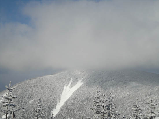
Looking at the Arrow Slide on North Hancock from near the summit of South Hancock

Directions to trailhead: Take Route 112 west from Route 16. After going over the pass, continue down hill a bit. The Hancock WMNF fee parking area will be on the left, just before a hairpin turn.
Back to Mt. Hancock (North Peak) Profile
Back to Mt. Hancock (South Peak) Profile
|