Home
States
Colorado
Connecticut
Maine
Massachusetts
New Hampshire
New York
Rhode Island
Utah
Vermont
View All
Lists
NE 4,000 Footers
NE 100 Highest
NH 4,000 Footers
NH 100 Highest
NH 52 With A View
NH Belknap Range
NH Ossipee 10
Links
Trail Conditions
Trip Log
Sunrises
Sunsets
About
|
Mt. Hancock (North Peak), Mt. Hancock (South Peak)
Lincoln, NH, Livermore, NH
Trailheads, measurements, times, distances, and maps are all approximate and relative to the hike(s) as shown below.
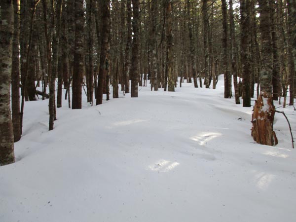
The Cedar Brook Trail
Route: Hancock Notch Trail, Cedar Brook Trail, Hancock Loop Trail, (Mt. Hancock North Peak), Hancock Loop Trail, (Mt. Hancock South Peak), Hancock Loop Trail, Cedar Brook Trail, Hancock Notch Trail
Hancock Notch Trail was well packed out, but probably a bit awkward in bareboots due to bareboot damage. Okay going in snowshoes though.
Cedar Brook Trail was also well packed out.
Hancock Loop steeps had a few minor blue ice and frozen granular patches that could be tackled or avoided whilst wearing snowshoes. Buttsliders could make this worse though.
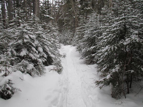
Between the peaks, there was significant drifting, just from last night alone. Fresh drifts of 2 feet. There was one other snowshoer out, but I suspect barebooters will be the last through, which may make this a mess with the warming temperatures.
I wore my snowshoes roundtrip and never thought about taking them off. Snowpack in the woods is 2 to 3 feet. 4,000 footers in winter with snow...snowshoes!
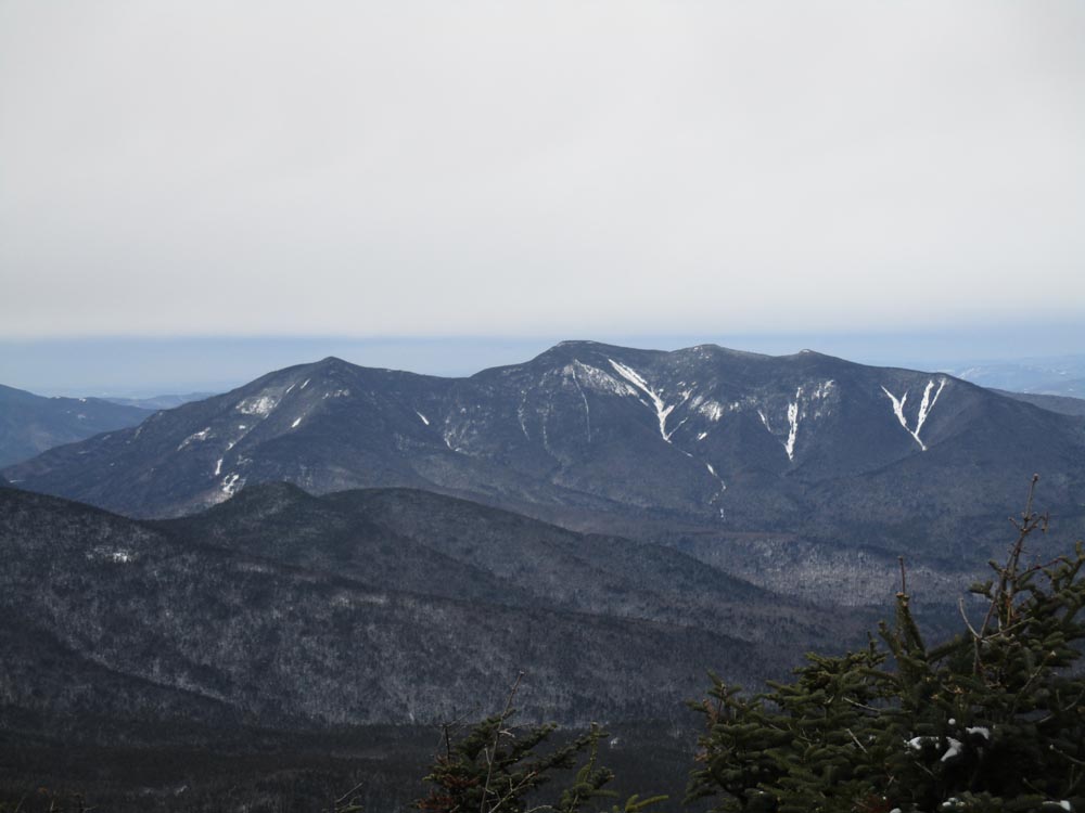
No sign of activity heading beyond the normal route on Hancock Notch or Cedar Brook. Arrow Slide looks very icy right now.
Better weather than forecasted, as the sun poked out for an hour or two.
| Hike Ratings |
|
Getting To Trailhead: |
Easy |
| Destination: |
Mt. Hancock (North Peak) |
|
Length: |
Moderate |
|
Steepness: |
Very Difficult |
|
Navigation: |
Easy |
|
Views: |
Excellent |
|
Crowds: |
Minimal |
| Destination: |
Mt. Hancock (South Peak) |
|
Length: |
Moderate |
|
Steepness: |
Difficult |
|
Navigation: |
Easy |
|
Views: |
Excellent |
|
Crowds: |
Minimal |
|
| Hike Stats |
|
Date Hiked: |
Saturday, December 24, 2016 |
| Parking Elevation: |
2,140' |
| Destination: |
Mt. Hancock (North Peak) |
| Time Elapsed: |
01:40 |
| Trailhead Elevation: |
2,140' |
| Summit Elevation: |
4,420' |
| Vertical Gain: |
2,480' |
| Destination: |
Mt. Hancock (South Peak) |
| Time Elapsed: |
00:28 |
| Trailhead Elevation: |
4,420' |
| Summit Elevation: |
4,319' |
| Distance: |
1.4 miles |
| Vertical Gain: |
534' |
|
|
| Hike Time Elapsed: |
03:25 |
| Hike Vertical Gain: |
3,174' |
|
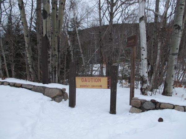
The Hancock Notch Trail trailhead
Looking at the Osceolas from the North Hancock viewpoint
The drifted Hancock Loop Trail between the peaks
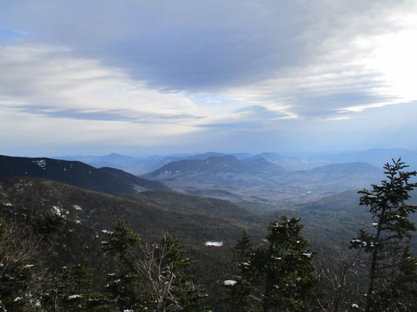
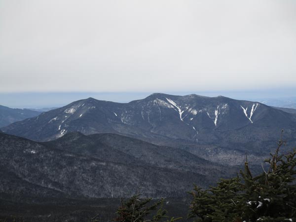
Looking toward Bartlett from the South Hancock viewpoint
Directions to trailhead: Take Route 112 west from Route 16. After going over the pass, continue down hill a bit. The Hancock WMNF fee parking area will be on the left, just before a hairpin turn.
Back to Mt. Hancock (North Peak) Profile
Back to Mt. Hancock (South Peak) Profile
|