Home
States
Colorado
Connecticut
Maine
Massachusetts
New Hampshire
New York
Rhode Island
Utah
Vermont
View All
Lists
NE 4,000 Footers
NE 100 Highest
NH 4,000 Footers
NH 100 Highest
NH 52 With A View
NH Belknap Range
NH Ossipee 10
Links
Trail Conditions
Trip Log
Sunrises
Sunsets
About
|
Mt. Hancock (South Peak), Mt. Hancock (North Peak)
Lincoln, NH, Livermore, NH
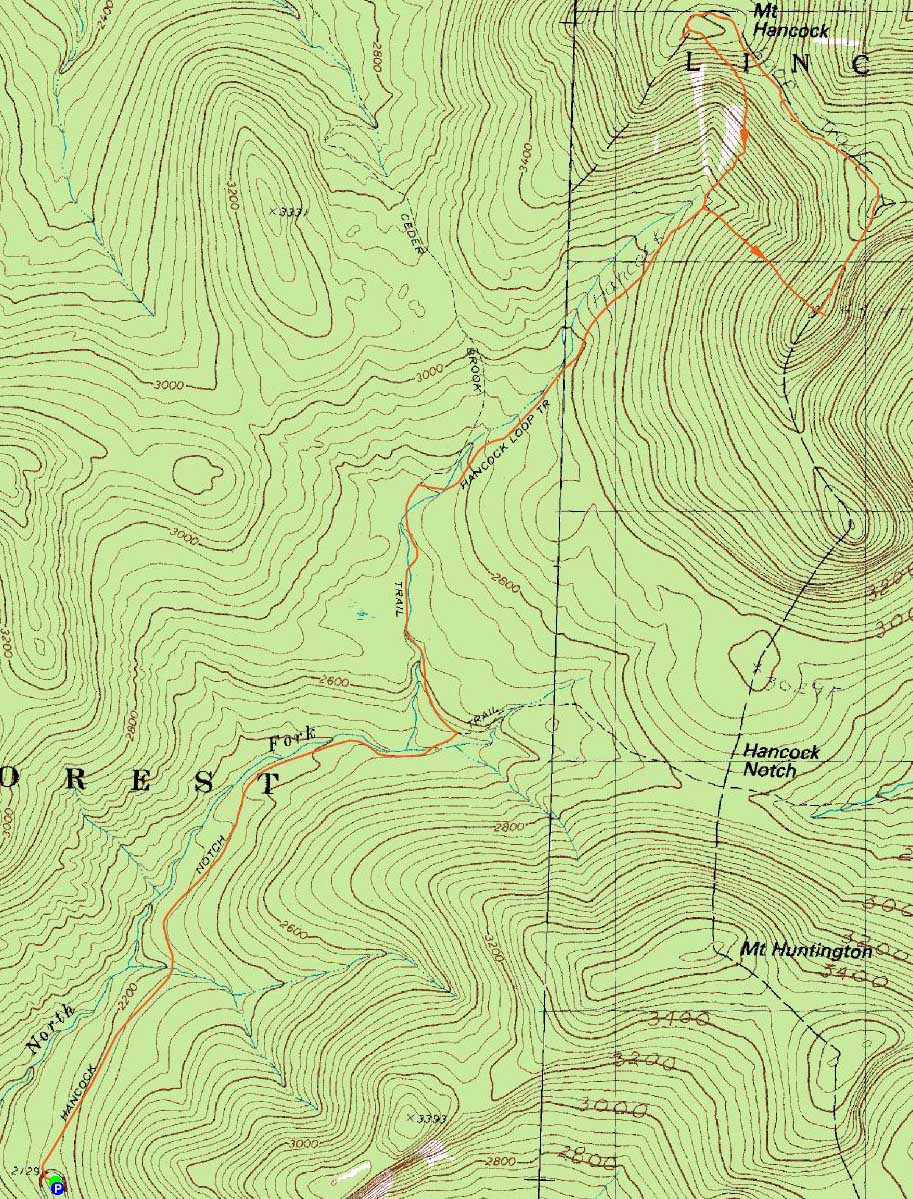
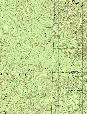
Trailheads, measurements, times, distances, and maps are all approximate and relative to the hike(s) as shown below.
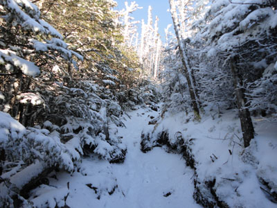
Looking up the Hancock Loop Trail on the way to South Hancock
Route: Hancock Notch Trail, Cedar Brook Trail, Hancock Loop Trail, (Mt. Hancock South Peak), Hancock Loop Trail, (Mt. Hancock North Peak), Hancock Loop Trail, Cedar Brook Trail, Hancock Notch Trail
With lots of rain forecasted for the following day, I decided to take the afternoon off and head up to the Hancocks.
Starting at the trailhead, there was a dusting of snow. After making my way through the flats, snow depths increased to one to two inches, along with some patches of ice. Reaching the loop split, I opted to mix things up a bit and head to South Hancock first. Though still very much a workout, I found the slightly shorter climb to be a bit easier than going the other way. Nonetheless, I think I prefer to go clockwise.
After checking out the somewhat limited but decent views near the summit, I continued along the ridge to North Hancock. Though a nice ridgewalk, the grown in nature (resulting in a carwash effect with the melting snow in the branches) and mud patches were less than optimal.
Reaching the North Hancock viewpoint, I had good views, stretching as far as the Green Mountains.
From there, I took my time heading down the steep descent back to the loop junction, then tried to make as good of time as possible on the muddy lower Hancock Loop Trail, as well as the muddy Cedar Brook Trail.
| Hike Ratings |
|
Getting To Trailhead: |
Easy |
| Destination: |
Mt. Hancock (South Peak) |
|
Length: |
Moderate |
|
Steepness: |
Very Difficult |
|
Navigation: |
Easy |
|
Views: |
Excellent |
|
Crowds: |
Minimal |
| Destination: |
Mt. Hancock (North Peak) |
|
Length: |
Moderate |
|
Steepness: |
Difficult |
|
Navigation: |
Easy |
|
Views: |
Excellent |
|
Crowds: |
Minimal |
|
| Hike Stats |
|
Date Hiked: |
Wednesday, November 3, 2010 |
| Hike Commenced: |
12:41 PM |
| Parking Elevation: |
2,140' |
| Destination: |
Mt. Hancock (South Peak) |
| Ascent Commenced: |
12:41 PM |
| Summit Reached: |
2:34 PM |
| Time Elapsed: |
01:53 |
| Trailhead Elevation: |
2,140' |
| Summit Elevation: |
4,319' |
| Vertical Gain: |
2,329' |
| Destination: |
Mt. Hancock (North Peak) |
| Ascent Commenced: |
2:36 PM |
| Summit Reached: |
3:13 PM |
| Time Elapsed: |
00:37 |
| Trailhead Elevation: |
4,319' |
| Summit Elevation: |
4,420' |
| Distance: |
1.4 miles |
| Vertical Gain: |
635' |
|
|
| Hike Ended: |
5:09 PM |
| Hike Time Elapsed: |
04:28 |
| Hike Vertical Gain: |
3,154' |
|
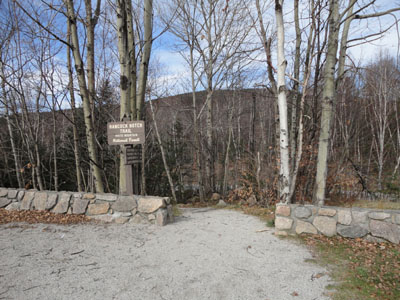
The Hancock Notch Trail trailhead
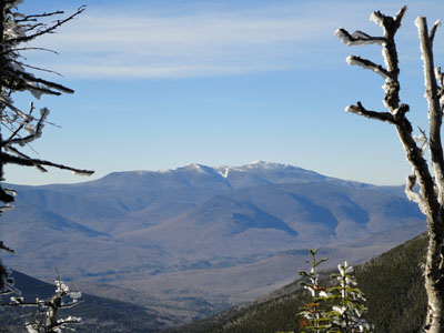
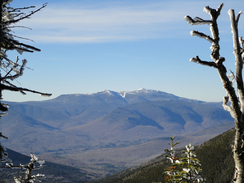
Looking at the Franconia Ridge from near the summit of South Hancock
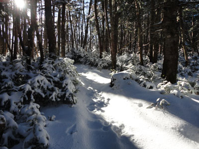
The Hancock Loop Trail between the peaks
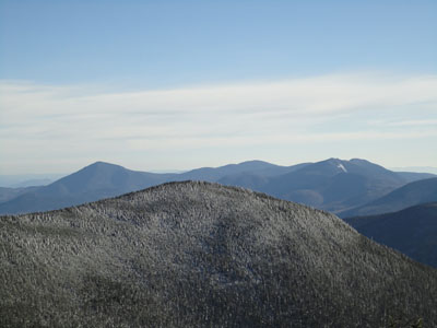
South Hancock and the Sandwich Range as seen from near the summit of North Hancock

Directions to trailhead: Take Route 112 west from Route 16. After going over the pass, continue down hill a bit. The Hancock WMNF fee parking area will be on the left, just before a hairpin turn.
Back to Mt. Hancock (South Peak) Profile
Back to Mt. Hancock (North Peak) Profile
|