Home
States
Colorado
Connecticut
Maine
Massachusetts
New Hampshire
New York
Rhode Island
Utah
Vermont
View All
Lists
NE 4,000 Footers
NE 100 Highest
NH 4,000 Footers
NH 100 Highest
NH 52 With A View
NH Belknap Range
NH Ossipee 10
Links
Trail Conditions
Trip Log
Sunrises
Sunsets
About
|
Mt. Jackson
Carroll, NH, Hart's Location, NH, Bean's Grant, NH
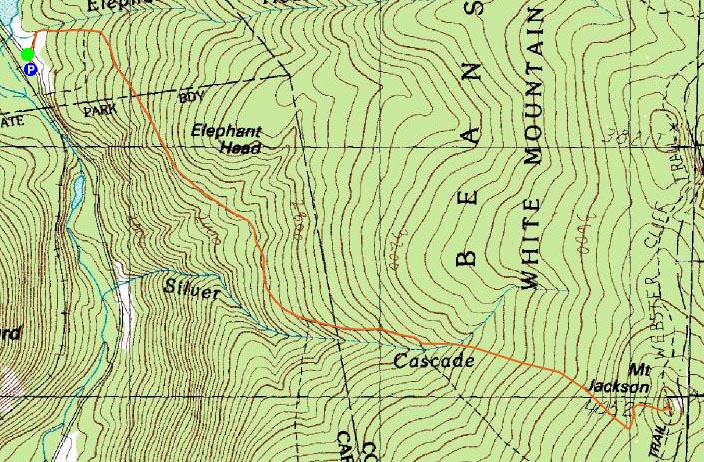
Trailheads, measurements, times, distances, and maps are all approximate and relative to the hike(s) as shown below.
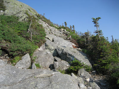
Looking up the steep, rocky section of the Webster-Jackson Trail just below the summit of Mt. Jackson
Route: Webster-Jackson Trail
My three previous attempts at hiking two thousand vertical feet with the knee injury had ended in pain. Thus, why not try again?
I wanted to do hike something new after work, so I decided to head up north and try Mt. Jackson and possibly Mt. Webster. Arriving at the trailhead a bit after 4:00, I decided it would only be Mt. Jackson, as I didn't feel like driving home in the dark.
The first half of the Webster-Jackson Trail is rather easy - though there are a few short, steep rocky pitches, most of the trail is gentle and rolly. After the leg that heads to Mt. Webster breaks off to the right, things start to steepen a bit and become a bit more rocky. Nonetheless, it's a relatively easy hike until the last few hundred vertical feet - at which point, some scrambling is required up some large rocks.
There was not a single person out on the trail the entire hike. Other than the bugs (not too bad until the summit, and still not bad at all), a few toads, a few chipmunks/squirrels, and a few small snakes, I was all alone.
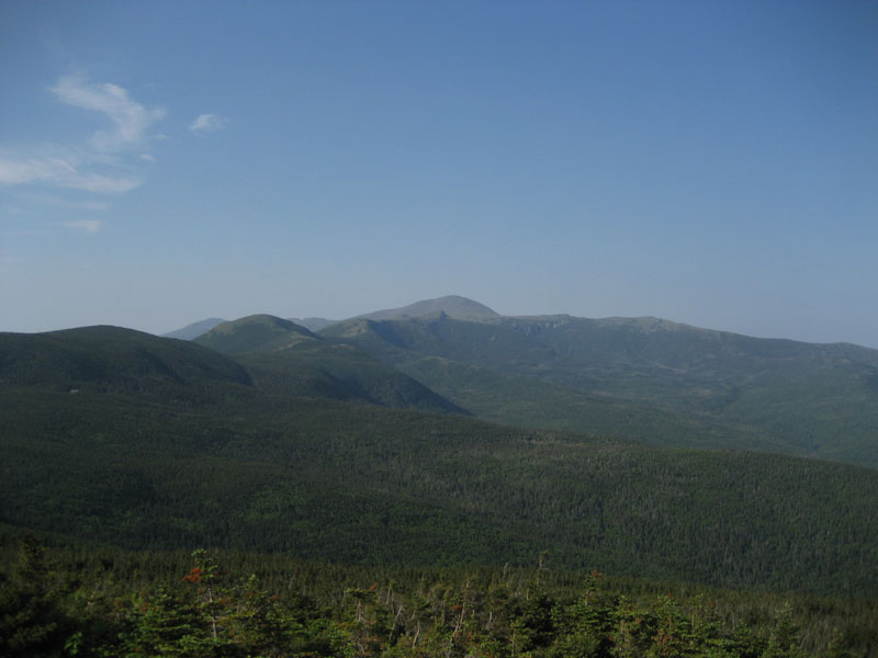
The views from the summit were strong despite the haze. To the west, there wasn't much to see, as the haze and the gradually setting sun made it kind of bland, however the excellent views toward Mt. Washington and Mt. Isolation were worth the trip alone.
My knee was sore the minute I hit the summit ledge (my guess is consecutive days of hiking, along with the numerous small downhill sections without wearing the patella strap added up), however it wasn't as bad as it has been. Once I put on the strap and made it down the steep stuff near the summit area, the descent wasn't overly painful.
Six of the NH 4,000 footers down...at this pace, I should be done with them by the time I'm on AARP!
| Hike Ratings |
|
Getting To Trailhead: |
Easy |
| Destination: |
Mt. Jackson |
|
Length: |
Moderate |
|
Steepness: |
Difficult |
|
Navigation: |
Easy |
|
Views: |
Excellent |
|
Crowds: |
Minimal |
|
| Hike Stats |
|
Date Hiked: |
Tuesday, June 19, 2007 |
| Hike Commenced: |
4:16 PM |
| Parking Elevation: |
1,900' |
| Destination: |
Mt. Jackson |
| Ascent Commenced: |
4:17 PM |
| Summit Reached: |
5:41 PM |
| Time Elapsed: |
01:24 |
| Trailhead Elevation: |
1,905' |
| Summit Elevation: |
4,052' |
| Distance: |
2.6 miles |
| Vertical Gain: |
2,322' |
|
|
| Hike Ended: |
7:36 PM |
| Hike Time Elapsed: |
03:20 |
| Hike Distance: |
5.2 miles |
| Hike Vertical Gain: |
2,512' |
|
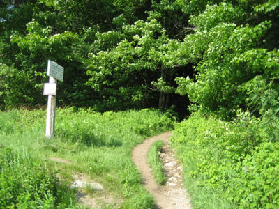
Webster-Jackson Trail trailhead on Route 302
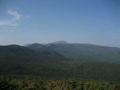
Looking northeast at Mt. Washington from the Mt. Jackson summit


Directions to trailhead: Take Route 302 West from Bartlett into Carroll. There is a small parking lot on the left side of the road. Trailhead is located on the right side of the road, just after the parking lot and just before Saco Lake.
Back to Mt. Jackson Profile
|