Home
States
Colorado
Connecticut
Maine
Massachusetts
New Hampshire
New York
Rhode Island
Utah
Vermont
View All
Lists
NE 4,000 Footers
NE 100 Highest
NH 4,000 Footers
NH 100 Highest
NH 52 With A View
NH Belknap Range
NH Ossipee 10
Links
Trail Conditions
Trip Log
Sunrises
Sunsets
About
|
Mt. Jackson
Carroll, NH, Hart's Location, NH, Bean's Grant, NH
Trailheads, measurements, times, distances, and maps are all approximate and relative to the hike(s) as shown below.
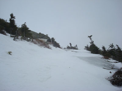
Looking up the Webster-Jackson Trail near the summit
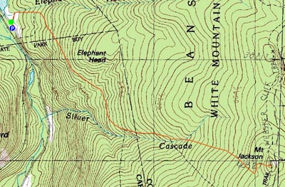
Route: Webster-Jackson Trail
After having a filling Christmas breakfast at the Highland Center, we set out on the Webster-Jackson Trail en route to Mt. Jackson. While the weather forecast a day earlier had looked good, the winds and clouds told a different story.
Fortunately for my sake, the trail was broken out - after breaking trail on Mt. Hale a day earlier, my face would have quickly become pale had I ended up in trailbreaking jail once again. The last part really didn't make sense, but I wanted to keep the rhyme in existence.
The trail was a bit crusty, but nonetheless decent for snowshoeing. From the winds, there were plenty of branches down everywhere. While I'm not a fan of the ups and downs on this trail, they were a bit welcome on this day, as they provided breaks from the wind.
As we neared the summit, the winds were howling. Leaving our snowshoes just below the last rock scramble (the previous one had been covered), we donned Microspikes and zigzagged our way up the ledges to the summit, dodging ice and wind gusts whenever possible. The views weren't anywhere as good as normal due to the clouds, however Mt. Webster and Mt. Eisenhower were both visible, making the scenery decent nonetheless.
After getting blown around by the wind a bit more, we made our way back down into the trees, put on our snowshoes, and partook (if that's even a word) in a leisurely descent, stopping to clear all but one of the blowdowns. By the time we reached the trailhead, the clouds had moved out and it had turned into a nice, sunny day. Not a bad way to spend Christmas!
| Hike Ratings |
|
Getting To Trailhead: |
Easy |
| Destination: |
Mt. Jackson |
|
Length: |
Moderate |
|
Steepness: |
Difficult |
|
Navigation: |
Easy |
|
Views: |
Excellent |
|
Crowds: |
Minimal |
|
| Hike Stats |
|
Date Hiked: |
Thursday, December 25, 2008 |
| Hike Commenced: |
8:40 AM |
| Parking Elevation: |
1,900' |
| Destination: |
Mt. Jackson |
| Ascent Commenced: |
8:49 AM |
| Summit Reached: |
11:01 AM |
| Time Elapsed: |
02:12 |
| Trailhead Elevation: |
1,905' |
| Summit Elevation: |
4,052' |
| Distance: |
2.6 miles |
| Vertical Gain: |
2,322' |
|
|
| Hike Ended: |
1:17 PM |
| Hike Time Elapsed: |
04:37 |
| Hike Distance: |
5.2 miles |
| Hike Vertical Gain: |
2,512' |
|
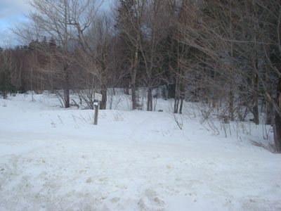
Webster-Jackson Trail trailhead on Route 302
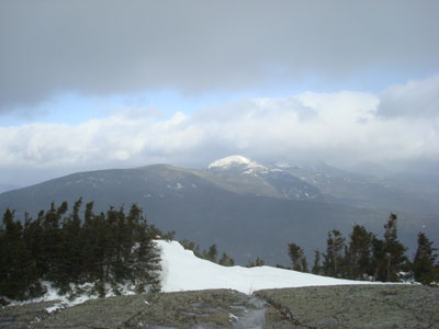
Looking at Mt. Eisenhower from Mt. Jackson

Directions to trailhead: Take Route 302 West from Bartlett into Carroll. There is a small parking lot on the left side of the road. Trailhead is located on the right side of the road, just after the parking lot and just before Saco Lake.
Back to Mt. Jackson Profile
|