Home
States
Colorado
Connecticut
Maine
Massachusetts
New Hampshire
New York
Rhode Island
Utah
Vermont
View All
Lists
NE 4,000 Footers
NE 100 Highest
NH 4,000 Footers
NH 100 Highest
NH 52 With A View
NH Belknap Range
NH Ossipee 10
Links
Trail Conditions
Trip Log
Sunrises
Sunsets
About
|
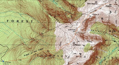
Mt. Jefferson, Mt. Adams
Thompson and Meserve's Purchase, NH
Trailheads, measurements, times, distances, and maps are all approximate and relative to the hike(s) as shown below.
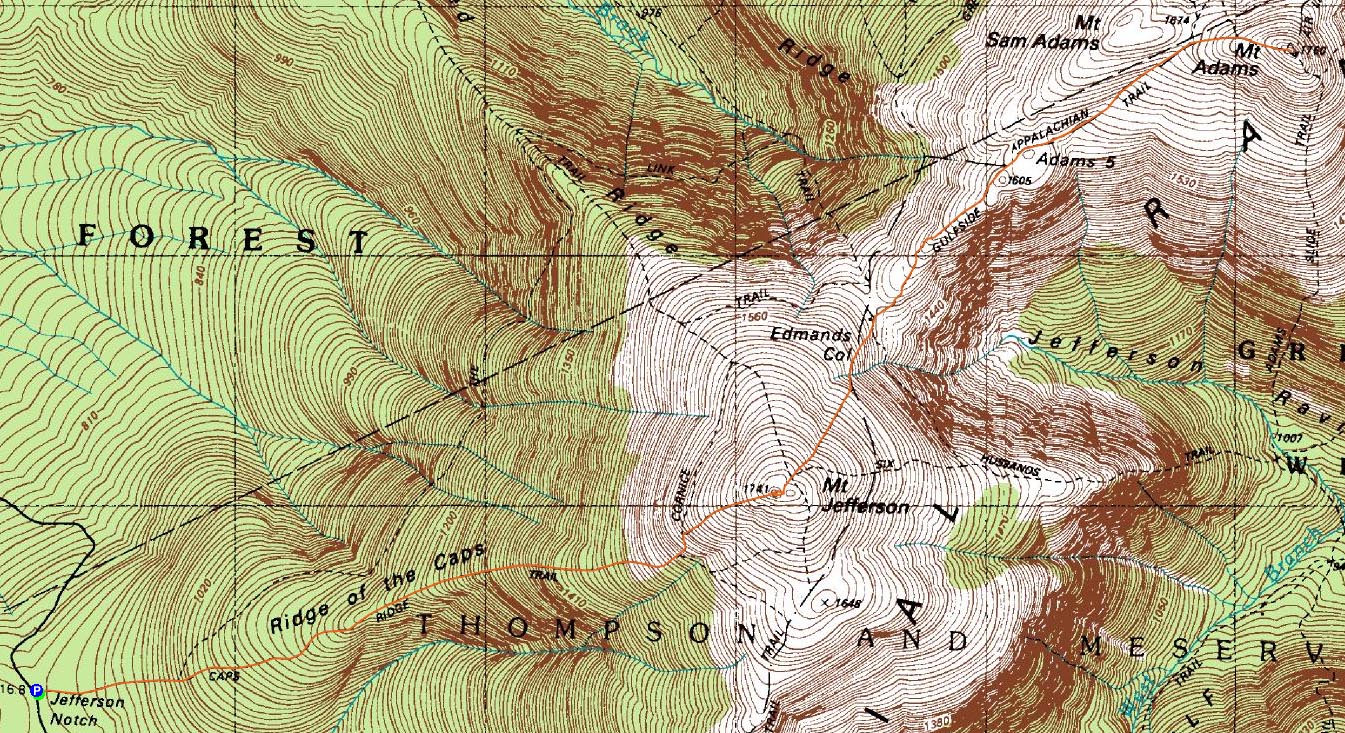
The Caps Ridge Trail
Route: Caps Ridge Trail, (Mt. Jefferson), Mt. Jefferson Loop, Gulfside Trail, Israel Ridge Path, Lowe's Path, (Mt. Adams), Lowe's Path, Israel Ridge Path, Gulfside Trail, Mt. Jefferson Loop, (Mt. Jefferson), Caps Ridge Trail
With a nice weather forecast, I decided to take the day off and head up to the Northern Presidentials. Arriving at the Caps Ridge Trail parking lot, I was surprised to see only a few cars.
While the Caps Ridge Trail is a challenging ascent (and descent for that matter), it seemed less challenging a year and a hundred plus peaks later. Nonetheless, I was a bit tired, so it gave me a good work out. Ironically, I ended up reaching the summit of Mt. Jefferson in the exact same amount of time as I had the previous summer.
The views from the top were excellent - even the Belknaps were visible. I ended up hanging around the summit for twenty minutes or so, visiting with some other hikers, eating a sandwich, and taking in the views.
I had envisioned the next leg of the hike the previous time I had been on Jefferson - heading over to Mt. Adams. From the summit of Jefferson, the hike looks fairly smooth up until the final ascent of Adams.
In reality, it wasn't a smooth, quick hike over - the Gulfside Trail is often rocky, slowing progress dramatically. In addition, there's nearly a thousand vertical foot difference from the low point on the Gulfside Trail to the summit of Adams. The beautiful weather, though a bit warm with the sun shining, made this ascent rather enjoyable.
The summit of Adams was where I encountered the first and only significant bugs of the day - quite a variety too! As a result, I only stayed to take a few photos, before retreating back down a few dozen feet to a bug free area. The views were tremendous - my previous time on Mt. Adams was basically a half hour waiting for clouds to never lift.
The trip back to Jefferson wasn't too bad, though it slowed a bit as I reached the Edmands Col, as the afternoon crowds were finally making their way across the ridge. The ascent back up Jefferson was a bit tiring after an already aggressive hike, but soon enough I was back on Jefferson, taking in the views and chatting with some other folks.
The descent seemed to take forever, as I had my mind set on a milkshake and was growing impatient. A nice hike, nonetheless.
| Hike Ratings |
|
Getting To Trailhead: |
Easy |
| Destination: |
Mt. Jefferson |
|
Length: |
Moderate |
|
Steepness: |
Very Difficult |
|
Navigation: |
Easy |
|
Views: |
Excellent |
|
Crowds: |
Minimal |
| Destination: |
Mt. Adams |
|
Length: |
Difficult |
|
Steepness: |
Difficult |
|
Navigation: |
Easy |
|
Views: |
Excellent |
|
Crowds: |
Moderate |
|
| Hike Stats |
|
Date Hiked: |
Wednesday, July 16, 2008 |
| Hike Commenced: |
8:18 AM |
| Parking Elevation: |
3,009' |
| Destination: |
Mt. Jefferson |
| Ascent Commenced: |
8:18 AM |
| Summit Reached: |
9:55 AM |
| Time Elapsed: |
01:37 |
| Trailhead Elevation: |
3,009' |
| Summit Elevation: |
5,712' |
| Distance: |
2.5 miles |
| Vertical Gain: |
2,768' |
| Destination: |
Mt. Adams |
| Ascent Commenced: |
10:15 AM |
| Summit Reached: |
11:45 AM |
| Time Elapsed: |
01:30 |
| Trailhead Elevation: |
5,712' |
| Summit Elevation: |
5,774' |
| Vertical Gain: |
952' |
|
|
| Hike Ended: |
3:48 PM |
| Hike Time Elapsed: |
07:30 |
| Hike Vertical Gain: |
4,675' |
|
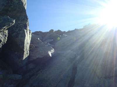
Caps Ridge Trail trailhead at Jefferson Notch
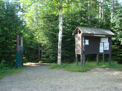
A wild flower on the Caps Ridge Trail
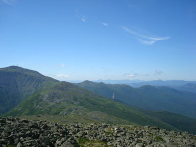
Looking south at the Southern Presidentials from Mt. Jefferson
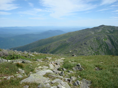
The Gulfside Trail on the way to Mt. Adams
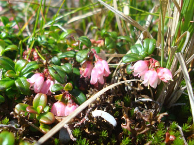
Blooms on the side of the Gulfside Trail
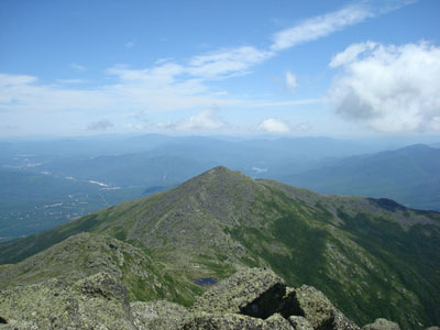
Looking northeast at Mt. Madison from Mt. Adams

Directions to trailhead: Take Route 302 West from Bartlett into Carroll. Just after Saco Lake, take a right onto Mt. Clinton Road. Cross over Base Road and continue on Jefferson Notch Road. At the high point of the road, the WMNF fee parking lot will be on the right. The Caps Ridge Trail trailhead is at the back of the parking lot.
Back to Mt. Jefferson Profile
Back to Mt. Adams Profile
|