Home
States
Colorado
Connecticut
Maine
Massachusetts
New Hampshire
New York
Rhode Island
Utah
Vermont
View All
Lists
NE 4,000 Footers
NE 100 Highest
NH 4,000 Footers
NH 100 Highest
NH 52 With A View
NH Belknap Range
NH Ossipee 10
Links
Trail Conditions
Trip Log
Sunrises
Sunsets
About
|
Mt. Klem, Rand Mountain, West Quarry Mountain
Gilford, NH, Alton, NH
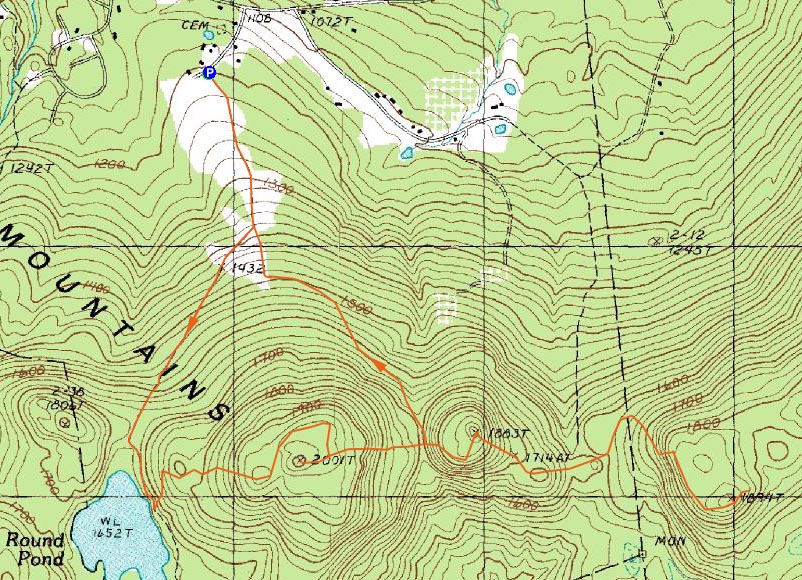
Trailheads, measurements, times, distances, and maps are all approximate and relative to the hike(s) as shown below.
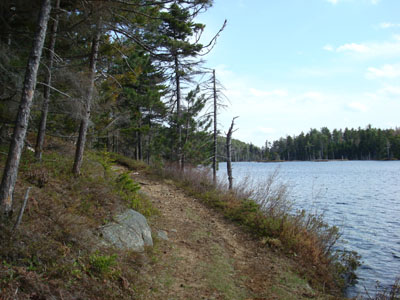
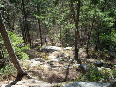
Heading past Round pond on the way to Mt. Klem
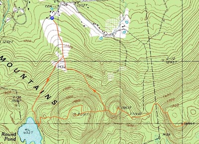
Route: Round Pond Trail, Red Trail, bushwack, (Mt. Klem), bushwack, Quarry Trail, (Rand Mountain), Quarry Trail, bushwack, (West Quarry Mountain), bushwack, Quarry Trail, (Rand Mountain), Quarry Trail, unknown herd path, bushwack
Upon finding out that the Belknaps were snow-free, I decided to head down and try to summit the elusive West Quarry Mountain.
The first portion of the Round Pond Trail, prior to the fields, was somewhat muddy from recent logging operations. From the fields to the height of land was also a bit wet (and also had a very small patch of ice still remaining), however from there to the summit of Mt. Klem was mostly dry. I was particularly amazed by the sounds coming from the wild low bush blueberry vines as I walked by - whenever I took a step or made a sound, I could hear what sounded like fleas hopping around. Odd.
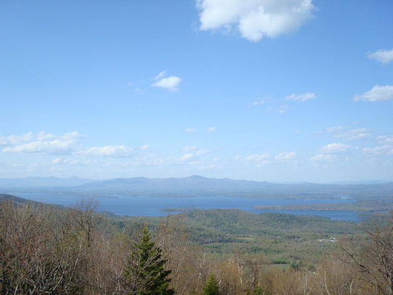
The viewpoint north of Mt. Klem was excellent as usual, reaching across the blue lake (my last two times up here it was still frozen) and beyond the Sandwich Range.
The bushwack to the summit wasn't bad, though it wasn't quite fast going as it was in the winter, as the snowpack covered up a lot of the saplings and bushes.
The Quarry Trail down into the col between Klem and Rand was steep, as I remembered. The brook crossing was no problem and the ascent up Rand was much easier than a few months earlier, when the steep ledges required traction to ascend.
The view from the Rand viewpoint was decent, however not as comprehensive as the similar one on West Quarry.
While there had been logging between Rand and West Quarry in recent years, nothing had been down this year and the trail was easy enough to follow. I was a bit let down by the quarry site - perhaps there are more interesting portions nearby, but all I observed was a pile of partially cut rock, a piece of something metallic, and a foundation of some sort.
From there, there was a short scramble up the ledges (a bypass route is available). After that, the trail evened out and came to the previously mentioned viewpoint, which stretched as far southwest as Mt. Monadnock.
While the summit sign is on a tree on the side of the trail, the actual summit (and cairn) are a few dozen feet to the north of it.
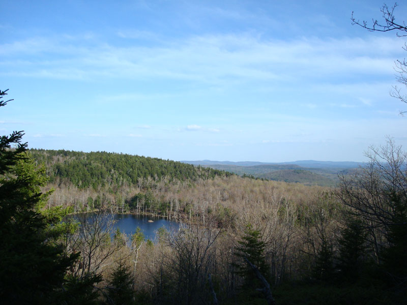
Beyond the summit of West Quarry was another viewpoint, this one to the southeast, over a pond. Certainly nice, but not as strong as I had envisioned it from accounts I have read.
Heading back, I decided to take a look at an unofficial trail at the base of the col between Rand Mountain and Mt. Klem. Sure enough, I found the flagging on the trees and followed it. Though obscure in some places, it was easy enough to follow. At first. After hitting the north side of Klem Mountain, I couldn't find the next flagged tree, nor a consistent herd path. With the black flies attacking me, I decided to bushwack my way toward the Round Pond Trail and/or the fields adjacent to it. Though I ripped my shirt along the way, I survived and ended up within a hundred feet of where I was intending to emerge - not bad, considering I left my compass in my bag and didn't have the map with me.
Though the black flies were bad at the end, it was a nice hike - in fact, in the lower elevations it felt like summer! Finally!
| Hike Ratings |
|
Getting To Trailhead: |
Easy |
| Destination: |
Mt. Klem |
|
Length: |
Moderate |
|
Steepness: |
Moderate |
|
Navigation: |
Easy |
|
Views: |
Excellent |
|
Crowds: |
Minimal |
| Destination: |
Rand Mountain |
|
Length: |
Moderate |
|
Steepness: |
Difficult |
|
Navigation: |
Moderate |
|
Views: |
Excellent |
|
Crowds: |
Minimal |
| Destination: |
West Quarry Mountain |
|
Length: |
Moderate |
|
Steepness: |
Very Difficult |
|
Navigation: |
Easy |
|
Views: |
Excellent |
|
Crowds: |
Minimal |
|
| Hike Stats |
|
Date Hiked: |
Friday, May 8, 2008 |
| Hike Commenced: |
3:50 PM |
| Parking Elevation: |
1,200' |
| Destination: |
Mt. Klem |
| Ascent Commenced: |
3:50 PM |
| Summit Reached: |
4:39 PM |
| Time Elapsed: |
00:49 |
| Trailhead Elevation: |
1,205' |
| Summit Elevation: |
2,001' |
| Vertical Gain: |
916' |
| Destination: |
Rand Mountain |
| Ascent Commenced: |
4:39 PM |
| Summit Reached: |
4:59 PM |
| Time Elapsed: |
00:20 |
| Trailhead Elevation: |
2,001' |
| Summit Elevation: |
1,883' |
| Vertical Gain: |
243' |
| Destination: |
West Quarry Mountain |
| Ascent Commenced: |
5:01 PM |
| Summit Reached: |
5:29 PM |
| Time Elapsed: |
00:28 |
| Trailhead Elevation: |
1,883' |
| Summit Elevation: |
1,894' |
| Vertical Gain: |
344' |
|
|
| Hike Ended: |
6:54 PM |
| Hike Time Elapsed: |
03:04 |
| Hike Vertical Gain: |
1,966' |
|
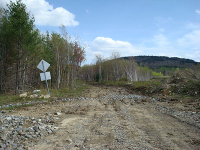
The Round Pond Trail trailhead off Grant Road
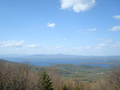
Looking at the Ossipee Mountains from near the Mt. Klem summit
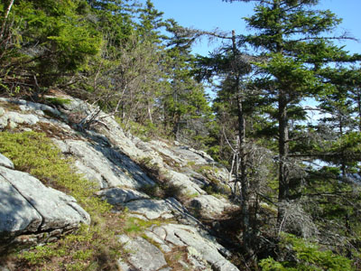
The Quarry Trail to Rand Mountain
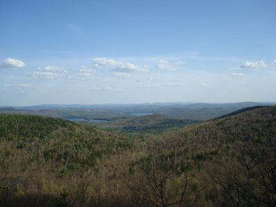
Looking southwest from the Rand Mountain vista
Looking down the ledges of the Quarry Trail on the way to the West Quarry Mountain summit

Looking southeast from near the West Quarry Mountain summit

Directions to trailhead: ---Please note, as of Fall 2008, this trailhead is reportedly closed to hikers.--- From Alton, take Route 11 West to Route 11A West. Take a left onto Grant Road - the small parking area and trailhead are on the left, just before the signs warning of road barriers, etc.
Back to Mt. Klem Profile
Back to Rand Mountain Profile
Back to West Quarry Mountain Profile
|