Home
States
Colorado
Connecticut
Maine
Massachusetts
New Hampshire
New York
Rhode Island
Utah
Vermont
View All
Lists
NE 4,000 Footers
NE 100 Highest
NH 4,000 Footers
NH 100 Highest
NH 52 With A View
NH Belknap Range
NH Ossipee 10
Links
Trail Conditions
Trip Log
Sunrises
Sunsets
About
|
Mt. Madison, Mt. Adams
Bean's Grant, NH, Chandler's Purchase, NH
Trailheads, measurements, times, distances, and maps are all approximate and relative to the hike(s) as shown below.
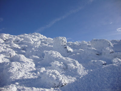
Looking up the Osgood Trail
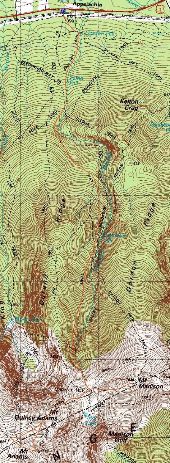
Route: Valley Way, Osgood Trail, (Mt. Madison), Osgood Trail, Gulfside Trail, snowfields, (Mt. Adams), Lowe's Path, snowfields, Gulfside Trail, Osgood Trail, (Mt. Madison), Osgood Trail, Valley Way
The weather looked like a borderline Presidential opportunity, so I decided to try and get an early start from Appalachia. An aggressive previous day, as well as the onset of a cold, slowed me a bit, but nonetheless I arrived at the trailhead just after sunrise and was soon slowly on my way up the Valley Way.
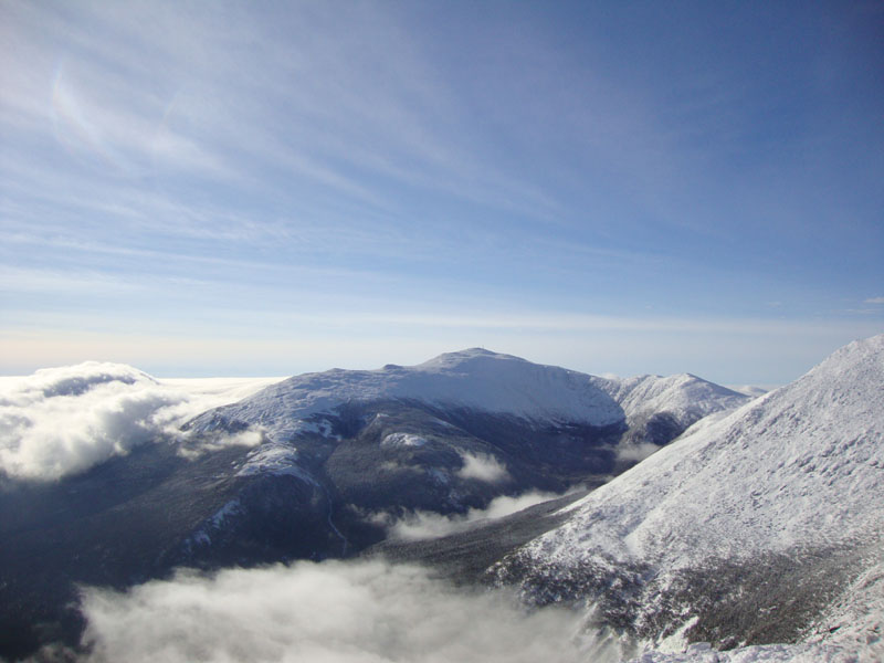
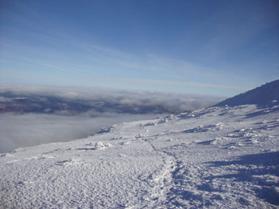
Nearing the tent site, I could see that I was indeed going to be climbing above the clouds. Joining up with some other folks, we headed up to Madison and had excellent views of an undercast in all directions. The snow conditions were perfect - the snowshoes stayed on all the way up Madison (and for the rest of the day).
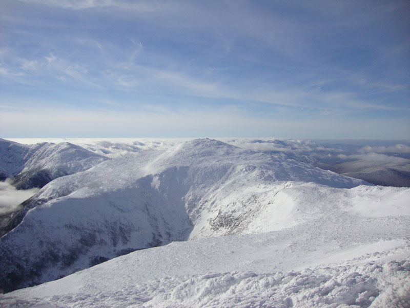
Back at the hut, it was time for a snack break. From there, I headed up the Gulfside, then climbed a bit west of the Air Line into the snowfields and to the top of Adams, where the views were strong, temperatures mild, and winds not too bad. From there, we headed down toward Thunderstorm junction. While I had planned to call it a day at this point, I decided to cut across the snowfields and back down to the hut, then join a group back up to the summit of Mt. Madison, where we once again had nice undercast views, though the skies were starting to cloud over.
The descent was once again bland - Valley Way has to be one of my least favorite trails in the Whites. Nonetheless, we made it out prior to dark. A surprisingly nice day, contrary to the forecasts.
| Hike Ratings |
|
Getting To Trailhead: |
Easy |
| Destination: |
Mt. Madison |
|
Length: |
Moderate |
|
Steepness: |
Difficult |
|
Navigation: |
Moderate |
|
Views: |
Excellent |
|
Crowds: |
Minimal |
| Destination: |
Mt. Adams |
|
Length: |
Moderate |
|
Steepness: |
Difficult |
|
Navigation: |
Moderate |
|
Views: |
Excellent |
|
Crowds: |
Minimal |
| Destination: |
Mt. Madison |
|
Length: |
Difficult |
|
Steepness: |
Difficult |
|
Navigation: |
Moderate |
|
Views: |
Excellent |
|
Crowds: |
Heavy |
|
| Hike Stats |
|
Date Hiked: |
Sunday, January 17, 2010 |
| Hike Commenced: |
7:18 AM |
| Parking Elevation: |
1,311' |
| Destination: |
Mt. Madison |
| Ascent Commenced: |
7:18 AM |
| Summit Reached: |
9:59 AM |
| Time Elapsed: |
02:41 |
| Trailhead Elevation: |
1,311' |
| Summit Elevation: |
5,367' |
| Vertical Gain: |
4,186' |
| Destination: |
Mt. Adams |
| Ascent Commenced: |
10:01 AM |
| Summit Reached: |
11:02 AM |
| Time Elapsed: |
01:01 |
| Trailhead Elevation: |
5,367' |
| Summit Elevation: |
5,774' |
| Vertical Gain: |
989' |
| Destination: |
Mt. Madison |
| Ascent Commenced: |
11:13 AM |
| Summit Reached: |
12:51 PM |
| Time Elapsed: |
01:38 |
| Trailhead Elevation: |
5,774' |
| Summit Elevation: |
5,367' |
| Vertical Gain: |
582' |
|
|
| Hike Ended: |
4:16 PM |
| Hike Time Elapsed: |
8:58 |
| Hike Vertical Gain: |
5,887' |
|
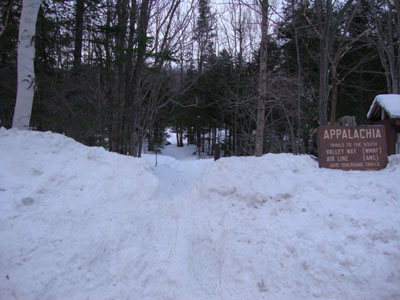
Valley Way Trail trailhead at Appalachia

Looking at Mt. Washington from Mt. Madison
Looking down the snowfields on the way to Mt. Adams
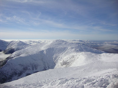
Looking at Mt. Jefferson from Mt. Adams
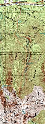

Directions to trailhead: Take US 2 West from Gorham to the Appalachia parking lot.
Back to Mt. Madison Profile
Back to Mt. Adams Profile
|