Home
States
Colorado
Connecticut
Maine
Massachusetts
New Hampshire
New York
Rhode Island
Utah
Vermont
View All
Lists
NE 4,000 Footers
NE 100 Highest
NH 4,000 Footers
NH 100 Highest
NH 52 With A View
NH Belknap Range
NH Ossipee 10
Links
Trail Conditions
Trip Log
Sunrises
Sunsets
About
|
Mt. Madison, Mt. Adams
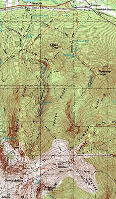
Randolph, NH, Bean's Grant, NH, Thompson and Meserves Purchase, NH
Trailheads, measurements, times, distances, and maps are all approximate and relative to the hike(s) as shown below.
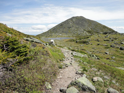
Looking down the Howker Ridge Trail
Route: Howker Ridge Trail, Osgood Trail, (Mt. Madison), Osgood Trail, Star Lake Trail, (Mt. Adams), Air Line, Randolph Path
With a nice day in between rainy days, I headed up north and opted to try a new-to-me trail to the Northern Presidentials.
Starting at Randolph East, the temperature was in the upper 40s. The Howker Ridge Trail started off gradually with generally nice footing, passing some cascades in Bumpus Brook. After crossing the brook on a somewhat tricky set of large boulders, the trail climbed steeply, passing near a rock crevace called Bear Pit. Beyond that, it continued uphill through some nice woods lined with blueberry bushes.
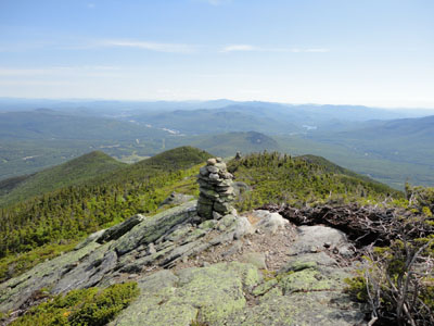
The trail reached multiple peaks (and thus had multiple ups and downs) via a few minor scrambles as well as a few alpine zones. After the second Pine Link junction, the trail eventually emerged into the typical Northern Presidential traprock fields.
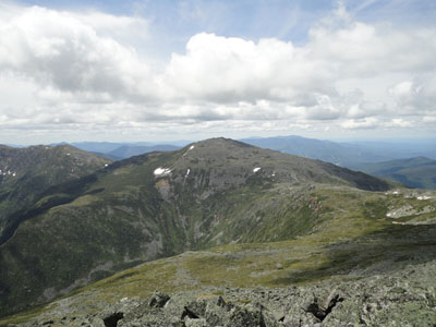
There was a chilly breeze on Mt. Madison as some clouds started to move in overhead. Nonetheless, the views were quite strong.
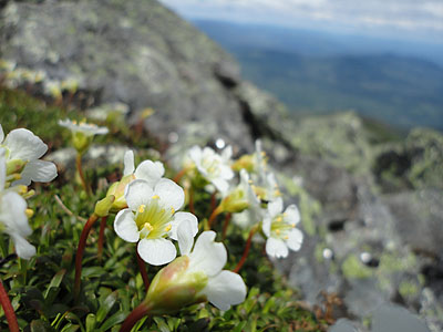
On my way to Mt. Adams, I took a snack/warm up break at the Madison Spring Hut (which was undergoing heavy renovation). From there, I headed up the steep Star Lake Trail, passing by various patches of alpine flowers.
The winds had dropped significantly by the time I reached Mt. Adams. Though the skies were continuing to cloud up, the views were still quite strong.
For the descent, I headed down the Air Line Trail, eventually taking a right onto the Randolph Path. The Randolph Path back to Randolph East was generally gradual with good footing, passing through nice hardwoods.
| Hike Ratings |
|
Getting To Trailhead: |
Easy |
| Destination: |
Mt. Madison |
|
Length: |
Moderate |
|
Steepness: |
Very Difficult |
|
Navigation: |
Easy |
|
Views: |
Excellent |
|
Crowds: |
Minimal |
| Destination: |
Mt. Adams |
|
Length: |
Difficult |
|
Steepness: |
Very Difficult |
|
Navigation: |
Moderate |
|
Views: |
Excellent |
|
Crowds: |
Minimal |
|
| Hike Stats |
|
Date Hiked: |
Wednesday, June 9, 2010 |
| Hike Commenced: |
7:21 AM |
| Parking Elevation: |
1,225' |
| Destination: |
Mt. Madison |
| Ascent Commenced: |
7:21 AM |
| Summit Reached: |
10:08 AM |
| Time Elapsed: |
02:47 |
| Trailhead Elevation: |
1,225' |
| Summit Elevation: |
5,367' |
| Distance: |
4.5 miles |
| Vertical Gain: |
4,295' |
| Destination: |
Mt. Adams |
| Ascent Commenced: |
10:12 AM |
| Summit Reached: |
11:36 AM |
| Time Elapsed: |
01:24 |
| Trailhead Elevation: |
5,367' |
| Summit Elevation: |
5,774' |
| Vertical Gain: |
1,014' |
|
|
| Hike Ended: |
2:28 PM |
| Hike Time Elapsed: |
7:07 |
| Hike Vertical Gain: |
5,686' |
|
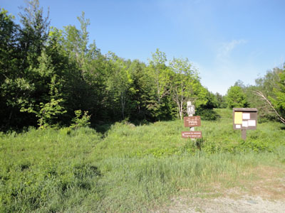
The Howker Ridge Trail trailhead at Randolph East

Diapensia along the Osgood Trail

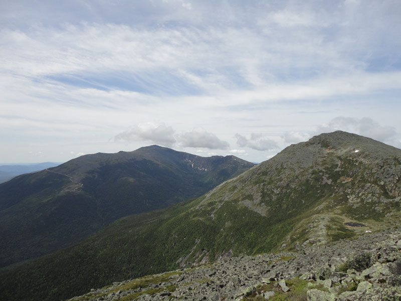
Looking at Mt. Washington and Mt. Adams from Mt. Madison
Looking down the Star Lake Trail on the way to Mt. Adams
Looking at Mt. Jefferson from Mt. Adams
Diapensia along the Air Line

Directions to trailhead: Take US 2 West from Gorham. At the bottom of the big hill, take a left onto Pinkam B - Dolly Copp Road. The Randolph East parking lot and Howker Ridge Trail trailhead are on the right shortly thereafter.
Back to Mt. Madison Profile
Back to Mt. Adams Profile
|