Home
States
Colorado
Connecticut
Maine
Massachusetts
New Hampshire
New York
Rhode Island
Utah
Vermont
View All
Lists
NE 4,000 Footers
NE 100 Highest
NH 4,000 Footers
NH 100 Highest
NH 52 With A View
NH Belknap Range
NH Ossipee 10
Links
Trail Conditions
Trip Log
Sunrises
Sunsets
About
|
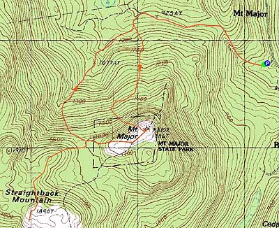
Mt. Major, Straightback Mountain
Alton, NH
Trailheads, measurements, times, distances, and maps are all approximate and relative to the hike(s) as shown below.
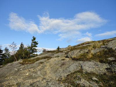
Looking up the Crosscut Saw Trail near the summit of Mt. Major
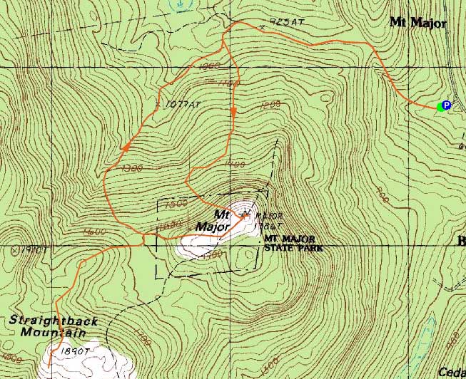
Route: Mt. Major Trail, Brook Trail, Rock Cave Trail, Crosscut Saw Trail, (Mt. Major), Major/Straightback Link, (Straightback Mountain), Major/Straightback Link, (Mt. Major), Brook Trail, Mt. Major Trail
With a rare Tuesday afternoon free, I headed down away from the clouds to Mt. Major.
The trail description for the Crosscut Saw Trail sounded interesting (a crosscut saw that had grown into a tree), so I headed up the Mt. Major Trail to the Brook Trail, then found the entrance to the Rock Cave Trail (not marked or blazed, but a red and yellow blazed tree was located on the opposite side of the trail) shortly after passing a logging road on the right.
In trying to follow the right trail, I missed seeing the rock cave (which I suspect was on the left). The footbed for the trail wasn't overly obvious. Nonetheless, I found the beginning of the Crosscut Saw Trail (confirmed with a wooden sign a few feet up it). At the far curve on the trail, a state park boundary, I found two saw blades nailed to a tree - not exactly what I had expected. My guess is perhaps the old tree had fallen down and someone had hung the blade on a younger tree.
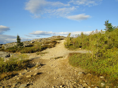
The trail continued vaguely thereafter, eventually reaching some steeps and finally, just short of the summit, some ledges.
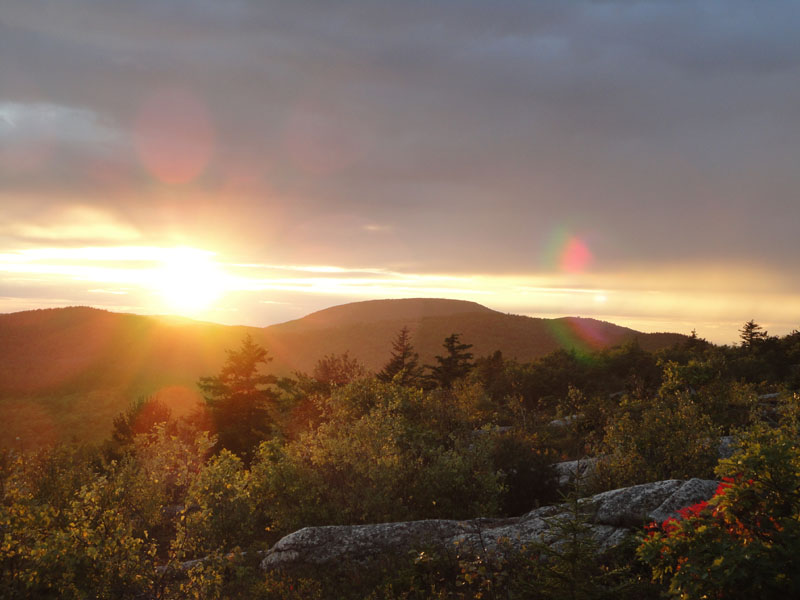
After checking out the summit views, strong as usual, I headed down the Major-Straightback link to Straightback. After reaching the summit of Straightback, I continued south a bit to some of the ledges, where I found a decent spot to wait for the sunset.
Just as the sun was getting ready to set, a light rain started, making for a dramatic scene - and, difficult photography, as the wind was blowing the drops onto my camera lens. While this was happening, I observed purple rain to the northwest - if I were a decent photographer with a big camera, I could have captured the scene.
As good as the sunset was from this perspective, the western Belknaps likely blocked out the best of it. In hindsight, I probably would have had a better photo op on Mt. Major, as it looked like the clouds might have been reflecting on the lake. Nonetheless, it was nice to see the sunset from another Belknap peak.
For the descent, I jogged back to the Brook Trail, put on my headlamp, then jogged to the parking lot, making surprisingly good time, despite the poor footing in places.
| Hike Ratings |
|
Getting To Trailhead: |
Easy |
| Destination: |
Mt. Major |
|
Length: |
Moderate |
|
Steepness: |
Difficult |
|
Navigation: |
Easy |
|
Views: |
Excellent |
|
Crowds: |
Moderate |
| Destination: |
Straightback Mountain |
|
Length: |
Moderate |
|
Steepness: |
Moderate |
|
Navigation: |
Easy |
|
Views: |
Excellent |
|
Crowds: |
Minimal |
|
| Hike Stats |
|
Date Hiked: |
Tuesday, September 14, 2010 |
| Hike Commenced: |
4:56 PM |
| Parking Elevation: |
585' |
| Destination: |
Mt. Major |
| Ascent Commenced: |
4:56 PM |
| Summit Reached: |
5:44 PM |
| Time Elapsed: |
00:48 |
| Trailhead Elevation: |
600' |
| Summit Elevation: |
1,786' |
| Vertical Gain: |
1,231' |
| Destination: |
Straightback Mountain |
| Ascent Commenced: |
5:49 PM |
| Summit Reached: |
6:13 PM |
| Time Elapsed: |
00:24 |
| Trailhead Elevation: |
1,786' |
| Summit Elevation: |
1,890' |
| Distance: |
1.1 miles |
| Vertical Gain: |
365' |
|
|
| Hike Ended: |
7:40 PM |
| Hike Time Elapsed: |
02:44 |
| Hike Vertical Gain: |
1,716' |
|
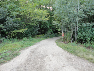
The Mt. Major Trail trailhead at the back of the Route 11 parking lot
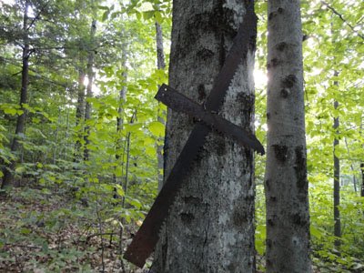
The cross cut saw blade on its eponymous trail
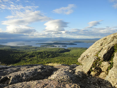
Looking at Lake Winnipesaukee from Mt. Major
Looking back toward Mt. Major while on the Major/Straightback Link trail to Straightback Mountain
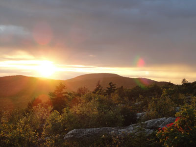
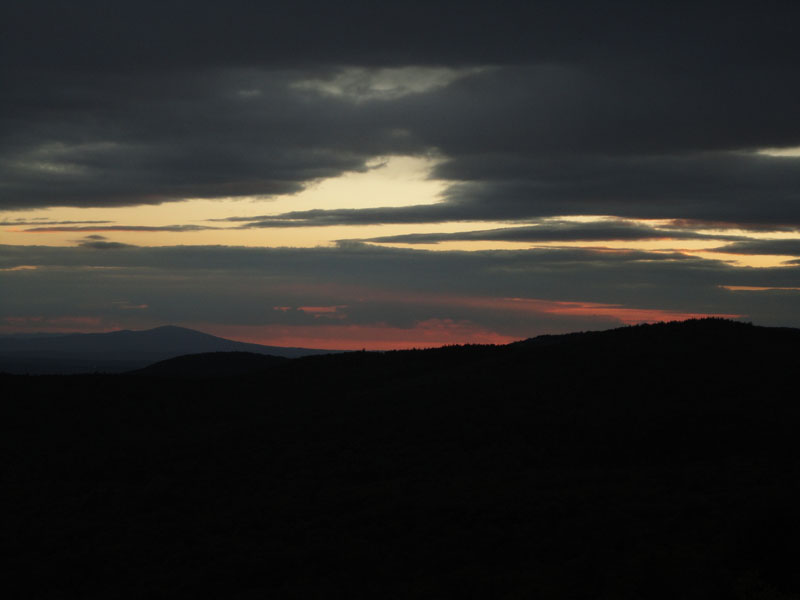
The sunset over Belknap Mountain from Straightback Mountain

Sunset colors north of Kearsarge from Straightback Mountain

Directions to trailhead: Take Route 11 West (north in reality) from Alton Bay. Parking lot and trailhead are on the left after the blasted out section of Route 11.
Back to Mt. Major Profile
Back to Straightback Mountain Profile
|