Home
States
Colorado
Connecticut
Maine
Massachusetts
New Hampshire
New York
Rhode Island
Utah
Vermont
View All
Lists
NE 4,000 Footers
NE 100 Highest
NH 4,000 Footers
NH 100 Highest
NH 52 With A View
NH Belknap Range
NH Ossipee 10
Links
Trail Conditions
Trip Log
Sunrises
Sunsets
About
|
Mt. Mexico
Tamworth, NH
Trailheads, measurements, times, distances, and maps are all approximate and relative to the hike(s) as shown below.
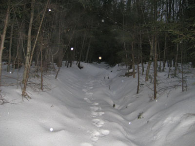
Looking up the Big Rock Cave Trail
Route: Cabin Trail, Big Rock Cave Trail, bushwhack, (Mt. Mexico), bushwhack, Big Rock Cave Trail, Cabin Trail
Mt. Mexico. Sleet and freezing rain. Limited daylight. Nothing particularly appealing. Nonetheless, I needed to get some exercise and didn't want to drive too far on the roads.
I was a bit surprised to see someone had been up the Big Rock Cave Trail perhaps only minutes before me. While they barebooted, I decided to go on my snowshoes. It was fairly easy snowshoeing with two inches of loose granular over a firm frozen granular base.
Reaching the height of land, I turned left and headed up toward what I suspected to be the highpoint of Mt. Mexico. In my previous trip to this peak, I had turned back at the height of land on the trail due to excessive mosquitoes. No mosquitoes on this evening.
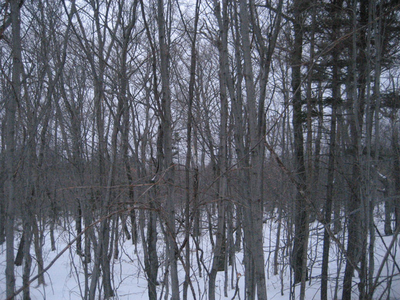
As expected, there weren't any views at or near the summit, which I deemed to be a bit west of the height of land on the trail. Interestingly enough, the area was filled with sapplings - perhaps it was rather scenic a decade or two earlier. Not wanting to backtrack, I decided to buswhack south to the trail.
While not a particularly exciting hike, it was nice to get a little exercise.
| Hike Ratings |
|
Getting To Trailhead: |
Easy |
| Destination: |
Mt. Mexico |
|
Length: |
Easy |
|
Steepness: |
Moderate |
|
Navigation: |
Moderate |
|
Views: |
Minimal |
|
Crowds: |
Minimal |
|
| Hike Stats |
|
Date Hiked: |
Wednesday, January 7, 2009 |
| Hike Commenced: |
3:44 PM |
| Parking Elevation: |
1,060' |
| Destination: |
Mt. Mexico |
| Ascent Commenced: |
3:44 PM |
| Summit Reached: |
4:19 PM |
| Time Elapsed: |
00:35 |
| Trailhead Elevation: |
1,060' |
| Summit Elevation: |
2,020' |
| Vertical Gain: |
970' |
|
|
| Hike Ended: |
4:48 PM |
| Hike Time Elapsed: |
01:04 |
| Hike Vertical Gain: |
980' |
|
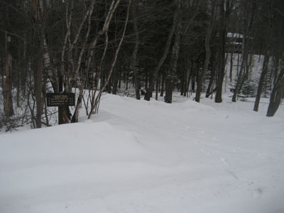
The Cabin Trail trailhead on Route 113A
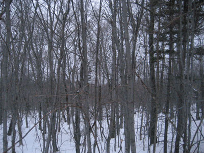
Lack of views from Mt. Mexico
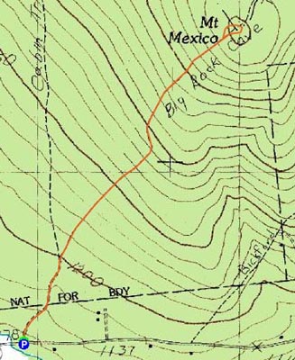

Directions to trailhead: Take Route 113A West from Tamworth. Just prior to arriving in Wonalancet village, the Cabin Trail follows a dirt road on the right. There is some room for parking on the left side of Route 113A West.
Back to Mt. Mexico Profile
|