Home
States
Colorado
Connecticut
Maine
Massachusetts
New Hampshire
New York
Rhode Island
Utah
Vermont
View All
Lists
NE 4,000 Footers
NE 100 Highest
NH 4,000 Footers
NH 100 Highest
NH 52 With A View
NH Belknap Range
NH Ossipee 10
Links
Trail Conditions
Trip Log
Sunrises
Sunsets
About
|
Mt. Monroe, Mt. Washington
Chandler's Purchase, NH, Sargent's Purchase, NH
Trailheads, measurements, times, distances, and maps are all approximate and relative to the hike(s) as shown below.
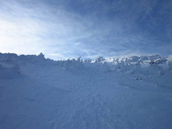
Looking up the Ammonoosuc Ravine Trail
Route: Unknown trail, Ammonoosuc Ravine Trail, snowfield, (Mt. Monroe), snowfield, Crawford Path, snowfield, (Mt. Washington), snowfield, Crawford Path, Ammonoosuc Ravine Trail
Good morning conditions, though a cold breeze. Snowshoes the whole hike.
| Hike Ratings |
|
Getting To Trailhead: |
Easy |
| Destination: |
Mt. Monroe |
|
Length: |
Moderate |
|
Steepness: |
Very Difficult |
|
Navigation: |
Difficult |
|
Views: |
Excellent |
|
Crowds: |
Minimal |
| Destination: |
Mt. Washington |
|
Length: |
Moderate |
|
Steepness: |
Difficult |
|
Navigation: |
Moderate |
|
Views: |
Excellent |
|
Crowds: |
Minimal |
|
| Hike Stats |
|
Date Hiked: |
Wednesday, February 29, 2012 |
| Parking Elevation: |
2,650' |
| Destination: |
Mt. Monroe |
| Time Elapsed: |
01:42 |
| Trailhead Elevation: |
2,740' |
| Summit Elevation: |
5,372' |
| Vertical Gain: |
2,732' |
| Destination: |
Mt. Washington |
| Time Elapsed: |
00:54 |
| Trailhead Elevation: |
5,372' |
| Summit Elevation: |
6,288' |
| Vertical Gain: |
1,301' |
|
|
| Hike Time Elapsed: |
04:29 |
| Hike Vertical Gain: |
4,343' |
|
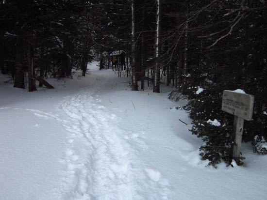
The trailhead near the Marshfield Base Station
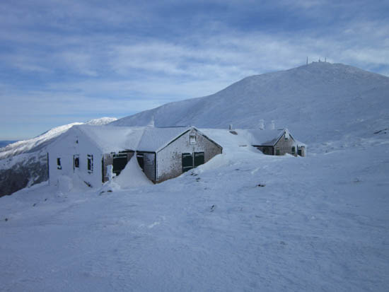
The Lakes of the Clouds Hut
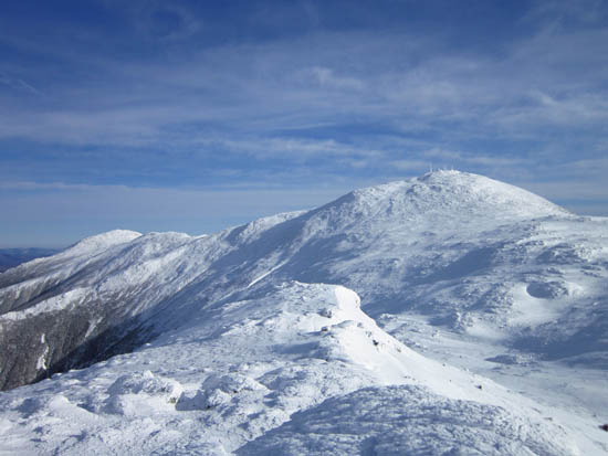
Looking at Mt. Washington from Mt. Monroe

Looking up the Crawford Path on the way to Mt. Washington

Looking at the northern Presidentials from near the summit of Mt. Washington
Directions to trailhead: To get to the Cog Base Station in winter, take 302 West from Crawford Notch, then take a right onto Base Station Road. In winter 2011-12, there was plowed parking available at the lower lot at the Cog Base Station. Looking up the mountain from the parking lot, the spur trail to the Ammonoosuc Ravine Trail begins up the hill to the right, adjacent to two cabins.
Back to Mt. Monroe Profile
Back to Mt. Washington Profile
|


