Home
States
Colorado
Connecticut
Maine
Massachusetts
New Hampshire
New York
Rhode Island
Utah
Vermont
View All
Lists
NE 4,000 Footers
NE 100 Highest
NH 4,000 Footers
NH 100 Highest
NH 52 With A View
NH Belknap Range
NH Ossipee 10
Links
Trail Conditions
Trip Log
Sunrises
Sunsets
About
|
Mt. Monroe
Chandler's Purchase, NH, Sargent's Purchase, NH
Trailheads, measurements, times, distances, and maps are all approximate and relative to the hike(s) as shown below.
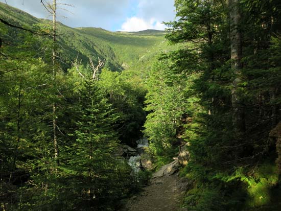
Looking up the Ammonoosuc Ravine Trail
Route: Spur trail, Ammonoosuc Ravine Trail, Crawford Path, Mount Monroe Loop, (Mt. Monroe), Mount Monroe Loop, Crawford Path, Ammonoosuc Ravine Trail, spur trail
Trails were generally quite wet.
Spur from Cog to Ammo proper was rather muddy with water running down it in places. Lower Ammo to the Gem Pool was also quite wet/muddy. The short reroute built a few years ago, with nice footing, sharply contrasts with the rest of the segment of the trail, which is increasingly rough.
The steeps were a mixture of wet and dry rock. Old steps are slowly sliding away.
Some wet ledges approaching treeline. Above treeline, with the exception of the Crawford Path adajcent to the hut (water running down it), was mostly dry.
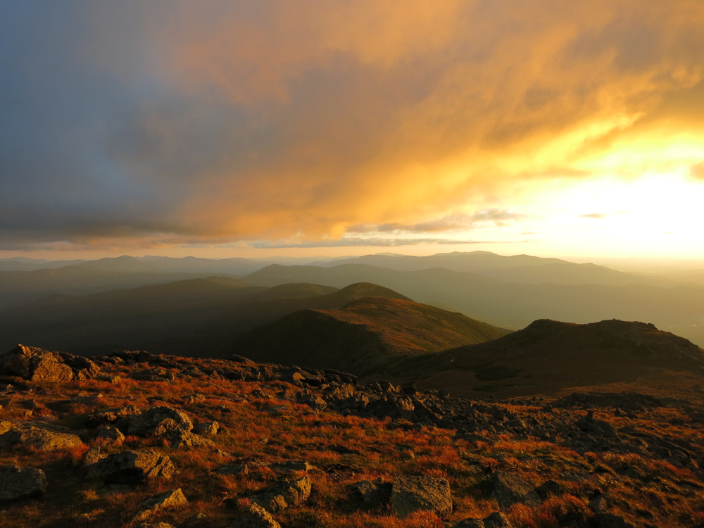
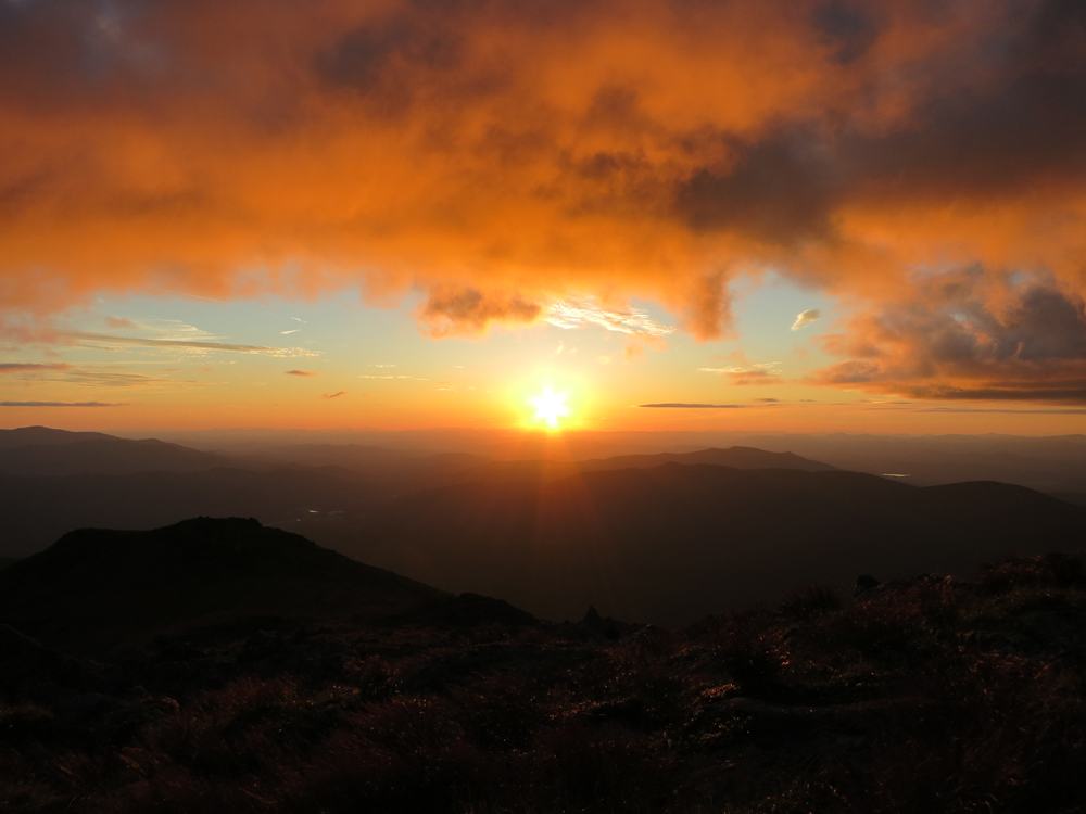
Excellent weather for a sunset hike - moderate temperatures, slight breeze.
| Hike Ratings |
|
Getting To Trailhead: |
Easy |
| Destination: |
Mt. Monroe |
|
Length: |
Moderate |
|
Steepness: |
Difficult |
|
Navigation: |
Easy |
|
Views: |
Excellent |
|
Crowds: |
Heavy |
|
| Hike Stats |
|
Date Hiked: |
Tuesday, August 19, 2014 |
| Parking Elevation: |
2,700' |
| Destination: |
Mt. Monroe |
| Time Elapsed: |
01:21 |
| Trailhead Elevation: |
2,740' |
| Summit Elevation: |
5,372' |
| Vertical Gain: |
2,732' |
|
|
| Hike Time Elapsed: |
03:23 |
| Hike Vertical Gain: |
2,862' |
|
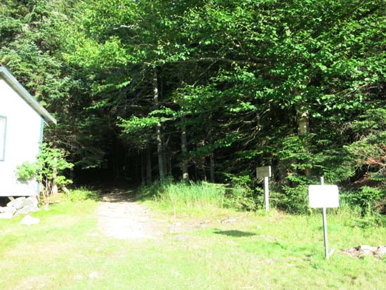
The trailhead near the Marshfield Base Station
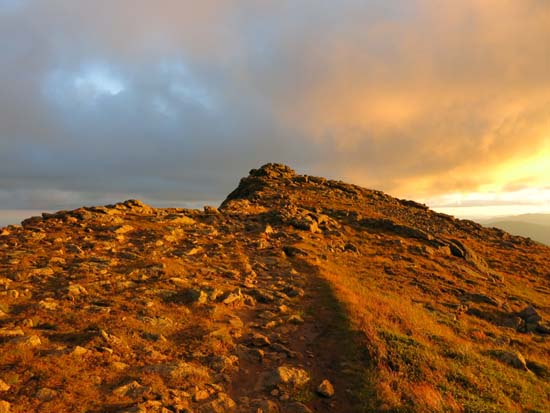
The Monroe Loop

Looking at the Southern Presidentials from Mt. Monroe
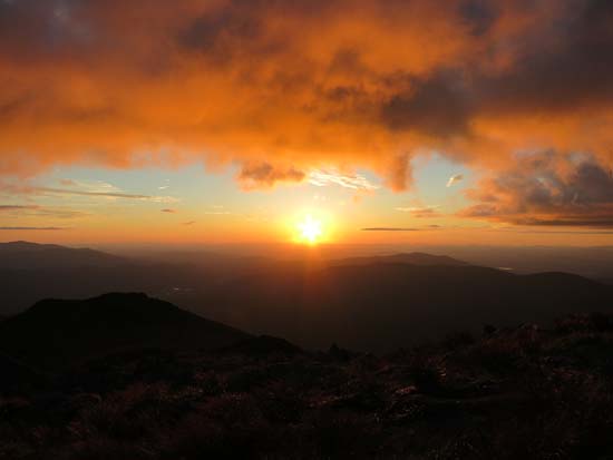
The sunset from the Mt. Monroe summit
Directions to trailhead: To get to the Cog Base Station, take 302 West from Crawford Notch, then take a right onto Base Station Road. In summer 2014, there was hiker parking available at the Cog Base Station's bottom lot. Looking up the mountain from the parking lot, the spur trail to the Ammonoosuc Ravine Trail begins up the hill to the right, a bit below two cabins.
Back to Mt. Monroe Profile
|