Home
States
Colorado
Connecticut
Maine
Massachusetts
New Hampshire
New York
Rhode Island
Utah
Vermont
View All
Lists
NE 4,000 Footers
NE 100 Highest
NH 4,000 Footers
NH 100 Highest
NH 52 With A View
NH Belknap Range
NH Ossipee 10
Links
Trail Conditions
Trip Log
Sunrises
Sunsets
About
|
Mt. Monroe, Mt. Washington
Chandler's Purchase, NH, Sargent's Purchase, NH
Trailheads, measurements, times, distances, and maps are all approximate and relative to the hike(s) as shown below.
Looking down the Ammonoosuc Ravine Trail
Route: Ammonoosuc Ravine Trail, Crawford Path, Monroe Loop, Trinity Heights Connector, Gulfside, Jewell Trail, herd path
Lower Ammo had lots of minor mud pits and wet rocks. Not a fan of how rough this section of trail is due to erosion, etc.
Steeps and above treeline weren't as wet or slippery.
Jewell had some blowdowns to climb over, but trail was generally dry.
The spur trail to the Cog had a closed sign on the upper junction (ie if coming downhill). A well defined herd path goes immediately left and soon empties out onto the Cog tracks a few hundred yards above the base. Yet, when you reach the base, you have to duck under a chain with (not facing uphill traffic) No Trespassing signs. And, the lower side of the Jewell spur (ie where the bridge was) does not have a closed sign.
| Hike Ratings |
|
Getting To Trailhead: |
Easy |
| Destination: |
Mt. Monroe |
|
Length: |
Moderate |
|
Steepness: |
Difficult |
|
Navigation: |
Easy |
|
Views: |
Excellent |
|
Crowds: |
Heavy |
| Destination: |
Mt. Washington |
|
Length: |
Moderate |
|
Steepness: |
Difficult |
|
Navigation: |
Easy |
|
Views: |
Excellent |
|
Crowds: |
Heavy |
|
| Hike Stats |
|
Date Hiked: |
Sunday, June 14, 2015 |
| Parking Elevation: |
2,700' |
| Destination: |
Mt. Monroe |
| Time Elapsed: |
02:20 |
| Trailhead Elevation: |
2,740' |
| Summit Elevation: |
5,372' |
| Vertical Gain: |
2,732' |
| Destination: |
Mt. Washington |
| Time Elapsed: |
01:30 |
| Trailhead Elevation: |
5,372' |
| Summit Elevation: |
6,288' |
| Vertical Gain: |
1,301' |
|
|
| Hike Time Elapsed: |
08:08 |
| Hike Vertical Gain: |
4,298' |
|
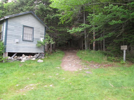
The trailhead near the Marshfield Base Station

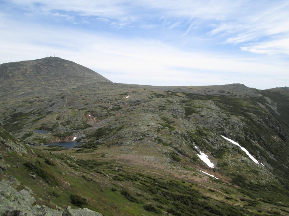
Looking at the Mt. Washington and Lakes of the Clouds from Mt. Monroe

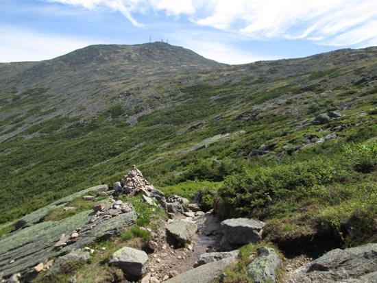
The Crawford Path near Lakes of the Clouds

Looking at the Northern Presidentials from Mt. Washington
Directions to trailhead: To get to the Cog Base Station, take 302 West from Crawford Notch, then take a right onto Base Station Road. In summer 2014, there was hiker parking available at the Cog Base Station's bottom lot. Looking up the mountain from the parking lot, the spur trail to the Ammonoosuc Ravine Trail begins up the hill to the right, a bit below two cabins.
Back to Mt. Monroe Profile
Back to Mt. Washington Profile
|