Home
States
Colorado
Connecticut
Maine
Massachusetts
New Hampshire
New York
Rhode Island
Utah
Vermont
View All
Lists
NE 4,000 Footers
NE 100 Highest
NH 4,000 Footers
NH 100 Highest
NH 52 With A View
NH Belknap Range
NH Ossipee 10
Links
Trail Conditions
Trip Log
Sunrises
Sunsets
About
|
Mt. Monroe, Mt. Washington, Mt. Jefferson
Chandler's Purchase, NH, Sargent's Purchase, NH
Trailheads, measurements, times, distances, and maps are all approximate and relative to the hike(s) as shown below.
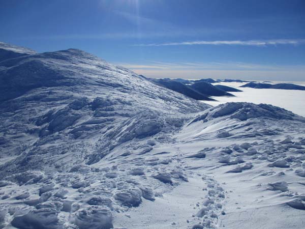
Ascending Monroe
Route: Unknown trail, Ammonoosuc Ravine Trail, snowfield, (Mt. Monroe), snowfield, Crawford Path, snowfield, (Mt. Washington), snowfield, Gulfside Trail, snowfield, (Mt. Jefferson), snowfield, Gulfside Trail, snowfield, Jewell Trail, unknown trail
Snowshoes the entire day. More snowpack this fall than some of the last few winters. It is extremely risky to be in the higher Presidentials right now without having snowshoes.
Lower Ammo has a lot more snowpack than two weeks ago. Good snowshoe track set by multiple groups this morning. 2-3 feet of snowpack at the start, getting deeper at elevation. Trail deviates significantly at treeline. Despite this, a few postholers were out. A little wind drifting or loss of visibility would put them in peril, as they are completely reliant on following an established packed trail and would be at least waist deep if even taking one false step. Folks without snowshoes who get in trouble in the high peaks right now should have to pay for their full rescue expenses.
Snow is just about touching the roof of the hut on the east side.
From the hut, there is a direct bee line up to Monroe, as it is a snowfield.
From the hut to Washington, the packed route this morning deviates significantly from the Crawford Path (though the dangerous side slope is there now and filling in more with each storm). Packed route veers well east of the Crawford Path on the cone, making for a more direct route. Very risky to boot this.
I beelined off the summit to the Cog-West Side junction; great snowfield coverage. From there, I hopped over to Gulfside (no one had been here since the last storm) and broke that out to Sphinx, where I crossed paths with southbound Presi traversers. Packed route deviates from the trail before Jefferson Loop, basically favoring east of the summit. Might be nice to set a route a little west of this. Nevertheless, good snowfield coverage. Some of the areas in the col have very deep drifts. Everyone out this way had snowshoes, thank gosh.
Returning southbound, I hopped off Gulfside near the spring above the col and took the snowfields in a mild descent down to the Jewell, cutting off the unnecessarily up and down of the summer route. Very good snowpack in here, walking among the treetops (managed to not end up in any spruce traps). This route often isn't an option until midwinter, so it's a real treat to be able to do this shortcut in fall.
Jewell Trail above treeline was a minefield. A few folks broke it out while I was over at Jefferson, but they found a lot of spruce traps. I ended up taking my own route down, though my spruce trap luck ran out just before treeline. Below treeline, the trail is not at all well packed, as it appeared to be two other snowshoers and one skier (and thank gosh, no barebooters). Very soft, and plenty deep. No tracks down the Jewell spur to the USFS lot.
Fantastic weather today. Undercast held all day with blue skies overhead. Slight breeze, but temperatures were above freezing in the sun by late morning. Winter conditions in the Presis don't get much better than this.
| Hike Ratings |
|
Getting To Trailhead: |
Easy |
| Destination: |
Mt. Monroe |
|
Length: |
Moderate |
|
Steepness: |
Difficult |
|
Navigation: |
Difficult |
|
Views: |
Excellent |
|
Crowds: |
Moderate |
| Destination: |
Mt. Washington |
|
Length: |
Moderate |
|
Steepness: |
Difficult |
|
Navigation: |
Difficult |
|
Views: |
Excellent |
|
Crowds: |
Minimal |
| Destination: |
Mt. Jefferson |
|
Length: |
Difficult |
|
Steepness: |
Difficult |
|
Navigation: |
Difficult |
|
Views: |
Excellent |
|
Crowds: |
Minimal |
|
| Hike Stats |
|
Date Hiked: |
Sunday, December 1, 2018 |
| Parking Elevation: |
2,700' |
| Destination: |
Mt. Monroe |
| Time Elapsed: |
01:45 |
| Trailhead Elevation: |
2,740' |
| Summit Elevation: |
5,372' |
| Vertical Gain: |
2,732' |
| Destination: |
Mt. Washington |
| Time Elapsed: |
01:11 |
| Trailhead Elevation: |
5,372' |
| Summit Elevation: |
6,288' |
| Vertical Gain: |
1,301' |
| Destination: |
Mt. Jefferson |
| Time Elapsed: |
01:37 |
| Trailhead Elevation: |
6,288' |
| Summit Elevation: |
5,712' |
| Vertical Gain: |
922' |
|
|
| Hike Time Elapsed: |
07:00 |
| Hike Vertical Gain: |
5,205' |
|
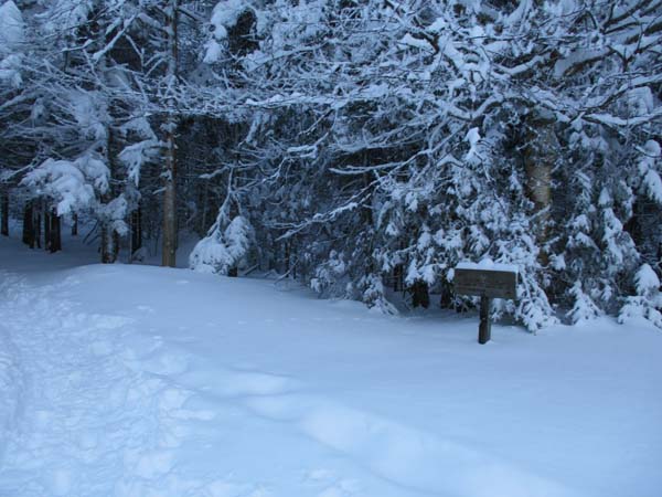
The trailhead near the Marshfield Base Station
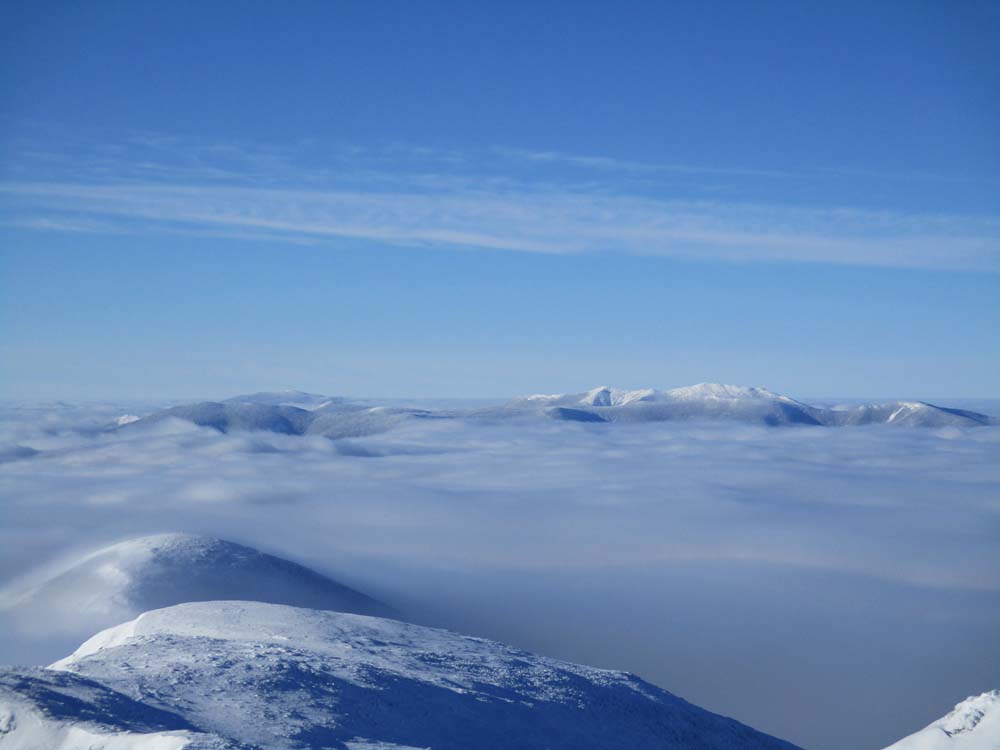
Looking at the Southern Presidentials, Bonds, Moosilauke, Franconia Ridge, and Twins from Mt. Monroe

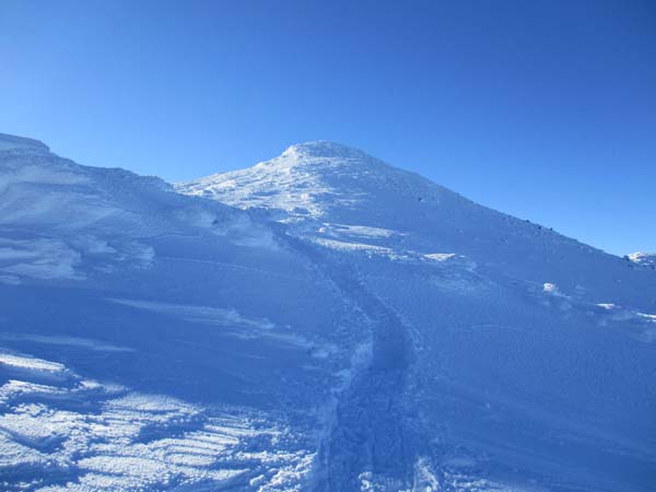
Ascending Mt. Washington

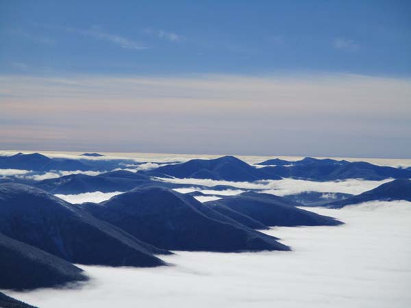
Looking at the Northern Presidentials from near the summit of Mt. Washington
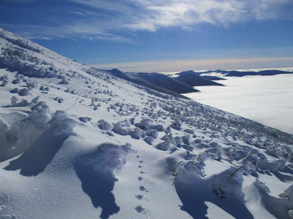
The Gulfside Trail on the way to Mt. Jefferson
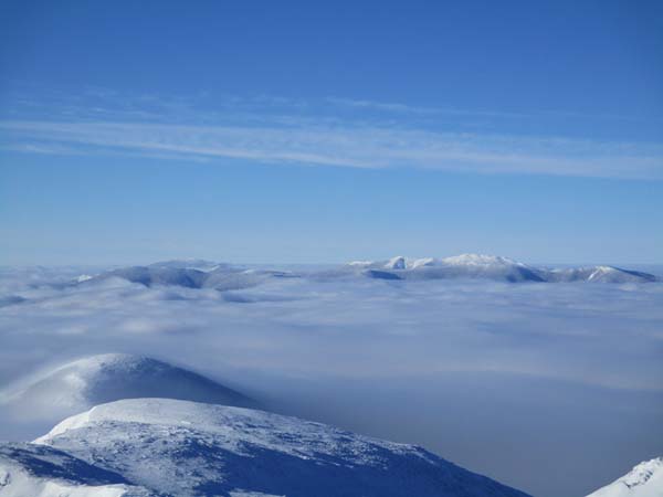
Looking at the southern Presidentials from Mt. Jefferson
Cutting across to the Jewell Trail
Directions to trailhead: To get to the Cog Base Station in winter, take 302 West from Crawford Notch, then take a right onto Base Station Road. In winter 2018-19, there was plowed parking available for $10 at the Cog Base Station. Looking up the mountain from the parking lot, the spur trail to the Ammonoosuc Ravine Trail begins up the hill to the right, a bit below two cabins.
Back to Mt. Monroe Profile
Back to Mt. Washington Profile
Back to Mt. Jefferson Profile
|