Home
States
Colorado
Connecticut
Maine
Massachusetts
New Hampshire
New York
Rhode Island
Utah
Vermont
View All
Lists
NE 4,000 Footers
NE 100 Highest
NH 4,000 Footers
NH 100 Highest
NH 52 With A View
NH Belknap Range
NH Ossipee 10
Links
Trail Conditions
Trip Log
Sunrises
Sunsets
About
|
Mt. Osceola, Mt. East Osceola
Livermore, NH, Lincoln, NH
Trailheads, measurements, times, distances, and maps are all approximate and relative to the hike(s) as shown below.
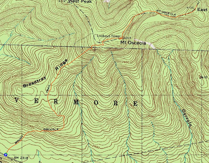
Mt. Osceola Trail to Mt. Osceola
Route: Mt. Osceola Trail
Sunny, temperatures in the upper 60s, excellent visibility. A perfect day for hiking.
Having worked a lot of hours this week, I was able to sneak out of work early and get over to the Waterville Valley area not too long after lunch.
The Mt. Osceola Trail starts off very gradually from Tripoli Road - though a bit rocky. Though things steepen up a bit, nothing was overly challenging on this ascent. Soon, I was at a set of concrete footings. From here, I found a herd path to a nice lookout toward the Pemi. After taking a few photos, I continued to the next set of concrete footings - and a very wide view.
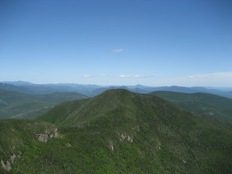
Thanks to the mild temperatures (minimal haze for once!), the views ranged from Mt. Washington to Lake Winnipesaukee.
After talking to some folks, I continued onward to the East Osceola Peak.
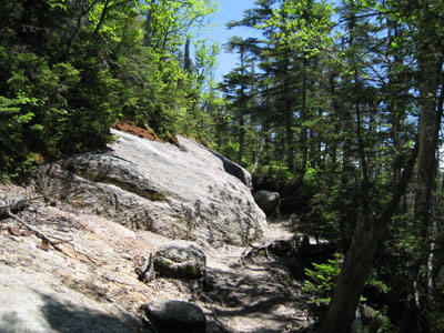
The initial descent is a bit steep, before flattening out. Not too long after, it steepens up again. Next thing I knew, I was standing at the bottom of the infamous chimney - the alternate route is well enough warn and marked that it's that easy to miss.
Continuing on, the ascent up the East Peak is more challenging than the main peak (though not too difficult). The summit is anti climatic - very limited views except for a moderate view point just a bit north of the cairn.
On the way back, I made sure I didn't skip the chimney again. Though certainly one should not take this for granted, it's not that challenging - there are plenty of places for hand and foot holds, the pitch isn't straight up, and the length isn't really that bad.
The descent off the main peak was fairly easy - not too hard on the knee. A little pain, but certainly worth it for such a nice day on the trails.
| Hike Ratings |
|
Getting To Trailhead: |
Easy |
| Destination: |
Mt. Osceola |
|
Length: |
Moderate |
|
Steepness: |
Moderate |
|
Navigation: |
Easy |
|
Views: |
Excellent |
|
Crowds: |
Moderate |
| Destination: |
Mt. East Osceola |
|
Length: |
Moderate |
|
Steepness: |
Very Difficult |
|
Navigation: |
Easy |
|
Views: |
Moderate |
|
Crowds: |
Minimal |
|
| Hike Stats |
|
Date Hiked: |
Friday, June 29, 2007 |
| Hike Commenced: |
12:35 PM |
| Parking Elevation: |
2,340' |
| Destination: |
Mt. Osceola |
| Ascent Commenced: |
12:36 PM |
| Summit Reached: |
2:01 PM |
| Time Elapsed: |
01:25 |
| Trailhead Elevation: |
2,340' |
| Summit Elevation: |
4,340' |
| Vertical Gain: |
2,090' |
| Destination: |
Mt. East Osceola |
| Ascent Commenced: |
2:26 PM |
| Summit Reached: |
2:56 PM |
| Time Elapsed: |
00:30 |
| Trailhead Elevation: |
4,340' |
| Summit Elevation: |
4,156' |
| Vertical Gain: |
386' |
|
|
| Hike Ended: |
5:28 PM |
| Hike Time Elapsed: |
04:53 |
| Hike Vertical Gain: |
3,171' |
|
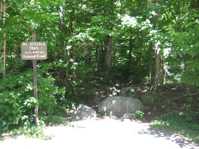
Mt. Osceola Trail trailhead at the Tripoli Road parking lot
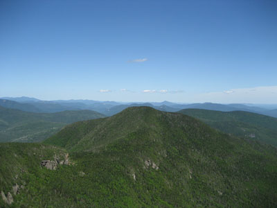
Looking northeast at the East Peak of Mt. Osceola
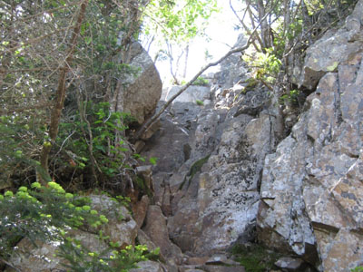
Looking up the rock chimney on the Mt. Osceola Trail between Mt. Osceola and the East Peak

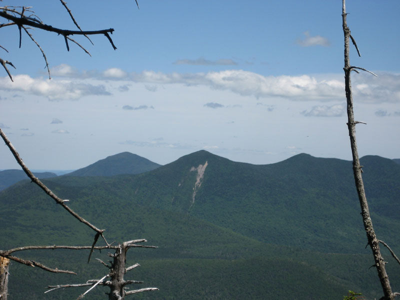
Looking southeast toward Mt. Tripyramid from the wooded East Peak summit of Mt. Osceola
 ' '

Directions to trailhead: From Waterville Valley, take Tripoli Road (bear right at the entrance to the ski area) to the top of the gap. Just after the road turns from pavement from dirt, the Mt. Osceola WMNF fee parking lot appears on the right. The trailhead is located at the back of the parking lot.
Back to Mt. Osceola Profile
Back to Mt. East Osceola Profile
|